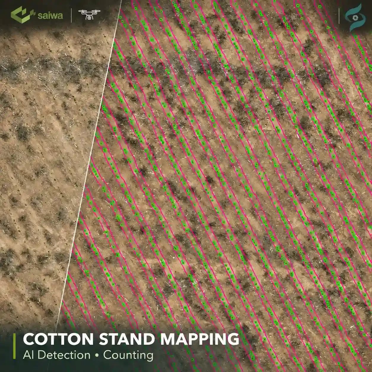
Drone-Based Cotton Stand Detection, Counting, and Mapping for Precision Agriculture
Discover how Saiwa developed an AI-powered solution that detects and counts individual cotton plants from drone imagery, maps their locations, and generates John Deere Operations Center-compatible outputs to support automated weed management in cotton fields.
- Timeline
- Jun 2026 – Jul 2026
- Industry
- Solution
- Platform
- Country
- Technology
About the Project
Accurate cotton stand assessment plays an important role in modern crop management. Knowing the location and number of individual plants, as well as their distribution across planting rows, provides valuable information for field operations and precision agriculture.
For this project, Saiwa collaborated with a US-based company to develop an AI-powered solution for cotton plant detection and counting using RGB images captured by drones.
Beyond plant detection, the project addressed an important operational requirement: transforming aerial imagery into structured geospatial data that could be used by agricultural machinery. By mapping individual cotton plants and associating them with their corresponding planting rows, the solution enables more targeted field operations, including automated weed control between crop rows.
Our Solution
Saiwa developed a two-stage computer vision pipeline combining cotton plant detection with crop-row segmentation.
The first stage identifies cotton planting rows within aerial images. The second stage detects individual cotton plants and associates each detection with its corresponding planting row. This approach helps filter out detections outside valid crop rows and produces structured results suitable for further analysis and mapping.
The project workflow included:
Preparation and annotation of drone-captured RGB imagery
Development of a customized AI model for cotton plant detection
Training of an instance segmentation model to identify cotton planting rows
Detection and counting of individual cotton plants within identified rows
Geospatial localization of detected plants and their associated crop rows
Generation of structured mapping outputs compatible with John Deere Operations Center (JDOC)
Results of Cotton Stand Detection
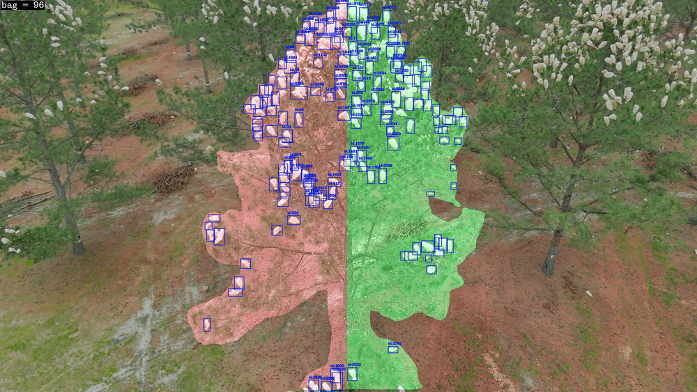
The developed solution automatically identifies individual cotton plants, determines their association with planting rows, and generates mapped detection results.
By combining plant-level detection with crop-row segmentation, the system produces structured spatial information that can support:
Automated cotton stand counting and assessment
Mapping of individual plant locations across the field
Identification of planting-row boundaries and plant distribution
Preparation of geospatial outputs for precision agricultural equipment
Cotton Stand Detection: Before & After AI Analysis
Compare original drone imagery with Sairone's AI-powered cotton plant detection and crop-row segmentation results.
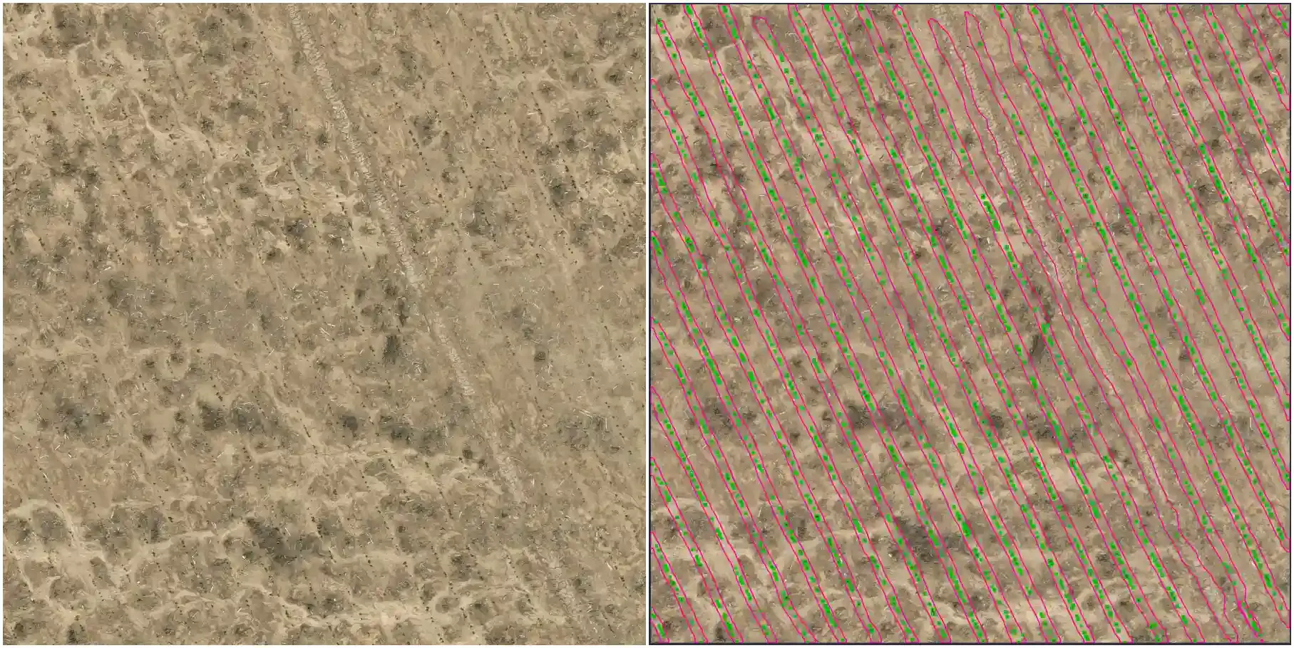
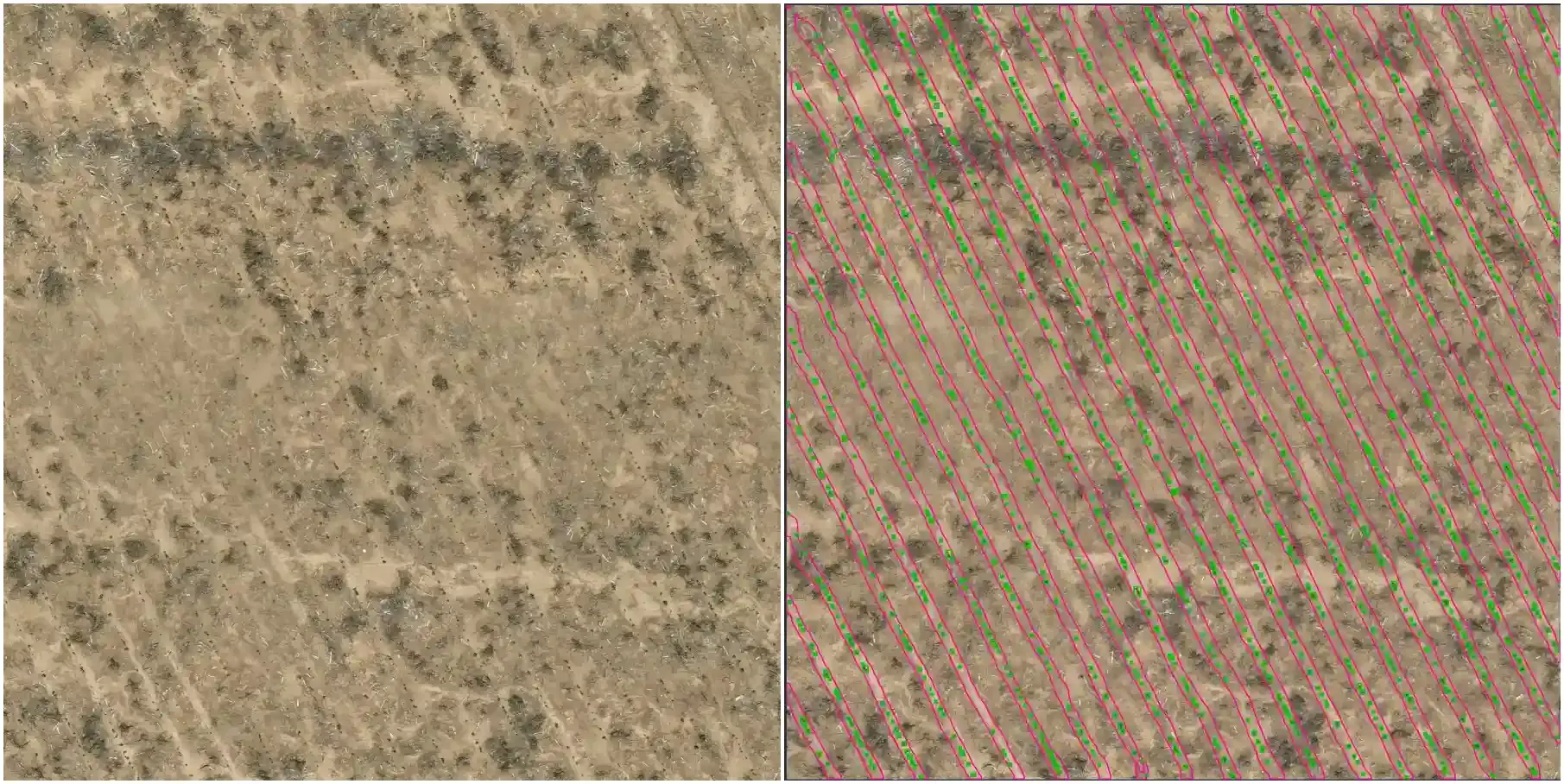
These capabilities demonstrate how AI-powered field analysis can improve cotton stand assessment and support more informed agricultural decisions. Explore Saiwa's cotton counting service to learn more about automated plant detection and counting using aerial imagery.
From Drone Imagery to Precision Field Operations
A key achievement of this project was connecting AI-powered aerial image analysis with real-world agricultural operations, transforming drone imagery into actionable geospatial data for precision farming.
The solution generates mapping outputs compatible with John Deere Operations Center (JDOC), a digital farm management platform that helps farmers manage field operations and agricultural data. This compatibility allows the customer to incorporate cotton plant detection and mapping results into their existing agricultural workflow.
By providing accurate spatial information about individual cotton plants and planting rows, the solution supports precision weed management. This data can help guide agricultural machinery in targeting weeds between cotton rows while accounting for crop plant locations, enabling more targeted and efficient field operations.
Collaborative AI Development
This project highlights Saiwa's expertise in developing customized AI and computer vision solutions that connect advanced image analysis with practical agricultural applications.
Through the integration of drone-based RGB imagery, object detection, instance segmentation, and geospatial mapping, Saiwa developed a complete solution powered by Sairone that automatically identifies, counts, and maps individual cotton plants. These capabilities are part of Saiwa's broader AI-powered crop yield estimation solutions, designed to support accurate crop monitoring and data-driven agricultural decisions.
The delivered solution demonstrates how AI-powered crop monitoring can transform aerial imagery into structured, actionable information, supporting precision agriculture, automated weed management, and data-driven field operations.
Share this project
Help others discover this work