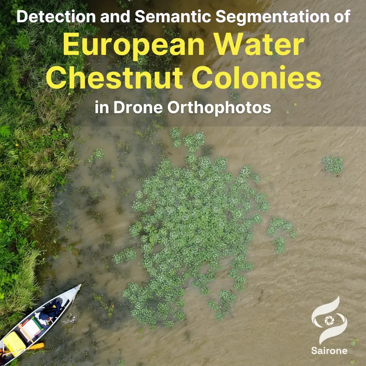
Detection and Semantic Segmentation of European Water Chestnut Colonies in Drone Orthophotos
Development
May 6, 2026
Aug 20, 2026
In earlier phases of the project, Saiwa developed a robust deep learning pipeline capable of segmenting European Water Chestnut with high accuracy under varying environmental conditions. Incremental learning techniques improved generalization to new plant appearances, while subsequent system enhancements enabled conversion of segmentation outputs into geographic coordinates and GIS-compatible formats.
However, earlier segmentation approaches exhibit limitations in capturing fine structural details, particularly in dense growth regions where multiple plants merge into contiguous clusters. In such cases, boundary ambiguity and limited contextual awareness can reduce the precision of colony delineation.
The 2026 phase addresses these limitations by advancing toward a more context-aware semantic segmentation framework, enabling more precise and coherent delineation of both individual plants and colonies at the pixel level.
While previous segmentation models achieved strong performance in identifying EWC regions, they remain limited in their ability to accurately represent complex spatial structures required for detailed ecological analysis and intervention planning.
Key challenges include:
A more advanced segmentation approach is required to accurately model the spatial distribution and morphology of EWC infestations.
The primary objectives of this phase are:
Large orthomosaic TIFF images are divided into manageable tiles for processing. A deep learning–based semantic segmentation model is trained to classify each pixel as either EWC or background, enabling continuous spatial representation across entire scenes.
The training dataset combines:
This hybrid labeling approach ensures both consistency with earlier datasets and improved representation of complex vegetation patterns.
Special attention is given to regions with dense vegetation where plant boundaries are ambiguous. The model is optimized to better capture:
Compared to earlier convolutional segmentation approaches, the adopted architecture provides improved modeling of long-range spatial dependencies and global context. This results in more coherent segmentation maps, reduced fragmentation, and more accurate boundary delineation in complex scenes.
Segmentation outputs are converted into GIS-compatible formats, enabling direct integration with mapping and monitoring tools. This includes:
The transition to a more advanced semantic segmentation framework significantly enhances the analytical value of the system. By capturing the full spatial extent and structure of EWC infestations, this phase enables:
Additionally, the improved segmentation approach provides stronger generalization across diverse environmental conditions and more stable performance on large-scale imagery compared to earlier methods.
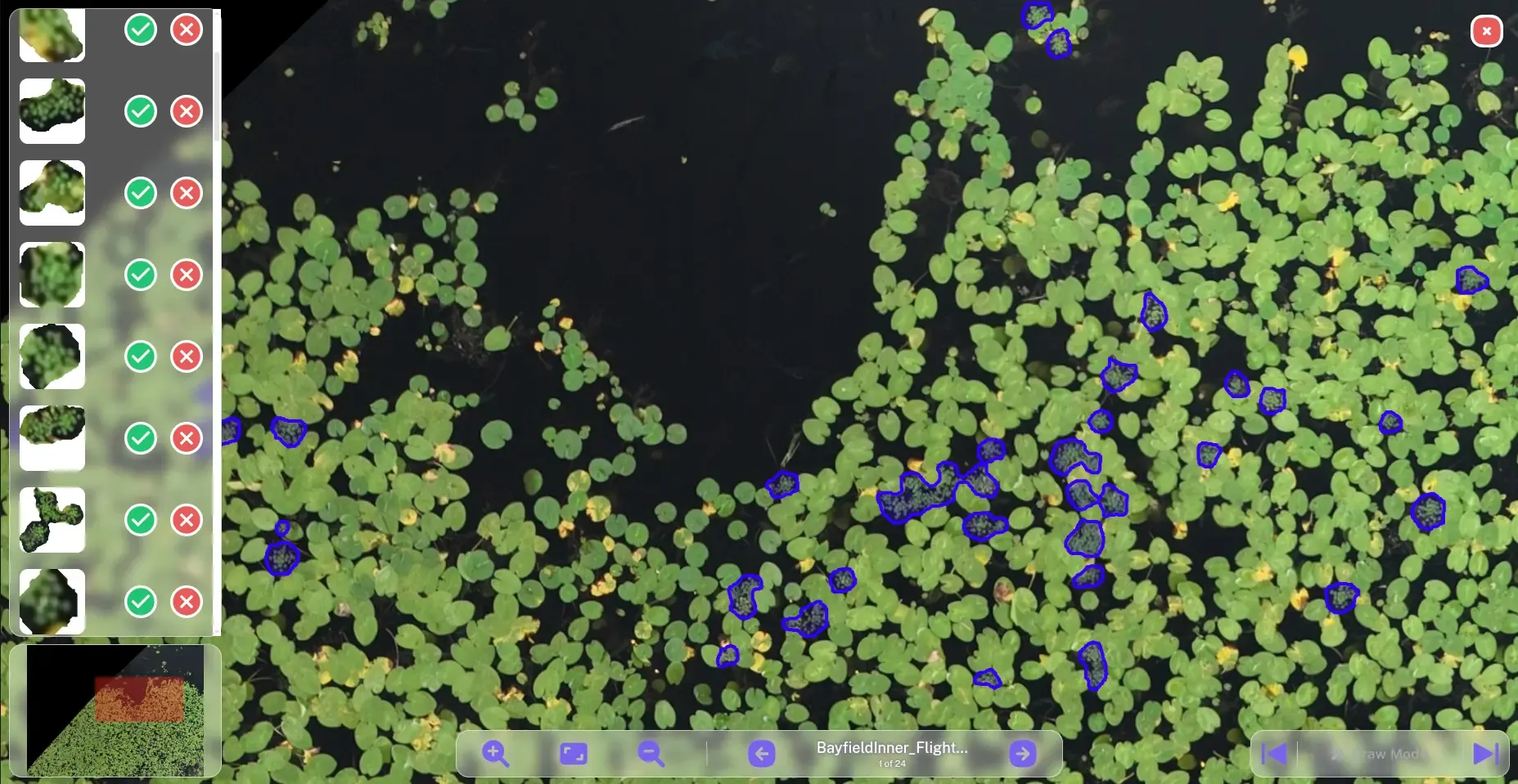
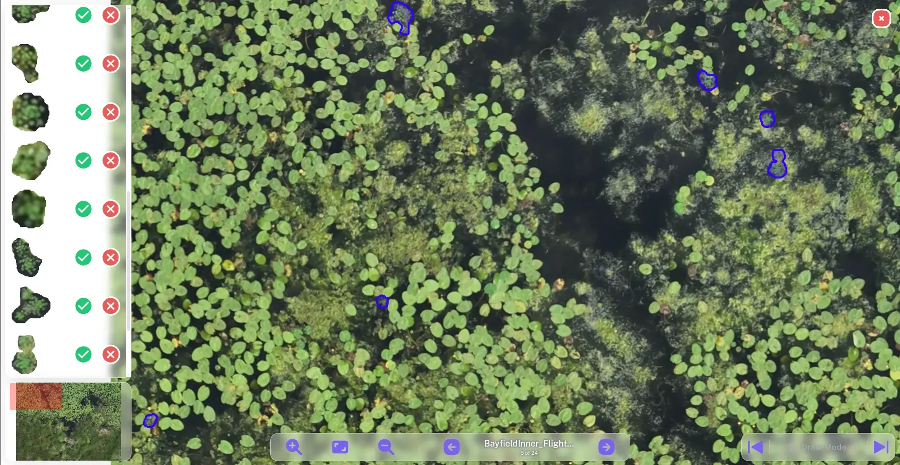
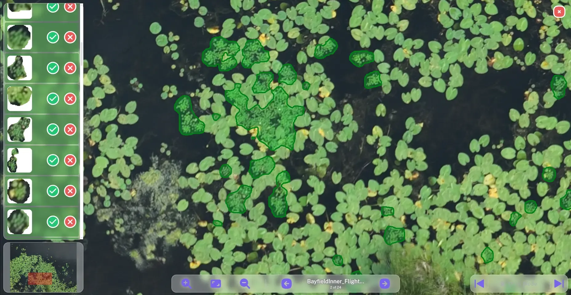
A web application was developed in collaboration with Ducks Unlimited Canada (DUC) to simplify the EWC segmentation workflow and the review of model predictions.
The application allows users to:
Select either the latest segmentation model or a model from an earlier project phase.
Set a minimum polygon size to remove small segmentation results.
Review the detected polygons after processing.
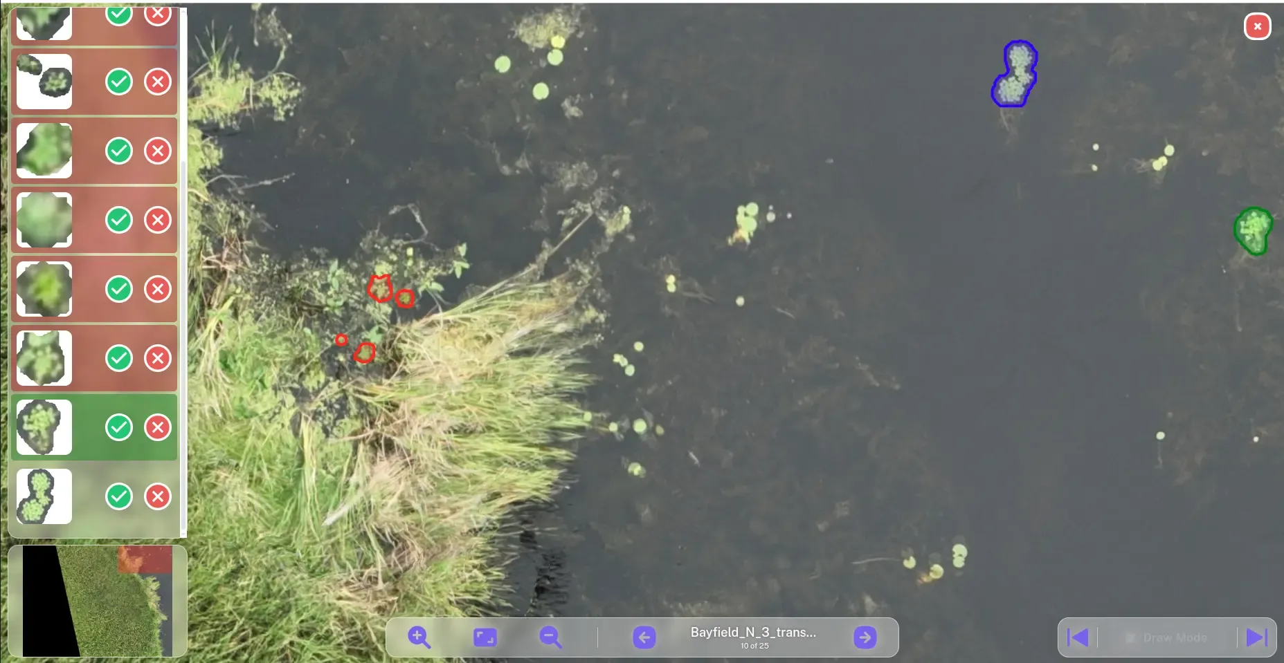
Accept or reject each segment. Accepted regions are displayed in green, rejected regions in red, while newly generated results are shown in blue until they are reviewed and are accepted by default.
The following figures show the main interface of the application and examples of the review workflow:
For technical details, implementation inquiries, or collaboration opportunities, please contact us via info@saiwa.ai or through the official Saiwa communication channels.


Ordered by
Ducks Unlimited Canada (DUC)

Ordered by
Ducks Unlimited Canada (DUC)

Funded by
Nature Conservancy of Canada (NCC)
Ordered by
Ducks Unlimited Canada