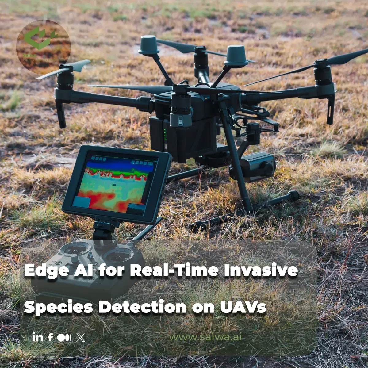
Edge AI for Real-Time Invasive Species Detection on UAVs
Aug 11, 2026
Oct 15, 2026
Written by: Amirhossein Komeili
Reviewed by: Boshra Rajaei, PhD
Written by: Amirhossein Komeili
Reviewed by: Boshra Rajaei, PhD
Unmanned aerial vehicles (UAVs) have become a practical way to survey vegetation over large, uneven terrain where ground crews struggle to keep pace with spreading invasives. The bottleneck is no longer capture alone: transferring every high-resolution frame to the cloud for inference introduces delay, bandwidth cost, and privacy constraints that weaken same-day response. This article walks through edge computing on UAVs, vision and spectral pipelines for species-level detection, field operational limits, and published surveillance examples—then closes with how the Sairone platform turns aerial intelligence into precision-agriculture workflows. You will leave with a grounded picture of where onboard AI fits, what accuracy demands in real flights, and how maps and export formats connect detection to action.
Moving inference closer to the sensor changes the economics of aerial monitoring. Instead of treating the drone as a data-collection pipe, architects treat it as a mobile edge node: imagery is acquired, georeferenced, and classified while the aircraft is still airborne or immediately upon landing, with only alerts, bounding boxes, or compressed map tiles uplinked. That pattern matters for invasives because infestations are patchy; crews need to know where to intervene before storage cards fill with redundant background pixels.
Platform choices typically pair a flight controller with a companion computer hosting a GPU or dedicated neural accelerator. Reported conservation and pest-detection prototypes follow this split: stabilization and navigation stay on the autopilot stack, while convolutional models run on modules sized for watt-weight limits. Software stacks often combine a real-time operating environment for capture with optimized inference runtimes so frame rates stay usable at the resolutions required to resolve individual plants or rosettes.
Field prototypes described in the invasive-species literature mount compact edge modules directly on the airframe so RGB (and sometimes multispectral) streams never leave the aircraft uncompressed. In one documented hogweed-surveillance setup, researchers integrated edge AI into the drone workflow so detection could proceed during flight rather than after offline upload—an explicit response to the volume of aerial imagery invasive mapping generates. Conservation-oriented edge deployments described by hardware vendors similarly emphasize Jetson-class devices running trained detectors on live video or still bursts for rare or protected species, reducing reliance on datacenter round trips.
Integration work extends beyond bolting on a board. Camera trigger timing, gimbal stability, and storage I/O must keep pace with inference; otherwise models skip frames or run on motion-blurred tiles that degrade class scores. UAV orthomosaic pipelines from remote-sensing practice show that geospatial consistency—knowing which pixel belongs to which ground coordinate—remains essential even when classification is local; edge outputs are most valuable when they can be fused into map products compatible with GIS workflows.
Latency reduction is the operational payoff. Cloud-only pipelines wait on upload bandwidth, queue depth, and batch scheduling; edge paths shrink the interval between “sensor saw the target” and “operator receives a geolocated hit”. For management teams tracking fast annuals or biennials, that interval influences whether scouting and treatment occur in the same mobilization window.
Edge intelligence also enables selective uplink: the aircraft transmits coordinates and class labels for positive detections while retaining full imagery locally for audit or retraining. IoT-oriented agricultural edge frameworks emphasize this filter-at-source behavior as a way to cut recurring connectivity costs without sacrificing model refresh cycles, because representative hard negatives can still be synced when links are available. The trade-off is model staleness onboard versus in the cloud; teams mitigate it with periodic over-the-air weight updates once validated on held-out aerial tiles.
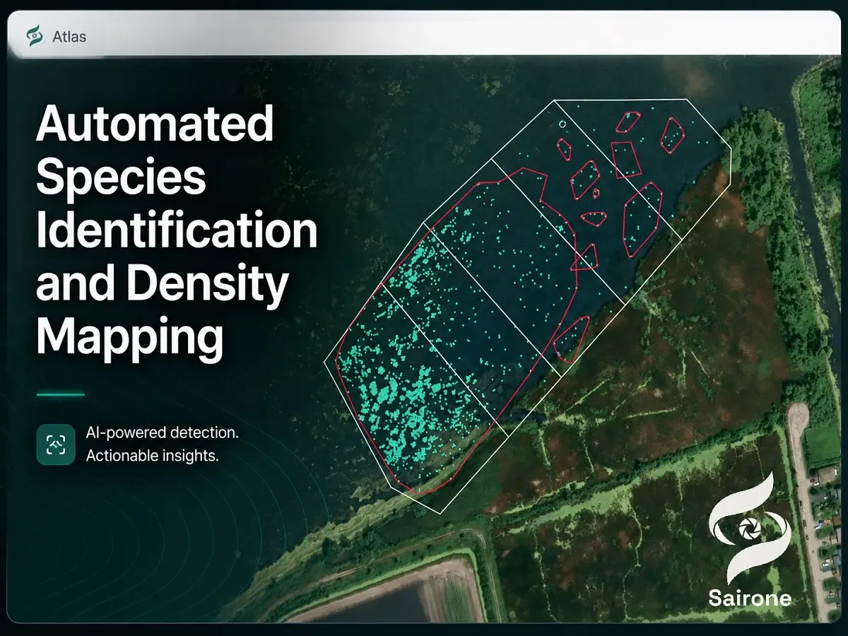
Computer vision on UAV imagery has shifted from hand-crafted texture and color rules toward learned representations that tolerate canopy clutter, soil background, and shadow edges. High-resolution RGB orthomosaics and oblique strips both feed networks that output either image-level labels, bounding boxes, or per-pixel masks depending on management needs—mapping contiguous patches favors segmentation, while early warning along corridors may tolerate box-level alerts.
Training data quality dominates outcomes. Studies mapping invasive plants from UAV products stress representative flight altitudes, sun angles, and phenological stages because class appearance shifts with moisture stress and flowering. Transfer learning from generic image classifiers to domain-specific fine-grained species discrimination is a recurring pattern in weed and invasive CNN literature, reducing the labeled tile count required before field trials.
Convolutional neural networks (CNNs) appear throughout UAV weed and invasive detection papers as the default architecture for multispectral or RGB patch classification. Sensors-era work on weed identification in UAV multispectral frames reports CNN pipelines that ingest narrow-band stacks and output species or “weed versus crop” decisions at patch scale, leveraging spatial context unavailable to point spectra alone. Ecological Informatics–style mapping studies extend CNNs to dense prediction: encoder–decoder structures segment invasive grasses or forbs directly on orthomosaic pixels, yielding management-ready polygons instead of sparse point samples.
Implementation details that recur in these sources include tile-based inference with overlap and majority voting to suppress seam artifacts, and class imbalance handling because invasives often occupy far fewer pixels than background. For edge deployment, authors and industry notes describe converting trained models to TensorRT or similar runtimes, quantizing weights where accuracy permits, and profiling batch-1 latency on the companion computer actually flown.
Variable altitude, wind gusts, and changing illumination push models off their training manifold. ISPRS-era UAV species studies highlight radiometric normalization and consistent ground sampling distance as prerequisites before comparing classifiers across dates. More recent remote-sensing work on invasive identification from aerial platforms combines spectral indices with deep features so models are less brittle when clouds alter diffuse light.
Operational mitigations include flying at prescribed times of day, using exposure lock, and augmenting training sets with motion blur and brightness jitter to mimic real rotorcraft capture. Where segmentation masks define treatment zones, authors report post-processing—morphological filtering, minimum mapping units—to remove speckle false positives that would otherwise fragment spray plans. Edge systems add another constraint: input resolution may be downscaled to meet frame-rate targets, so accuracy tuning becomes a co-design problem linking optics, flight height, and model stride.
Multispectral and narrow-band sensors extend discrimination beyond what RGB alone can separate when invasive foliage mimics native species in visible wavelengths. UAV payloads carrying multiple discrete bands capture reflectance signatures tied to pigment chemistry and canopy structure, supporting classifiers that remain stable when green tones look alike to the human eye.
Feature extraction in these pipelines blends classical vegetation indices with learned fusion layers: indices emphasize chlorophyll and cell structure contrasts, while CNNs learn spatial textures of leaf shape and crown architecture. For invasive riparian or grassland targets, remote-sensing articles document band combinations that widen separability between natives and invaders across seasons, then feed those stacks into either shallow learners or end-to-end networks.
Narrow waveband capture from UAVs demands radiometric calibration discipline—sensor vignetting, lens angle, and altitude interact with per-band digital numbers. Multispectral weed studies describe workflows that align band rasters to a common geometry before stacking features for CNN input, preventing misregistration from masquerading as spectral difference. Platform vibration and rolling shutter can smear bands acquired sequentially; literature on UAV environmental mapping recommends faster frame rates or stabilized mounts when species signatures live in subtle red-edge shifts.
Vegetation indices derived from multispectral UAV data provide interpretable channels that complement black-box deep features. Authors combine indices such as NDVI-like contrasts with red-edge sensitive formulations to highlight physiologically stressed or phenologically distinct invaders, then threshold or classify jointly with spatial CNN outputs. Ecological mapping papers show pixel-wise invasive labels improved when spectral preprocessing isolates bare soil and senescent background before segmentation heads run, reducing confusion along trail edges and shorelines.
On edge hardware, index math is inexpensive relative to convolutions; hybrid pipelines compute indices on the fly per tile, concatenate them with RGB channels, and run a single compact network—an approach aligned with power budgets that cannot afford duplicate forward passes. Outputs feed the same GIS layers whether inference ran onboard or offline, preserving compatibility with variable-rate equipment downstream.
Even strong models fail when missions ignore environmental physics and aircraft limits. Remote invasive programs span wetlands, steep slopes, and utility corridors where line-of-sight radio and safe landing zones constrain flight planning. Managers must reconcile detection confidence with legal overflight rules, buffer distances to sensitive habitats, and the reality that repeated surveys—not single sorties—drive eradication success.
Data governance intersects ecology: geotagged positives for regulated invasives can be sensitive, so teams balance sharing maps with landowners against public disclosure risks. Edge preprocessing limits raw imagery circulation while still exporting anonymized heatmaps for contractors.
Cloud cover, specular glint on wet leaves, and long shadows from low sun angles shift spectral ratios and CNN activations. Studies across UAV species detection recommend multi-temporal compositing or restricting flights to narrow solar elevation windows when indices are central to discrimination. Wind moves flexible stems, blurring fine structures that define rosette weeds; higher shutter speeds and gimbal isolation appear in practical drone invasive surveys discussed in extension and research outreach.
Canopy occlusion hides understory invaders from nadir views; oblique imagery and multi-pass mosaics increase cost but raise recall for shrubs and emergent forbs. Post-storm surveys introduce debris and mud backgrounds that look like new green shoots unless models retrain on post-event tiles.
Every additional sensor and compute watt draws down flight time. Research summaries on drone invasive work note the tension between covering hectares per battery and carrying enough resolution to see target species. Edge AI modules add heat and mass; thermal throttling on long transects can silently reduce inference FPS unless airflow and duty cycles are engineered.
Storage bandwidth competes with inference when cameras write 4K streams while GPUs read tiles; prototypes mitigate by capturing bursts over waypoints instead of continuous video. Power budgets often force choices: multispectral payloads or heavy edge GPUs on the same small quadcopter, pushing larger fixed-wing or hybrid platforms for all-day mapping. Planning tools that cluster flights by infestation prior probability—survey hotspots at high resolution and background at coarse scale—mirror ideas later industrialized in cloud platforms that auto-segment fields into management blocks.
Published case studies bridge lab metrics and land-manager workflows. They show drones detecting invasives earlier than walk-through surveys, especially across riparian zones and post-disturbance sites where foot access is slow. Automated outputs increasingly feed not just maps but treatment prioritization: polygon area, neighbor proximity to native communities, and accessibility layers stacked in GIS.
Edge-AI case narratives emphasize during-flight awareness for hazardous plants—giant hogweed surveillance prototypes explicitly motivated real-time edge inference to keep crews from unknowingly entering infested grids while the aircraft still circles. Conservation technology write-ups generalize the pattern: endangered species and invasive sentinel events both benefit when onboard models flag frames for human review instead of flooding analysts with hours of video.
Protected-area applications combine high-resolution segmentation with stewardship protocols. Deep learning mapping of invasive plants from UAV orthomosaics demonstrates pixel-wise products that rangers import into existing databases, aligning machine outputs with manual verification transects. University extension summaries describe drone reconnaissance for aquatic and terrestrial invasives—Eurasian watermilfoil, phragmites patches, woody encroachment—where repeat flights measure spread rates and treatment efficacy.
Spectral–spatial fusion papers on invasive identification from aerial platforms support riparian and grassland programs where managers must distinguish look-alike natives from invaders under partial canopy. Edge deployments in these landscapes prioritize geotagged alerts along boardwalks and fire roads where ground teams enter first.
Scaling requires tiling schemes, distributed storage, and consistent taxonomy across crews. Orthomosaic-centric deep mapping studies process entire fields or reserves as unified rasters, then vectorize polygons for spray or hand-pull crews. Outreach on drone invasive management highlights mosaics and 3D context for estimating biomass and planning herbicide volumes—steps that only matter when detection scales beyond demo plots.
Cloud-scale ingestion complements edge: aircraft run detectors for immediacy, while high-density TIFF mosaics upload intact for QA, retraining, and enterprise dashboards. IoT-edge agricultural frameworks describe backend services that merge edge events with slower, higher-fidelity cloud models—an architecture large-area programs adopt as infestations cross farm or watershed boundaries. Selective sync keeps cellular costs bounded when thousands of hectares produce terabyte-class imagery each season.
Sairone is an advanced, AI-driven platform developed by Saiwa that ingests high-resolution aerial imagery from drones, satellite feeds, and machine-mounted cameras within a unified geospatial workflow. Its architecture is built to process multi-sensor data at scale, including cloud uploads of very large “mega files” such as high-density TIFF orthomosaics without forcing users to downsample or strip metadata on the desktop first. That design keeps ground sampling distance and radiometric detail intact for downstream computer vision, so field teams can pair same-day edge alerts with centimeter-grade mosaic review when connectivity allows.
By centralizing orthomosaics, point clouds, and aligned band stacks, Sairone gives agronomists and GIS leads a single workspace for time-series comparison—critical when invasive or weed pressure shifts between scouting flights. The platform’s cloud intelligence layer handles the storage and compute burden that otherwise fragments across local drives, while still exporting analysis-ready layers for enterprise agronomy tools.
Within Sairone, the Weed and Invasive Plant Control service applies computer vision to identify specific weed and invasive species from uploaded imagery and to quantify how densely they occupy each zone. The service targets named species including Taraxacum officinale, Amaranthus albus, fleabane, and thistle, producing exact spatial density maps rather than whole-field averages. Those maps translate model confidence and crown-scale detections into hectares, hotspots, and confidence-stratified zones managers can defend in stewardship reports.
Density mapping is designed for repeat flights: aligned outputs show whether patches expanded, retreated after treatment, or shifted along margins and waterways. Because classifications are species-aware, variable-rate programs can discriminate taxa where herbicide choice or mechanical method differs—an operational step beyond generic “green-on-brown” weed alerts.
Sairone turns detections into GIS-native deliverables—Shapefiles, GeoJSON, CSV, and KML—so smart sprayers, drill rigs, and contractor tablets ingest the same geometry agronomists see in the dashboard. Visualization layers stack infestation density with field boundaries, headlands, and application buffers, supporting prescription maps that match real equipment constraints.
An auto-clustering algorithm groups affected sections into clean management blocks within hours, compressing sprawling pixel hits into a handful of zones crews can treat in one pass. That automation shortens the lag between aerial survey and variable-rate herbicide or mowing plans, which is where many drone programs otherwise stall in spreadsheet hand work.
Sairone avoids one-size-fits-all templates. Saiwa offers customized plant-detection models when commodity classifiers miss regional biotypes or specialty crops, tailored reporting dashboards for agronomy teams and sustainability officers, White Label deployments for retailers and input suppliers, and Back-end as a Service (BaaS) APIs that embed detection, density mapping, and export logic directly into client portals. The intent is alignment with operational goals—whether the buyer is a cooperative, a machinery OEM, or a land-management agency—without forcing users off their existing ERP or FMIS stacks.
Enterprise integrations emphasize repeatable pipelines: imagery in, validated spatial products out, with hooks for human review on low-confidence tiles. That mirrors the edge-plus-cloud pattern discussed throughout UAV invasive surveillance—fast local hits where needed, authoritative mosaic analytics where scale and audit matter.
Edge AI on UAVs closes the loop between seeing an invasive patch and acting on it the same day: companion computers run CNN and hybrid spectral models onboard, cut uplink volume, and return geolocated positives managers can trust enough to route crews. Accuracy still depends on flight discipline, multispectral feature design, and segmentation workflows proven on orthomosaics at management resolution. Operational reality—light, wind, payload, and power—means architectures are always joint optimizations among optics, models, and flight plans.
For production agronomy, cloud platforms such as Sairone extend those principles by absorbing mega-scale TIFF mosaics, naming species-level weed and invasive targets, exporting standard GIS prescriptions, and clustering fields into treatable blocks while offering APIs and white-label paths for enterprise buyers. The through-line from research prototypes to variable-rate fields is the same: spatially explicit, species-aware maps that machines and people can execute—not merely detect.
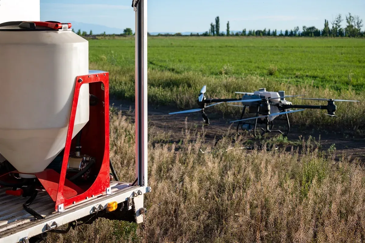
Post-harvest fields often show an uneven weed pattern: a few dense patches, thin linear infestations, and large areas with little green vege
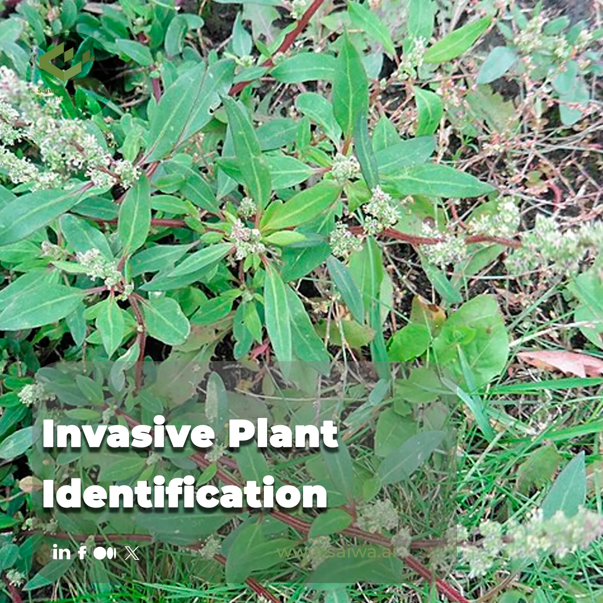
The unchecked spread of invasive alien plants is not just an ecological nuisance; it's a critical threat to agricultural productivity and gl
Be the first to share your thoughts
Start the conversation by sharing your thoughts
Share this article
Help others discover this content
Get expert insights, product news, and industry trends delivered straight to your inbox.
No spam, unsubscribe anytime. We respect your privacy.
