



Challenges of Green-on-Green Detection in AI-Based Weed Recognition Systems
Learn why green-on-green weed detection is difficult and how AI improves crop-weed recognition in dense canopies
Written by Amirhossein
Reviewed by Boshra
Why Green-on-Green Detection Is Intrinsically Difficult
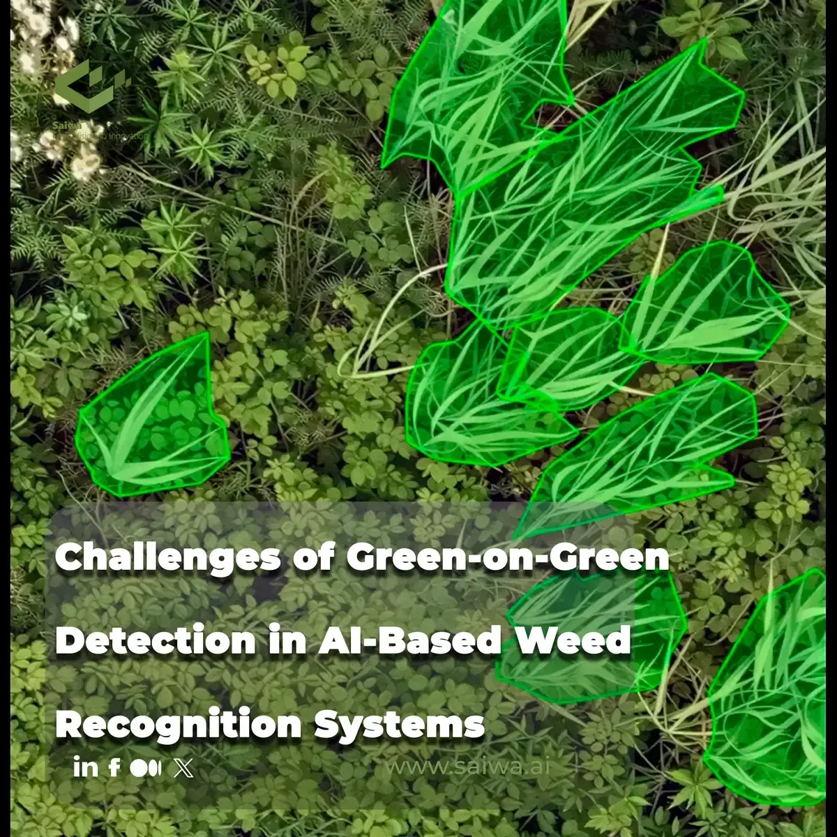
The transition from green-on-brown to green-on-green weed detection represents one of the most complex leaps in modern precision agriculture. While green-on-brown systems rely on straightforward vegetation indices to separate living plants from bare soil or residue, green-on-green architectures face the formidable challenge of isolating target weeds growing within an active crop canopy. This operational shift forces agricultural engineering away from basic thresholding algorithms and toward advanced computer vision pipelines capable of nuanced morphological and spectral differentiation.
Achieving high accuracy in this domain requires deep neural networks to resolve microscopic differences between species under highly variable field conditions. The fundamental difficulty lies in the fact that weeds and crops share the same fundamental biological characteristics, reflecting similar wavelengths of light and occupying the same spatial domain.
Visual Similarity Between Crops and Weeds in Color, Shape, and Texture
Distinguishing a weed from a crop when both exhibit near-identical spectral signatures is computationally demanding. Both plant types possess high chlorophyll concentrations, meaning their reflectance curves in the visible and near-infrared (NIR) spectrums overlap significantly. Consequently, traditional multispectral segmentation approaches, which rely on vegetation indices like the Normalized Difference Vegetation Index (NDVI), fail to provide the contrast needed for accurate classification.
To overcome this spectral overlap, detection algorithms must rely heavily on spatial features such as leaf shape, vein patterns, and overall canopy texture. However, morphological similarities often confound feature extractors. For instance, grassy weeds in cereal crops share linear leaf structures and parallel venation, creating a nearly indistinguishable visual profile during the early growth stages. Convolutional Neural Networks (CNNs) must therefore be trained to recognize highly localized, low-level texture gradients rather than broad color distributions.
Furthermore, phenotypic plasticity complicates structural recognition. A single weed species can exhibit drastically different leaf shapes and textures depending on soil nutrients, moisture levels, and competition from the surrounding crop. This intra-class variance forces machine learning models to learn a highly generalized feature space, which inadvertently increases the risk of false positives when analyzing atypical crop morphologies.
Illumination Variability, Background Complexity, and Field Heterogeneity
Field environments are inherently hostile to consistent image capture, introducing severe radiometric variations that degrade model confidence. Solar elevation, cloud cover, and moving shadows cast by the tractor or the crop canopy itself create dynamic illumination conditions. A leaf photographed under direct sunlight presents a significantly different pixel intensity distribution compared to the same leaf under a cloud shadow, forcing models to achieve high levels of illumination invariance.
Background complexity further degrades signal-to-noise ratios. In a green-on-green scenario, the background is not a uniform soil matrix but a chaotic aggregation of overlapping leaves, stems, and organic debris. This highly textured background acts as visual noise, confusing edge detection algorithms and causing regional proposal networks to generate inaccurate bounding boxes. The presence of senescent crop leaves or varied soil moisture levels introduces additional spectral artifacts that must be filtered during the preprocessing stage.
Field heterogeneity means that no two meters of a given paddock are identical. Variations in soil type alter the color of the ground plane, while topographic changes affect the camera angle and the resulting Ground Sample Distance (GSD). Such environmental variance disrupts the spatial relationships learned by the model during training, leading to brittle deployment performance where a system tuned for one specific field architecture fails completely in another.
Data Acquisition and Dataset Preparation for Weed Recognition
Developing robust green-on-green detection models is entirely dependent on the quality and volume of the underlying training data. Unlike controlled industrial environments where lighting and subject positioning are fixed, agricultural datasets must capture the immense biological and environmental diversity of the open field. Gathering and curating this data is a massive logistical undertaking.
The lack of standardized, large-scale, publicly available datasets for specific crop-weed interactions forces most agricultural technology developers to build proprietary datasets from scratch. This process is highly resource-intensive and directly dictates the eventual upper limit of a model's predictive capability.
Imaging Pipelines Across UAV, Ground-Based, and In-Field Platforms
Data acquisition strategies vary wildly, each introducing specific biases into the training pipeline. Unmanned Aerial Vehicles (UAVs) provide excellent spatial coverage for generating orthomosaics, but their higher altitude results in a larger Ground Sample Distance, reducing the pixel footprint of individual weeds. This makes UAV imagery highly effective for broad patch detection but less reliable for identifying early-stage, single-plant emergence.
Conversely, ground-based systems mounted on tractor booms or autonomous rovers capture high-resolution imagery with sub-millimeter GSDs. These systems provide the dense pixel data required to train complex morphological feature extractors. However, they suffer from a narrow field of view and are subject to severe motion blur induced by mechanical vibrations. Models trained exclusively on high-fidelity, static ground imagery often fail when fed motion-compromised data during live field operations.
Merging these distinct imaging modalities into a unified training pipeline remains a significant engineering hurdle. The disparity in scale, viewing angle, and sensor calibration between a drone-mounted multispectral camera and a ground-based RGB sensor requires sophisticated data normalization protocols. Without strict spatial alignment and color correction, the neural network struggles to converge across the disparate data distributions.
Annotation Burden, Class Imbalance, and Limited Labeled Datasets
The supervised learning algorithms driving modern weed detection require exhaustive human annotation, which serves as the primary bottleneck in system development. While drawing bounding boxes for object detection is time-consuming, creating polygon masks for instance segmentation is exponentially more labor-intensive. Agronomists must manually trace the intricate boundaries of individual overlapping leaves, a process that can take minutes per image and is prone to subjective human error.
Class imbalance naturally arises in agricultural datasets because a healthy field predominantly consists of crop plants, with weeds occurring sparsely or in clustered patches. If a dataset contains a 99:1 ratio of crop pixels to weed pixels, standard loss functions like Cross-Entropy will heavily bias the model toward the majority class. This results in a network that minimizes overall error by simply classifying everything as a crop, effectively nullifying its utility as a weed detector.
To counteract this sparsity, data engineers employ heavy augmentation techniques — such as synthetic rotations, contrast adjustments, and generative adversarial networks (GANs) — to artificially inflate the minority weed class. However, synthetic data rarely captures the nuanced physics of shadowing and leaf occlusion present in genuine field imagery, meaning models trained on heavily augmented datasets often experience a drop in precision when deployed in the real world.

Deep Learning Workflows for Green-on-Green Weed Recognition
To process complex agricultural imagery, developers deploy varied deep learning architectures, each tailored to a specific operational requirement ranging from rapid localization to exact morphological profiling. These workflows dictate how the automated hardware will physically interact with the field environment.
Selecting the appropriate neural network architecture is a balancing act between the required spatial resolution of the output and the computational budget available on the field machinery.
Object Detection for Weed Localization in Precision Spraying Systems
Object detection algorithms, such as the YOLO (You Only Look Once) family and Faster R-CNN, are the standard architectures for real-time localization. These models output bounding boxes defined by spatial coordinates and a class probability score. In the context of precision spraying, the center of the bounding box provides the target coordinate for the sprayer nozzle, while the box dimensions determine the required dosage of herbicide.
The primary metric for evaluating these models is Mean Average Precision (mAP), which balances precision and recall across various Intersection over Union (IoU) thresholds. High precision ensures that expensive chemicals are not wasted on the crop, while high recall guarantees that no weeds are missed. Due to their single-pass architecture, models like YOLO are highly optimized for inference speed, making them ideal for boom sprayers operating at standard tractor speeds.
Image Segmentation for Pixel-Level Weed Delineation in Dense Canopies
When bounding boxes lack the precision required for delicate mechanical weeding or highly targeted micro-dosing, developers turn to image segmentation. Architectures like U-Net (for semantic segmentation) or Mask R-CNN (for instance segmentation) classify every individual pixel in the image, providing exact, non-rectangular boundaries of the plant structures.
This pixel-level delineation is critical in dense canopies where crops and weeds physically intertwine. A bounding box around a weed in a dense canopy inevitably includes crop leaves, risking collateral damage during chemical application. Instance segmentation isolates the exact morphology of the weed, calculating geometric properties such as leaf area and orientation. However, the computational overhead required to calculate dense pixel maps often precludes segmentation from being used in high-speed, real-time applications on low-power edge devices.
Image Classification for Species and Growth-Stage Recognition
Beyond mere localization, advanced systems must determine the specific species and developmental stage of the identified weed. Image classification networks, typically utilizing architectures like ResNet or EfficientNet, process localized image crops to output a probability distribution across various botanical classes using a Softmax activation function.
Identifying the exact phenological stage is crucial because herbicide efficacy is highly dependent on plant maturity. A weed at the two-leaf stage requires a different chemical concentration than the same species at the tillering stage. By training classification heads on multi-stage botanical datasets, agronomic AI systems can dynamically adjust tank mixes or mechanical actuation force based on the biological resilience of the specific target.
Failure Modes in Complex Crop-Weed Scenes
Even heavily optimized deep learning models encounter scenarios in the field where detection confidence plummets. Understanding these failure modes is essential for setting realistic agronomic expectations and designing fail-safes within the hardware.
The transition from a controlled dataset validation set to an active agricultural field exposes algorithmic vulnerabilities that are rarely apparent during initial development.
Occlusion, Dense Plant Populations, and Missed Small-Target Weeds
Occlusion represents a hard physical limit on optical detection. In later growth stages, the crop canopy naturally closes, physically covering understory weeds. If a weed is completely hidden beneath a broad crop leaf, no optical sensor can detect it. Even partial occlusion disrupts the morphological feature extraction, causing the network to misclassify the visible fragments of the weed as background debris.
Small-target detection remains a persistent issue, particularly for newly emerged seedlings. In imagery captured with a higher GSD, a cotyledon-stage weed might be represented by fewer than a dozen pixels. At this scale, the texture and shape features are entirely lost, reducing the plant to a green blob that the model cannot confidently differentiate from crop artifacts. This often leads to critical misses early in the season when weed control interventions are most impactful.
Sensitivity to Crop Stage, Seasonal Variation, and Cross-Field Domain Shift
A model trained extensively on early-season crops often fails completely when applied to the same field weeks later. As plants mature, their geometric structure, leaf orientation, and spectral reflectance shift significantly. This temporal variance causes a domain shift, where the live data distribution diverges from the training data distribution, leading to a rapid degradation in accuracy.
Similarly, spatial domain shifts occur when a model trained in one geographic region is deployed in another. Differences in local soil coloration, regional agronomic practices (such as row spacing), and local weed ecotypes confuse the feature extractors. An algorithm highly accurate in a specific trial farm will often exhibit brittle behavior when sold commercially across different climate zones, necessitating continuous local retraining to maintain operational viability.
Deployment Trade-Offs in AI-Based Weed Detection Systems
Translating high laboratory accuracy into field-level reliability requires overcoming severe constraints related to mobile computing power, ruggedization, and mechanical synchronization. The AI must operate flawlessly in an environment actively hostile to sensitive electronics.
Hardware engineering becomes just as critical as software development once the system leaves the server cluster and is bolted onto an agricultural implement.
Balancing Accuracy, Inference Speed, and Edge-Device Constraints
Real-time spot spraying requires the AI to capture an image, process it, and actuate a nozzle within a fraction of a second. This mandates extremely high inference speeds, typically requiring the system to process upwards of 30 frames per second (FPS). Running deep, heavy neural networks like Mask R-CNN at these speeds is impossible on standard agricultural hardware.
Developers are forced to deploy models on ruggedized edge-computing devices, such as NVIDIA Jetson AGX modules, which possess limited thermal and power envelopes. To fit complex models onto these edge TPUs, engineers must employ aggressive optimization techniques like quantization (reducing floating-point precision from FP32 to INT8) and network pruning. While these techniques drastically reduce latency, they inherently trade away a degree of detection accuracy, requiring a delicate balance between computational speed and agronomic efficacy.
Connecting Recognition Outputs to Sprayers, Robotic Actuators, and Prescription Mapping
The physical realities of a moving tractor introduce severe operational noise. Boom sprayers operating at 15 to 20 kilometers per hour generate intense vibrations that cause motion blur in the camera sensors. If the shutter speed is increased to mitigate blur, the image becomes darker, exacerbating the illumination issues previously discussed.
Furthermore, field machinery operates in clouds of dust, chemical mist, and flying debris. Sensor lenses quickly become obscured, gradually degrading the input image quality over a working shift. Algorithms must be robust enough to maintain functional detection metrics even when the input data is partially corrupted by lens dirt or erratic camera positioning caused by uneven terrain.
Emerging Strategies to Reduce Detection Error and Labeling Cost
To bypass the intrinsic limitations of direct computer vision, researchers are developing alternative architectural strategies aimed at minimizing the need for exhaustive pixel-level data while improving robustness against field variations.
These emerging techniques shift the paradigm from purely visual identification to context-aware spatial reasoning.
Crop-Based Indirect Weed Detection and Grid-Based Localization Approaches
Instead of attempting to learn the infinite variations of weed morphology, indirect detection flips the objective: the model is trained exclusively to identify the highly uniform crop rows. By establishing a rigid spatial grid based on the detected crop lines, the system assumes that any green biomass occurring in the inter-row space is, by definition, a weed.
This grid-based localization significantly reduces the computational burden. The model only needs to learn a single class (the crop), which dramatically lowers the required training data volume and avoids the complexities of multi-species weed identification. While this approach struggles with intra-row weeds (weeds growing directly inside the crop line), it provides a highly robust, computationally light solution for bulk inter-row weed management.
Semi-Supervised Learning, Transfer Learning, and Multi-Scale Model Design
To alleviate the immense cost of manual annotation, developers are increasingly leveraging semi-supervised learning. In this workflow, a model is trained on a small set of meticulously labeled data and then turned loose on a massive dataset of unannotated field images to generate "pseudo-labels." By iteratively training on its own high-confidence predictions, the model expands its feature representation without requiring thousands of hours of human labor.
Transfer learning further accelerates deployment. Models are pre-trained on massive generalized datasets (like COCO or ImageNet) before fine-tuning on specific agricultural imagery, allowing the network to leverage pre-existing knowledge of basic shapes and textures. Multi-scale model designs, such as Feature Pyramid Networks (FPNs), are also deployed to fuse semantic data from deep layers with high-resolution spatial data from shallow layers, greatly improving the detection rate of small-target weeds that otherwise vanish in the deeper convolutions.
Sairone and its Field Application in AI-Driven Precision Agriculture
Cloud-Scale Multi-Sensor Processing for Drone, Satellite, and Machine-Mounted Imagery
Sairone operates as an advanced, AI-driven platform engineered by Saiwa to ingest and process high-resolution remote sensing data from diverse agricultural hardware ecosystems. The architecture is explicitly designed to handle the massive data payloads generated by modern precision agriculture, effortlessly integrating inputs from high-altitude satellite passes, UAV orthomosaics, and ground-level tractor-mounted cameras. By unifying these disparate imaging modalities, the platform bridges the gap between macro-level field scouting and micro-level plant analysis.
The system's cloud-native infrastructure is built to process "mega files," such as multi-gigabyte, high-density TIFF orthomosaics, without the need for local down-sampling or data reduction. This ensures that the extreme sub-millimeter resolution required for early-stage green-on-green detection is preserved throughout the processing pipeline. Sairone leverages distributed cloud intelligence to parse these massive geospatial datasets, running complex convolutional networks across hundreds of hectares in a fraction of the time required by localized desktop software.
Automated Weed Identification and Spatial Density Mapping
At the core of the platform is its highly specialized "Weed and Invasive Plant Control" service, which utilizes advanced computer vision to separate complex plant morphologies within dense canopies. The system moves beyond binary green-on-brown detection, deploying deep learning models trained to identify specific, economically damaging weed species such as Taraxacum officinale (dandelion), Amaranthus albus (pigweed), fleabane, and thistle. By isolating these specific botanical targets, agronomists can tailor their chemical or mechanical interventions to the exact biological threats present in the field.
Upon identifying the target species, Sairone automatically generates exact spatial density maps. Instead of providing raw coordinate data, the platform aggregates the detections to visualize infestation severity across the paddock. These heat maps allow farm managers to immediately identify weed clustering patterns, monitor the spread of invasive species from field perimeters, and calculate precise agrochemical volume requirements based on the actual weed biomass rather than field acreage.
Translating Spatial Outputs into Variable-Rate Field Operations
To ensure that its cloud intelligence translates directly into physical agronomic action, Sairone outputs data in industry-standard GIS visualization layers. Users can export their spatial insights as Shapefiles, GeoJSON, CSV, or KML formats, ensuring seamless integration with modern smart sprayers and variable-rate application (VRA) monitors. This direct pipeline guarantees that the AI's detections map flawlessly to the physical GPS coordinates navigated by the tractor in the field.
Crucially, the platform features an auto-clustering algorithm designed to streamline agronomic planning. Rather than sending a sprayer to target thousands of isolated individual weeds — which can be mechanically inefficient — the algorithm groups affected field sections into logical, clean management blocks. This clustering happens within hours of data upload, saving agronomists days of manual zone-mapping and allowing for rapid, highly efficient spray route optimization that minimizes chemical usage while maximizing machine throughput.
Enterprise AI Customization, Dashboards, and API-Ready Integration
Recognizing that off-the-shelf algorithms often fail against local field variations, Sairone avoids rigid, generalized templates. The platform offers enterprise B2B customization, allowing large-scale agricultural operations to request tailored plant detection models trained specifically on their localized weed ecotypes and unique crop varieties. This bespoke approach ensures high operational accuracy regardless of geographic domain shifts or specialized farming practices.
Furthermore, Sairone is designed for deep enterprise integration. It provides customized reporting dashboards and white label options for agricultural cooperatives or drone service providers wanting to offer AI analytics under their own branding. Back-end as a Service (BaaS) APIs are fully accessible, allowing corporate clients to pull Sairone's advanced inference capabilities directly into their proprietary farm management software, aligning the AI infrastructure flawlessly with their specific operational goals and data ecosystems.
References (4)
Comments
No comments yet!
Table of Contents
No headings were found on this page.