



AI Weed Mapping for Variable Rate Herbicide Application
AI weed mapping turns crop imagery into prescription maps for variable-rate herbicide use, targeted spraying, and GIS-ready field action.
Written by Amirhossein
Reviewed by Boshra
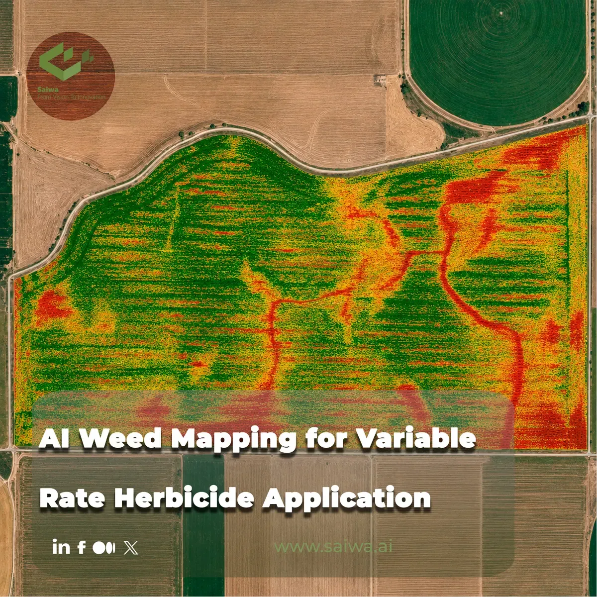
Weed Mapping connects field imagery, weed-identification algorithms, geospatial analysis, and spray-control systems into a practical workflow for site-specific herbicide application. Instead of treating a field as a uniform management unit, the workflow identifies where weeds occur, converts those detections into spatial treatment zones, and supports variable-rate or targeted spraying through prescription maps, real-time control, or autonomous platforms.
This article explains how AI weed mapping supports variable rate herbicide application, from sensing and weed recognition to prescription-map generation and field execution. It focuses on technically documented methods, reported field results, and operational tradeoffs across machine vision, UAV imaging, deep learning, GIS workflows, and Sairone’s documented role in AI-driven weed and invasive plant control.
Weed Mapping in Precision Agriculture
Spatial variability and site-specific management
Precision agriculture starts from a basic agronomic reality: weed pressure does not usually distribute evenly across a field. Weed patches vary by soil conditions, seedbank history, crop competition, moisture, field operations, and previous control failures. Precision agriculture uses spatial variability data for mapping, decision-making, and field management, so weed control can move from uniform broadcast treatment toward site-specific intervention.
AI weed mapping operationalizes that principle by converting image data into spatially explicit weed information. A weed map may show individual detections, weed patches, infestation zones, or treatment areas. When the map includes geographic coordinates, it can support site-specific weed management by linking weed presence to a field location rather than simply reporting a general infestation level.
Variable rate herbicide application applies the same logic at the sprayer. Instead of applying a fixed herbicide rate across an entire field, variable-rate application adjusts the application rate according to position or local field characteristics. In weed management, that adjustment may mean spraying only detected weed patches, changing rates by infestation intensity, or creating treatment zones for later field action.
Why prescription charts can fall short
Prescription-map systems usually combine sensing, GPS, GIS, and sprayer control. A map defines where and how much product should be applied, and the machine executes those instructions in the field. This approach can reduce unnecessary chemical use when weed pressure is patchy, because treated areas can be limited to mapped weed zones rather than the full field.
However, prescription charts have practical constraints. Generating them can be complex, and the map may diverge from actual field conditions if weeds emerge, grow, or shift between imagery collection and spraying. That gap matters because weeds are biological targets, not static infrastructure. A prescription map built from outdated imagery can misrepresent the field on the day of treatment.
Real-time machine-vision spraying addresses part of this problem by detecting weeds during field operation. Yet real-time systems require fast and accurate extraction of weed distribution while the platform is moving. As a result, modern site-specific weed management often balances two approaches: map-based planning for field-scale logistics and real-time or near-real-time sensing for operational responsiveness.

Imaging for Weed Detection
Visible, grayscale, and multispectral inputs
Weed detection depends heavily on image quality, spatial resolution, sensor type, and crop–weed separability. Research has used visible imagery, grayscale imagery, and multispectral inputs for weed identification and mapping. Each input type changes the technical design of the detection workflow.
Visible cameras offer a practical advantage because they are generally less expensive and easier to use than near-infrared or multispectral cameras. One real-time row-crop weed-mapping study emphasized that visible cameras can reduce system cost and complexity compared with spectral sensors, noting that spectral sensors can cost approximately US$1,000. That matters for commercial deployment, where sensor cost, calibration burden, and maintenance can influence adoption.
Grayscale imaging can also support weed mapping when paired with appropriate image processing and field geometry. In a real-time row-crop system, researchers used a tractor-mounted grayscale camera with 1280 × 1060 pixel resolution, a 4–10 mm variable-focus lens, an F/1.4 aperture, and a 53.9° field of view. The study collected preliminary data at approximately 2.5 m/s tractor speed, showing how imaging parameters and vehicle movement become part of the engineering problem.
Multispectral imaging adds spectral information beyond standard RGB bands and can improve vegetation analysis in some applications. In an industrial targeted-weed-control case, a 10-hectare onion field in southern Poland was surveyed with a DJI Matrice 350 RTK at 50 m altitude using DJI Zenmuse P1 and Micasense Altum PT cameras. The project collected 641 RGB images and 6,305 multispectral images, although only RGB imagery was used for the specific weed-detection workflow.
UAV and ground-based sensing platforms
UAVs have become central to weed mapping because they can acquire imagery at centimeter-scale spatial resolution and daily temporal resolution. They are flexible, timely, and useful for small fields or difficult-to-access areas where ground sensing can be slow or logistically difficult. For weed management, those attributes make UAVs suitable for scouting, map generation, and prescription planning.
UAV mapping also enables separation between sensing and spraying. A site-specific weed-management system can use one UAV to collect imagery and generate weed maps, then use another platform to apply herbicide to mapped targets. This separation matters because carrying a pesticide tank and sensing payload on the same UAV can reduce battery duration and limit field capacity.
Ground-based sensing remains important where real-time detection and immediate actuation are required. Tractor-mounted cameras can feed weed maps or detections directly into a sprayer system, reducing the delay between observation and treatment. The tradeoff is that ground platforms cover the field from a lower viewpoint and must process imagery fast enough to support machine-speed decisions.
In practice, UAV and ground-based systems serve different points in the workflow. UAVs provide rapid field-scale imagery and prescription-map inputs; ground rigs can support real-time detection and direct nozzle control. Advanced workflows can also integrate both, using UAV maps to plan operations and machine vision to refine application during execution.
Algorithms for Weed Identification
Classical machine learning for weed features
Before deep learning became dominant in agricultural image analysis, weed detection often relied on handcrafted features and classical machine-learning methods. Documented approaches include morphological features, color-space models, probability-density approaches, support vector machines, high-pass Gaussian processing, and superpixel segmentation methods such as SLIC.
These methods depend on the ability to separate weeds from crops, soil, shadows, and residue using engineered visual cues. Shape, color, texture, row geometry, and plant size can all contribute to classification. In row crops, crop rows may provide structural information that helps distinguish in-row crop plants from inter-row weeds.
Classical methods have produced strong reported results in controlled contexts. One cited approach using support vector machines and morphological features reached 95% accuracy, while another method for rapeseed crop recognition using a reconstructed color model and high-pass Gaussian algorithm reported 98.2% accuracy. These figures show the value of feature engineering, but they also reflect the importance of crop type, field condition, growth stage, and image acquisition setup.
For variable-rate herbicide application, classification accuracy is only one part of the problem. The system must also localize weeds spatially, translate detections into treatment areas, and produce output that a sprayer or GIS workflow can use. A model that performs well in image classification still needs georeferencing, prescription logic, and reliable field execution before it becomes a herbicide-saving system.
Deep learning for detection and segmentation
Deep learning has expanded weed mapping by enabling object detection and semantic or instance segmentation from complex field imagery. Convolutional neural networks can learn visual features directly from training data, reducing reliance on manually designed color or shape rules. This capability is especially relevant when weeds overlap with crops, vary in morphology, or appear under changing illumination.
Recent UAV-based workflows use deep learning to connect recognition directly with prescription-map generation. A soybean-field study presented UAV imagery and an improved YOLOv11-seg model for weed segmentation, then integrated the recognition workflow with ArcGIS Pro to generate variable-rate prescription maps. The model incorporated architectural modifications including RCSOSA, SEAM, iRMB, and adaptive down-sampling.
The reported performance of that improved YOLOv11-seg workflow was mAP@0.5(Box) = 0.89 and mAP@0.5(Mask) = 0.84, with 25.3 GFLOPs and 8.3 million parameters. Those figures matter because weed mapping requires both detection quality and deployable computational efficiency. A high-performing model must still fit the hardware and processing workflow used by farms, service providers, or cloud platforms.
A rice-field workflow used UAV imagery, a YOLOv8n model improved through knowledge distillation from YOLOv8l, weed-distribution mapping, plot-level weed counts, prescription maps, and DJI plant-protection UAV spraying. The YOLOv8n-DT approach improved model accuracy by 3.1% while keeping model parameters constant, and weed-identification accuracy reached 0.82. The workflow then linked weed recognition to automatic variable-rate spraying and droplet evaluation with water-sensitive paper.
Prescription Maps and Spray Control
From weed maps to variable-rate prescriptions
A weed map becomes operationally useful when it can drive a field action. That transformation requires prescription logic: deciding how detections, patches, or infestation zones translate into herbicide rate, spray/no-spray commands, or treatment areas. GIS tools can then package those instructions in a format suitable for equipment or farm-management platforms.
In the soybean UAV workflow, weed recognition was connected to variable-rate prescription-map generation through ArcGIS Pro. In the rice-field workflow, UAV imagery and deep-learning weed recognition fed weed-distribution mapping, plot-level counts, and prescription maps used by DJI plant-protection UAVs. These examples show the full chain: image acquisition, AI detection, spatial mapping, prescription creation, and spray execution.
Industrial workflows follow similar logic. In the onion-field case, PIX4Dfields used machine learning to detect weeds from drone imagery and generate a targeted spraying map, which was uploaded to John Deere Operations Center. The field covered 10 hectares, the ground sampling distance was 0.6 cm, and processing took less than 2 hours. The sprayer used nozzles spaced every 50 cm, supporting targeted application based on the generated map.
Real-time and autonomous spray execution
Spray execution can occur through tractor-mounted variable-rate equipment, autonomous UAV sprayers, or targeted smart-spraying systems. Variable-rate control approaches include flow-based control using a controller, flow meter, ground-speed sensor, and servo valve; direct chemical injection, where chemical rate changes while carrier flow generally remains constant; and direct chemical injection with carrier control, which uses separate control loops for chemical injection and carrier-water flow.
Each control architecture has implications for response time, application accuracy, tank management, and chemical handling. Direct injection can reduce residual tank-mix exposure and support faster rate transitions because the chemical and carrier can be managed separately. Flow-based systems are more conventional but depend on hydraulic response and calibration across changing field speeds and application rates.
In real-time precision spraying, engineering constraints appear at the nozzle level. Variable-rate spraying can use pressure adjustment or pulse-width modulation, but pressure changes affect atomization and flow range, while low-frequency pulse-width modulation can create discontinuous spraying. These are not minor details: droplet spectrum, coverage, and timing determine whether the mapped weed target receives an agronomically meaningful dose.
Autonomous UAV spraying introduces additional parameters. In one site-specific weed-management experiment, researchers used a DJI AGRAS MG-1 octocopter for spraying at 1 m/s flight speed and 3 m height, with an application volume of 151 L/ha, four air-induction flat-fan nozzles, pressure of 12 kPa, and an effective swath of 1.5 m ± 0.5 m. These values show how prescription-based application must align with flight dynamics, spray swath, nozzle setup, and target geometry.
System Performance and Field Validation
Accuracy, efficiency, and herbicide savings
AI weed mapping is valuable when it improves field decisions, reduces unnecessary herbicide use, or enables more precise treatment. Reported herbicide savings vary by crop system, weed distribution, sensing workflow, and equipment. A UAV-generated weed-map approach linked to a variable-rate tractor sprayer achieved 39% herbicide savings in a cited study. A rice-field workflow using UAV imagery, deep learning, prescription maps, and plant-protection UAV spraying saved approximately 15.28% herbicide compared with traditional extensive spraying.
The onion-field case reported a larger reduction. The targeted spraying workflow in a 10-hectare field used drone imagery, machine-learning weed detection, a targeted spraying map, and John Deere integration, resulting in a reported 75% herbicide reduction. That outcome reflects a specific field, crop, weed distribution, image resolution, and equipment configuration.
Accuracy metrics also differ by task. Object detection metrics such as mAP@0.5(Box) measure bounding-box detection, while segmentation metrics such as mAP@0.5(Mask) evaluate mask-level target delineation. Weed-identification accuracy, as reported in the rice workflow, summarizes recognition performance in that study’s setup. For herbicide application, the most relevant validation usually combines detection quality, map quality, spray placement, droplet deposition, and product-use reduction.
Workflow constraints and operational tradeoffs
Field validation must account for timing. UAV imagery can be collected rapidly, but prescription maps must be processed and delivered before the weed situation changes materially. The onion-field workflow demonstrates a fast industrial case: a 10-hectare survey was completed in one day and image processing took less than 2 hours. That kind of turnaround supports practical decision-making when spraying windows are narrow.
Platform selection creates another tradeoff. UAVs offer high-resolution coverage and flexible deployment, but payload, battery life, flight regulations, weather, and tank capacity constrain spraying operations. The two-UAV architecture addresses one part of that problem by assigning mapping and spraying to separate aircraft, reducing the burden on a single platform.
Ground-based systems can combine sensing and spraying in one pass, but they require robust real-time processing. The detection pipeline must operate quickly enough to identify weeds, localize them, and actuate the sprayer before the nozzle passes the target. This requirement links algorithm design to camera placement, travel speed, boom geometry, latency, and nozzle response.
The best-performing workflow is therefore not just the most accurate model. It is the workflow that produces sufficiently accurate detections, converts them into usable geospatial instructions, and executes the spray plan within the constraints of equipment, crop stage, field size, weather, and operational timing.
Smart Spraying Technology Trends
Integration with autonomous UAV spraying
Smart spraying is moving toward tighter integration between sensing, mapping, decision-making, and autonomous execution. UAVs can acquire centimeter-scale imagery at frequent intervals, and autonomous spraying UAVs can apply herbicide to mapped areas. Machine learning and convolutional neural networks support the transition from broadcast UAV application toward site-specific weed treatment.
The two-UAV model is especially important for operational design. One UAV performs remote sensing and weed mapping, while another performs spraying. This architecture recognizes the physical limits of UAV payload and battery capacity while preserving the agronomic value of high-resolution imagery.
Deep-learning workflows are also becoming more map-aware. The soybean study connected UAV recognition with variable-rate prescription maps through GIS software. The rice-field study connected UAV imagery, YOLO-based weed recognition, weed-distribution mapping, prescription generation, and DJI plant-protection UAV spraying. These studies show a clear trend: weed detection is increasingly treated as one component in a full field-action pipeline rather than as a standalone computer-vision benchmark.
Targeted application across crop systems
AI weed mapping is being tested and deployed across different crop systems, including row crops, soybean fields, rice fields, and onion production. Each system presents a different visual and operational problem. Row crops provide geometry that can help distinguish crop from weed, while broadcast or dense-canopy systems may require segmentation models that handle overlapping vegetation.
Targeted spraying also depends on equipment compatibility. Prescription maps must move from imagery software or GIS into farm-management platforms, sprayer controllers, or UAV mission systems. In the onion-field case, the spraying map moved into John Deere Operations Center, demonstrating the importance of interoperability between mapping software and equipment ecosystems.
The trend is not a single universal weed-control machine. It is a modular workflow: high-resolution sensing, AI-based weed identification, GIS-based prescription logic, equipment-compatible outputs, and field validation. That modularity allows the same technical concept—apply herbicide where weeds justify treatment—to adapt across crops, platforms, and service models.
Sairone and its Field Application in AI-Driven Precision Agriculture
Cloud-scale geospatial processing for large imagery
Sairone is documented as a B2B SaaS platform that uses computer vision and AI for agricultural and environmental applications. Its intended users include agricultural service companies, agronomists, cooperatives, and ecologists. That positioning fits the service-provider layer of precision agriculture: organizations that collect imagery, process field data, and deliver actionable outputs to growers or land managers.
For weed and invasive plant control, Sairone supports high-resolution drone imagery, orthophotos, georeferenced GeoTIFF, TIFF, JPEG, and PNG inputs. Batch upload supports broad field surveys, while cloud file storage supports input imagery, raw drone data, processed outputs, folders, multiple formats, and large-file uploads. The platform can also process images, videos, and orthomosaics, and it can generate an orthomosaic from video.
Geospatial handling is central to the workflow. Sairone’s GeoTIFF optimization extracts geospatial metadata, preserves the coordinate reference system, and connects outputs with GIS and Atlas workflows. For variable-rate herbicide application, that geospatial continuity is essential because detections must remain tied to field coordinates from imagery ingestion through treatment planning.
Automated weed identification and density mapping
Sairone’s weed and invasive plant control documentation states that computer-vision models identify and classify crops, weeds, and invasive plants. Documented supported species include Taraxacum or dandelion, Amaranthus tuberculatus or waterhemp, Amaranthus palmeri or Palmer amaranth, European water chestnut, water soldier, fleabane, and thistle. Additional species listed for development include knotweed, geranium, Amsinckia, Bassia scoparia, Raphanus raphanistrum, and Ambrosia artemisiifolia.
The documentation states model accuracy above 99% and describes incremental learning as a method for reducing false positives. In operational terms, incremental learning matters because weed models may need to improve across new geographies, species, image conditions, and customer datasets. Sairone’s broader platform documentation also states that Saiwa can develop or customize AI models for specific audiences, data types, and agricultural or environmental challenges.
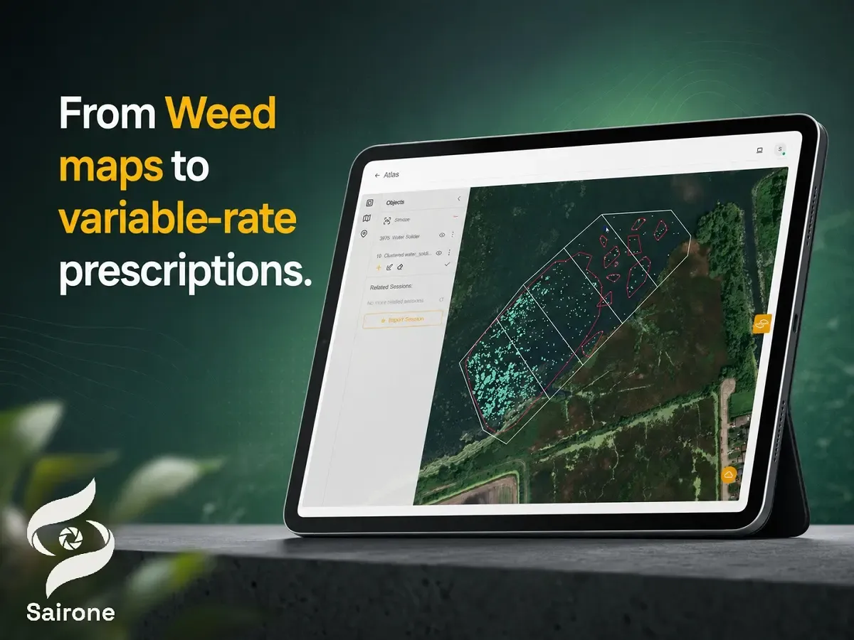
For field action, Sairone maps weed locations using precise geographic coordinates. Its Atlas environment visualizes weed distribution, infestation patterns, treatment maps, distribution maps, and clustering. Intelligent clustering groups detections into manageable treatment or spraying areas, turning many individual detections into operational zones that a field team can review and act on.
GIS outputs for variable-rate field action
Variable-rate herbicide application depends on moving from detection to equipment-ready data. Sairone supports GIS-ready exports including GeoJSON, Shapefile, KML, and CSV. These formats are relevant because prescription workflows often require data exchange between AI platforms, GIS software, farm-management systems, and sprayer-control environments.
Sairone’s documented output structure aligns with the practical needs of weed mapping: location-aware detections, distribution visualization, treatment maps, clustering, and GIS export. In a variable-rate workflow, those outputs can support review, editing, integration, and downstream field action where compatible equipment or client systems accept geospatial prescription data.
The platform also includes an analytics dashboard with weather status, validation and licensing information, storage usage, service-use statistics, processing time, recent files and processes, annotation projects, and interactive Atlas visualizations. That dashboard layer supports operational management because weed mapping projects involve file handling, processing status, visual validation, and iterative review before field action.
Enterprise customization and deployment
Sairone is documented with three deployment and integration paths: an online cloud platform, custom API integration, and White Label deployment. Its multi-tenant architecture supports BaaS and White Label models, and custom APIs can integrate with a client’s existing infrastructure. A fully White Label platform can also be offered under the client’s brand, needs, and workflow.
The platform includes annotation tools for custom classes, colors, multiclass annotation, polygons, and bounding boxes. These tools matter in AI weed management because new weed species, local crop systems, and specialized invasive-plant targets often require curated training data and expert review. Annotation and model customization support a feedback loop between field observations, labeled data, model improvement, and operational outputs.
In the broader precision-agriculture stack, Sairone occupies the AI geospatial intelligence layer. It ingests drone and geospatial imagery, identifies weeds and invasive plants, maps detections, visualizes infestation patterns, clusters treatment areas, and exports GIS-ready data. That role complements the equipment side of variable-rate herbicide application, where sprayer controllers, UAV sprayers, or farm-management platforms execute the field treatment.
Conclusion
AI weed mapping makes variable rate herbicide application technically feasible by connecting weed detection with location-aware field action. The workflow requires more than an accurate model: it needs reliable imagery, georeferencing, weed classification or segmentation, GIS-ready prescription logic, compatible spray-control systems, and field validation of application quality. Reported results show meaningful herbicide reductions in specific workflows, including 39% savings with UAV-generated weed maps and a variable-rate tractor sprayer, approximately 15.28% savings in a rice-field UAV workflow, and 75% reduction in a targeted onion-field case.
The strongest technical direction is integrated and modular: UAV or ground-based sensing captures weed conditions; AI models detect, segment, or classify weed targets; GIS systems convert detections into prescription maps; and sprayers execute site-specific treatment. Sairone’s documented capabilities fit this direction through cloud-based imagery processing, weed and invasive-plant identification, geospatial mapping, Atlas visualization, clustering of treatment areas, GIS-ready exports, and enterprise deployment options for agricultural and environmental service providers
Comments
No comments yet!
Table of Contents
No headings were found on this page.