



AI Orthomosaic Mapping for Invasive Plant Distribution
Learn how AI orthomosaic mapping combines UAV imagery, deep learning, GIS outputs, and precision spraying to map invasive plant distribution
Written by Amirhossein
Reviewed by Boshra
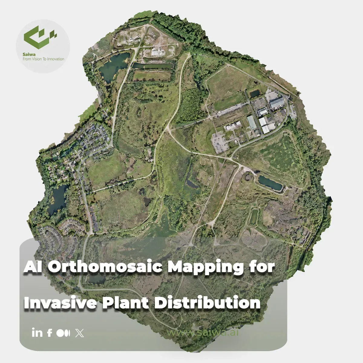
Invasive plants are spatial problems before they become treatment problems. A management team needs to know not only which species is present, but where it occurs, how extensively it has spread, and how those locations can be converted into treatment areas without affecting the rest of a field or natural site. AI-supported orthomosaic mapping connects those steps: it turns aerial imagery into georeferenced plant detections, distribution layers, and operational GIS outputs.
This article explains the technical workflow from UAV image capture and orthomosaic creation through deep-learning inference, model-improvement methods, GIS-based distribution mapping, and drone-enabled spot application. It also examines how Sairone applies cloud processing, computer vision, geospatial visualization, and customized AI deployment to weed and invasive-plant control.
Orthomosaic Workflows for Detection
UAV imagery in post-flight mapping
Unmanned aerial vehicles provide high-resolution imagery that can support plant-species mapping over agricultural and environmentally sensitive areas. In a wetland study focused on invasive blueberry species, UAV images were assembled into orthomosaics and analyzed with GIS and deep-learning methods to map plant locations, distribution, spread, bush height, and bush area. This demonstrates the value of orthomosaics as a spatially continuous base layer for invasive-species assessment.
Post-flight orthomosaic processing remains central to many drone-based plant-detection workflows. James and Bradshaw note that most plant-detection studies have concentrated on post-flight processed orthomosaics, even though real-world deployment also requires algorithms that tolerate changing environmental conditions. Orthomosaics are useful because they provide a map-aligned representation of the surveyed area, allowing plant detections to be related to field boundaries, management units, and subsequent GIS analyses.
The mapping process can also be designed around the practical structure of a treatment operation. In a Wisconsin wetland project, a site with approximately 1,400 acres targeted for Phragmites treatment was flown and mapped before application, enabling affected areas to be identified and marked for spot treatment. Surveying and mapping were performed in sections to make later spraying more manageable. This illustrates an operational principle: imagery collection and map production should be planned with downstream treatment logistics in mind.
Labeling and training image collections
Deep-learning detection depends on labeled examples that represent the target class and the imaging conditions expected during inference. An ArcGIS Pro plant-classification workflow creates a mosaic dataset from multiple images, labels the images using the Label Objects for Deep Learning tool, exports training data, and trains a deep-learning model from the labeled collection. The workflow is designed for classification where the pixels in each image are needed during training.
Training data preparation involves choices that affect both the model and the spatial interpretation of its output. In the ArcGIS Pro example, image tiles are exported in Pixel Space because the imagery used for classification does not contain spatial information. The selected metadata format is Labeled Tiles, while bounding-box cropping is used in the training-data export configuration. Those settings establish a structured path from image collection to trainable samples.
For drone workflows that begin with oblique imagery, labeling and model training can also be performed in Pixel Space. Esri’s object-detection workflow uses the Label Objects for Deep Learning pane with Image Collection and Pixel Space options, followed by export of training chips in Pixel Space and model training with a resulting model definition that records "ImageSpaceUsed": "PIXEL_SPACE". This is relevant when the raw drone view contains object detail that may be less visible after orthorectification.
Deep Learning for Plant Classification
Object detection in orthorectified imagery
Deep learning can identify plant targets from imagery, but the appropriate inference space depends on the imagery and detection objective. Orthoimages are often used for object detection, yet they may reduce visible object detail: certain features can appear only as dots or circles, and vegetation can obscure objects when viewed from directly above. Oblique drone imagery can preserve more visual detail for object recognition in some situations.
A Pixel Space-to-Map Space workflow addresses this distinction. In Esri’s approach, detections are first generated in the raw Pixel Space of drone images and then transformed to Map Space using image frame and camera information held by an orthorectified image collection. The required image collection includes camera information such as focal length and sensor characteristics; GPS accuracy is also identified as important where available.
The workflow requires the orientation of individual images to be calculated through block adjustment. Ground control points and tie points may be incorporated when available, and a depth map can be computed to improve detection-transformation accuracy. Candidate-item processing can then limit duplicate imagery by identifying images that best represent the mosaic area. The resulting process connects detailed image-space detection with mapped geometries suitable for spatial analysis.
Pixel-based and map-based inference
Pixel-level classification and map-level object output solve different mapping problems. In a high-resolution land-cover tutorial, ArcGIS Pro applies the Classify Pixels Using Deep Learning tool to an orthomosaic and generates an output land-cover raster. The input example is a true orthophoto derived from multiple drone images and published as an image tile service. This approach is appropriate when the required result is a classified surface rather than individual object features.
Processing high-resolution drone imagery also requires attention to model resolution and compute limits. In the ArcGIS example, the drone imagery has a ground pixel size of approximately 2.5 by 2.5 centimeters, whereas the referenced pretrained land-cover model was trained for imagery with 80- to 100-centimeter resolution. The tutorial therefore uses a 0.9-meter cell size during inference because processing the original 2.5-centimeter resolution would create a much larger number of pixels and increase processing time; the original resolution could also be excessively detailed for the model’s expected feature scale.
Image tiling is another operational constraint. Pixel classification does not process the entire image simultaneously; it splits the raster into tiles based on the configured tile size. Batch size controls how many tiles are handled at once, and reducing batch size can address memory limitations. These practical settings matter because orthomosaic mapping is not only a classification challenge but also a data-processing workflow.
Improving Model Performance
Transfer learning and model fine-tuning
Transfer learning can improve invasive-plant detection when a model is adapted to the target imagery and species. In the wetland invasive-blueberry study, deep-learning networks using transfer learning with unfrozen weights automatically detected blueberry bushes with a true-positive value of 93.83% and overall accuracy of 98.83%. The study also reported a Dice value of 0.624 after refinement of the result masks.
Fine-tuning should be treated as a controlled response to model behavior rather than an automatic substitute for representative training data. In the ArcGIS Pro plant-species workflow, the Train Deep Learning Model tool is configured to stop when improvement is no longer observed, while the Freeze Model option can be left unchecked to permit further training when model performance needs improvement. This supports iterative refinement of the trained model.
Pretrained models can reduce the time and effort required to begin a mapping workflow, but their intended image resolution remains important. ArcGIS describes its High Resolution Land Cover Classification package as trained on a large dataset and intended to classify land-cover features accurately; using it can avoid training a new model from the beginning. However, the tutorial explicitly notes that the model works best with imagery at a similar 80-centimeter to 1-meter resolution. Model reuse therefore needs to be paired with input preparation that matches the model’s operating conditions.
Augmentation and loss weighting strategies
Training data should represent the variability a model will encounter in field deployment. James and Bradshaw found that adding brightness variation as a training augmentation improved F1-score by 27% on an unseen test set. The result is particularly relevant for drone imagery because field imagery can vary with illumination and other environmental conditions.
The same research tested a weight map-based loss strategy to address uncertainty in annotation masks caused by indistinct target-plant edges. For the best hyperparameter configuration, this weighting approach improved precision by 15%, producing a final model with an F1-score of 83% and accuracy of 96%. The study further demonstrated that a commercially available drone integrated with a deep-learning model could detect invasive plants in the field.
A separate study of broad-leaved pepper mapping in a complex coastal environment compared Random Forest, XGBoost, and Support Vector Machine models with a U-Net deep-learning model. The U-Net model outperformed the evaluated classical machine-learning models, achieving 83% precision, 81% recall, and an 82% F1-score during training and validation. On a separate test dataset, it achieved 86% precision, 76% recall, 81% F1-score, and 68% intersection over union. The study’s methodology integrated multispectral data and vegetation indices with feature-extraction approaches.
Mapping Invasive Species Distribution
GIS outputs for location and spread
A plant detection becomes operationally useful when it is expressed in geographic space. The invasive-blueberry wetland workflow used UAV orthomosaics, GIS, computer vision, computational topology, and deep learning to create maps of location, distribution, and spread for each study site. The same workflow also derived bush height and area information, giving managers spatial attributes beyond simple presence or absence.
For object detection from drone image collections, Map Space is the coordinate-reference environment where inferred geometries can be used as mapped features. When detections are generated in Pixel Space and transformed using camera and frame information, the output becomes suitable for map-based review and spatial planning. This is the bridge between computer-vision predictions and management decisions.
Species classification outputs can also include confidence values. In the ArcGIS Pro plant-species example, the output feature class contains the class label, classification confidence, image location, and source identifier. Confidence attributes help distinguish a mapped classification result from the underlying certainty reported by the model.
Density, extent, and treatment zones
Distribution maps can be converted into treatment zones when the infestation pattern is spatially explicit. The Wisconsin Phragmites project used aerial mapping to locate and mark invasive patches, then exported those mapped treatment areas to a DJI AGRAS MG-1 spray drone. The operational treatment areas ranged from 0.1 to 10 acres.
The project also demonstrates how mapping can reduce the scale of manual field work. An agronomist involved in the project reported mapping 2,000 acres in 2.5 days with drone imagery and Pix4Dfields after previously mapping the same acreage manually over three months with a handheld GPS. The project used approximately 13,000 images and around 12 continuous flight hours. These figures reflect one documented project rather than a universal benchmark, but they show why map-based delineation is valuable for large and difficult wetland sites.
Spatial treatment design can support more selective chemical use. In the Phragmites case, treatment zones were created around affected areas, exported as shapefiles, and sent to the spray-drone operator. The operator reported that mapping and treating only Phragmites reduced chemical use and minimized effects on non-target plants.
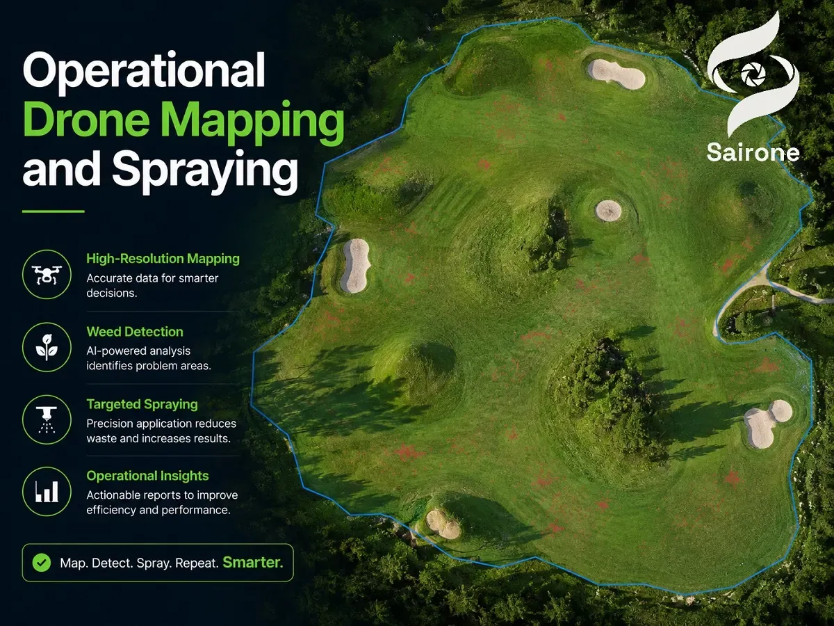
Operational Drone Mapping and Spraying
From mapped areas to spot application
Drone mapping and application form a connected workflow when treatment boundaries are transferred directly from GIS analysis to field equipment. In the documented Wisconsin project, Phragmites patches were easier to recognize in aerial maps while the plants were seeding. After identification and marking, spot-treatment areas were exported to the spray drone as a digital map.
The mapping platform’s advanced layer visualization was used to identify and map Phragmites, and the project participant reported using the Leaf Chlorophyll Index to highlight the invasive grass. Zones were then created around the areas requiring treatment. This sequence illustrates how image interpretation, delineation, and application planning can be combined without treating an entire site uniformly.
Spot spraying is especially relevant where invasive plants occur in patches and surrounding vegetation should remain untreated. In the documented operation, the drone controller received the shapefiles and the specified herbicide was loaded before the drone was used to spray the mapped Phragmites locations. The stated outcome was precise application in the identified areas rather than broad treatment across the wetland.
Shapefiles for precision spray workflows
Shapefiles are a practical interchange format for moving treatment boundaries from mapping software to field machinery. In the Phragmites case, the mapping requirement explicitly included creation of shapefiles for use with the AGRAS spray drone. This placed mapped infestation geometry directly into the application workflow.
The same project used a senseFly eBee SQ aircraft equipped with a Parrot Sequoia multispectral camera for imagery collection. The area was flown in sections, imagery was processed into maps, and treatment zones were exported as shapefiles. The workflow shows that a shapefile can operate as the handoff between remote-sensing interpretation and location-specific spraying.
The broader management value lies in applying treatment where mapped evidence indicates it is required. The project team reported that this precision approach helped leave non-target areas unaffected while maximizing treatment of Phragmites in a state wildlife area. For invasive-plant management, that spatial selectivity is the central reason to connect orthomosaic analysis with precision application.

GeoAI Workflows in ArcGIS Pro
Land-cover extraction from drone orthomosaics
GeoAI workflows in ArcGIS Pro support classification of orthomosaic imagery into land-cover outputs. The high-resolution land-cover tutorial starts with a true orthomosaic created from multiple drone images, then applies a pretrained deep-learning package through the Classify Pixels Using Deep Learning geoprocessing tool. The output is a raster dataset representing the classified land cover.
This kind of pixel-classification workflow is distinct from object detection. It labels the raster surface by class, while object-detection workflows create discrete geometries for detected targets. Both outputs can contribute to invasive-plant mapping, depending on whether the analytical goal is delineating a continuous vegetation cover or locating individual plants or patches.
The settings used for inference should account for the relationship between source imagery, target features, model training resolution, and hardware capacity. In ArcGIS Pro, tile size and batch size govern how an image is partitioned and processed, while cell size can be adjusted to align imagery with the model’s expected resolution. These controls make high-resolution orthomosaic analysis operationally manageable.
Pretrained models for high-resolution imagery
Pretrained deep-learning models offer a starting point for land-cover extraction because they carry learned information from their original training data. ArcGIS’s land-cover example describes this as a way to leverage knowledge embedded in an existing model and reduce the effort needed to train a new model. The model still must be evaluated against the imagery and classification task at hand.
For species-level identification, ArcGIS Pro provides a separate workflow that trains a model from labeled image collections and uses Classify Objects for Deep Learning to infer plant species. The output feature class records class labels and confidence values, supporting inspection of the classification results. This is useful where plant categories, rather than general land-cover classes, are the target of analysis.
When direct overhead views provide insufficient visual information, inference can use oblique drone images in Pixel Space before detections are transformed into Map Space. The workflow is designed around an orthorectified image collection with camera information, allowing detections to retain their spatial utility after being made from more detailed raw imagery.
Sairone and its Field Application in AI-Driven Precision Agriculture
Cloud-native processing for large orthomosaic inputs
Sairone is Saiwa’s AI-driven, computer-vision platform for agricultural and environmental applications. Its documented inputs include images, videos, and orthomosaics, and it can create orthomosaics from video. Saiwa positions Sairone as a B2B SaaS platform for agricultural service providers, agronomists, cooperatives, and ecologists.
The platform supports cloud-based data upload, processing, and report generation without requiring customers to develop and maintain their own dedicated infrastructure. Its Files capability provides cloud storage for raw drone images, uploaded inputs, processed results, and service outputs, with support for large files and large datasets. This supports workflows that need to retain and organize geospatial imagery and analysis outputs in one platform.
Sairone Weed Control accepts high-resolution drone images, accurately orthorectified orthophotos, and georeferenced GeoTIFF data. GeoTIFF processing automatically extracts spatial metadata, preserves the coordinate reference system during computer-vision analysis, and supports precise weed detection and localization integrated with GIS workflows.
Automated weed and invasive plant identification
Sairone Weed Control is an AI-based precision-agriculture service that uses computer vision and machine learning to identify, map, and analyze weeds and invasive plant species across agricultural fields and natural environments. Its detection models are designed to identify and classify crops, weeds, and invasive plants from image data, producing identification results, confidence scores, and precise geographic coordinates.
The currently supported plant list includes Taraxacum, waterhemp (Amaranthus tuberculatus), Palmer amaranth (Amaranthus palmeri), European water chestnut, water soldier, fleabane, and thistle. The service documentation also identifies knotweed, geranium, fiddleneck (Amsinckia), kochia (Bassia scoparia), wild radish (Raphanus raphanistrum), and common ragweed (Ambrosia artemisiifolia) as planned additions.
Sairone documents detection-model accuracy above 99% and states that incremental learning is used to improve performance over time and reduce false positives. AI-generated results are subject to a validation process in which users can confirm, revise, or approve detections before they are transferred to Atlas, Sairone’s spatial platform. This human-in-the-loop review keeps expert oversight connected to automated detection.
GIS exports for variable-rate field action
After validation, Sairone transfers detection data to Atlas for spatial visualization, infestation-pattern analysis, treatment-map generation, and precision-agriculture decision support. Atlas displays results through maps and geospatial layers, supports custom areas and hierarchical field zones, and provides real-time spatial analytics dashboards.
The service produces GIS-ready outputs in GeoJSON, Shapefile, KML, and CSV formats. These exports allow mapped weed locations, distribution patterns, and treatment zones to be moved into compatible GIS and precision-application workflows. In practice, this format interoperability is what enables a detection result to become a field-action layer rather than remain only a visual report.
Atlas also includes intelligent detection clustering, which groups detected weeds into manageable zones for treatment. The stated purpose is to optimize spraying operations and precision-agriculture workflows. By organizing detections into treatment-oriented management zones, the platform supports planning for location-specific intervention.
Enterprise AI customization and deployment
Saiwa describes its approach as specialized AI development for defined agricultural and environmental challenges rather than a one-size-fits-all software offering. Sairone’s computer-vision capabilities include tagging and annotation tools that allow users to label their data and identify or count the objects relevant to their operation. Saiwa can develop or customize AI models according to user requirements and data type.
The platform is available through a cloud-based online service, customized API integration, or a fully customized white-label platform aligned with a customer’s brand, requirements, and workflow. Saiwa also supports Back-end as a Service and white-labeling through a multi-tenant structure intended for agricultural-technology companies that want to outsource product development at lower cost.
This deployment model is relevant to organizations that need plant-detection infrastructure integrated with existing systems rather than limited to a fixed interface. Customized models, tailored API connections, branded delivery, and platform-level workflow alignment allow Sairone to be configured around operational goals in agriculture, ecology, and environmental monitoring.
Conclusion
AI orthomosaic mapping provides a structured route from UAV imagery to location-specific invasive-plant management. Orthomosaics and image collections support spatially referenced analysis; deep-learning models can classify vegetation, detect targets, and generate mapped outputs; and GIS layers can be converted into treatment zones for spot spraying. Research and operational examples show that model performance depends on training design, imagery conditions, augmentation, annotation quality, resolution matching, and map-space transformation methods.
For applied precision agriculture and invasive-plant control, the final value lies in the continuity of the workflow. Sairone combines cloud-based image handling, computer-vision detection, user validation, Atlas-based geospatial analysis, clustering, and GIS exports to support treatment-oriented decision-making. Its cloud, API, and white-label delivery options extend that workflow to organizations that require customized AI infrastructure for field operations.
About the team
Continue reading
Ottawa Weed Control - Targeted AI-Powered Services in Ontario
Ottawa is surrounded by fertile agricultural regions that support the cultivation of crops vital to Ontario’s economy. However, the region's

Top 10 Agriculture Data Analytics Companies Revolutionizing the Farming Industry
The agricultural sector is undergoing a profound transformation, moving from traditional practices to a future defined by precision and data
How is AI Used in Agriculture | Its Role in Farming
One of the biggest challenges in modern agriculture is feeding a growing population amid climate volatility, labor shortages, and rising inp
Smart Crop Protection System Using IoT - Field Intelligence
Precision agriculture powered by data and connected technologies stands poised to revolutionize farm productivity and sustainability amidst
AI vs. Field Surveys for Invasive Plant Detection: Accuracy and Cost
Invasive plant management depends on knowing where target species occur, how widely they are distributed, and how quickly those patterns are
The Impact of AI in Automated Harvesting
Harvesting represents one of the most labor-intensive phases across agricultural operations. As labor shortages compound and farm sizes scal
Comments
Be the first to share your thoughts
No comments yet
Start the conversation by sharing your thoughts
Share this article
Help others discover this content
Table of Contents
No headings were found on this page.