



Seasonal Phenology for AI-Based Invasive Plant Detection
Learn how seasonal phenology, hyperspectral imagery, and AI algorithms improve invasive plant detection, mapping, and precision management
Written by Amirhossein
Reviewed by Boshra
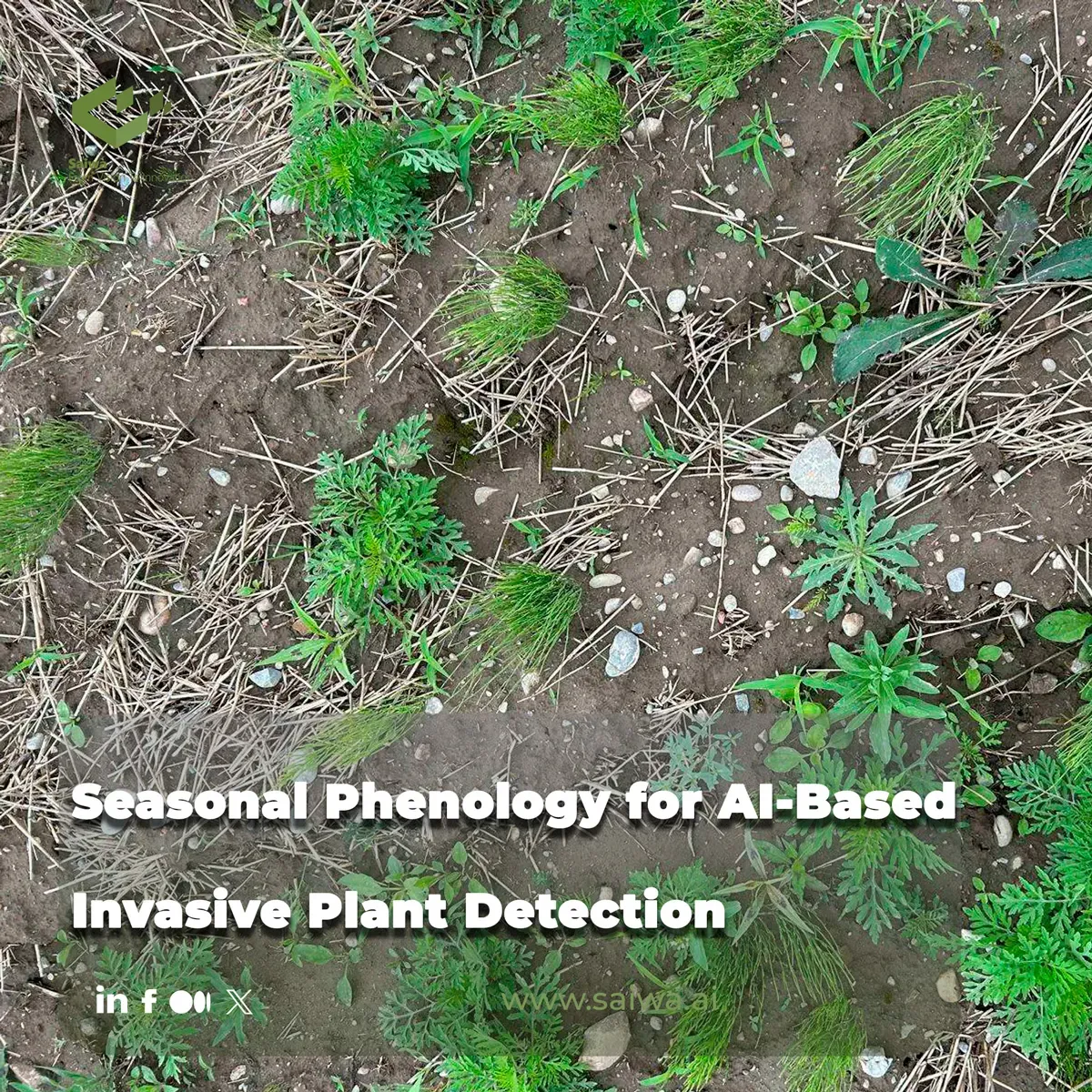
Seasonal phenology provides the biological timing framework needed to improve AI-based invasive plant detection. Plant growth, flowering, leaf development, senescence, and seed production alter the spectral and structural signals captured by drones, aircraft, and satellites. When these seasonal changes are incorporated into detection workflows, remote-sensing models can be designed around the periods when target species are most distinguishable from surrounding vegetation.
This article examines how hyperspectral and multitemporal imagery support invasive-plant classification across heterogeneous landscapes, why detection timing matters, and where remote sensing remains constrained by plant size, vegetation complexity, and data availability. It also explains how phenology can inform management schedules and how Sairone, Saiwa’s AI-driven precision-agriculture platform, translates imagery into species detections, density maps, treatment zones, and GIS-ready outputs.
Hyperspectral Detection Across Seasons
Fine-scale drone imagery in heterogeneous vegetation
Invasive plants often occur within mixed vegetation communities where target species can share similar colors, textures, and growth forms with native plants. This makes direct mapping more demanding than simply identifying areas with abnormal vegetation. Fine-scale hyperspectral imagery addresses part of this challenge by recording detailed spectral information at high spatial resolution. In one study, researchers collected hyperspectral drone imagery at a spatial resolution of 3 cm across seven dates from April through November 2020.
The study focused on three invasive species: Ailanthus altissima (tree of heaven), Elaeagnus umbellata (autumn olive), and Rhamnus davurica (Dahurian buckthorn). These species were evaluated within heterogeneous vegetation communities in Virginia, where all three are invasive. The research used a subsample of pixels from the imagery to develop multitemporal detection algorithms. This approach is technically significant because it demonstrates that an algorithm does not necessarily need to process every available pixel to derive useful species-level information. A carefully selected subset of hyperspectral data can support accurate invasive-plant detection when the imagery and phenological timing are appropriately designed.
The value of fine spatial resolution is particularly apparent when the management objective involves locating plants or patches within complex vegetation rather than classifying an entire landscape into broad land-cover categories. However, spatial detail alone does not guarantee reliable identification. The spectral response of the invasive plant must also differ sufficiently from nearby vegetation during the image-acquisition period. Phenology therefore becomes a model-design variable rather than a background ecological detail.
Multitemporal spectral features for classification
The seasonal study found that all three target species could be detected in June, but their detection performance differed across the growing season. E. umbellata produced consistently accurate algorithms and used consistent features in the visible and red-edge regions across the season. During summer, its most accurate detection algorithms also incorporated features from the yellow-orange spectral region.
The other two species showed less temporal consistency. A. altissima and R. davurica were detectable during the middle and later portions of the growing season, but their important spectral features had little overlap between acquisition dates. This finding has direct implications for AI-based classification. A single static spectral signature may not represent a species adequately throughout the season. Instead, the algorithm may need to account for the changing contribution of spectral regions as the plant moves through different phenological stages.
A multitemporal model can therefore use the seasonal sequence itself as information. The relevant question is not only whether a pixel resembles a target species on one date, but also whether its spectral behavior across dates is compatible with that species. The findings from the drone-based study indicate that incorporating species-specific phenological traits improves invasive-plant detection and establishes a methodological basis for future management applications.
Phenology-Driven Algorithm Design
Species-specific phenological traits
Phenology affects detection because plant development changes the observable properties of vegetation. The timing of leaf emergence, canopy development, flowering, and senescence can influence how a target plant appears relative to neighboring species. The three-species hyperspectral study showed that the most useful spectral features were not identical across species or stable across all dates. This supports an algorithmic design in which each species receives a detection strategy informed by its own seasonal behavior.
For AI systems, this means that training data should be associated with acquisition dates and phenological stages whenever possible. A model trained only on imagery from one period may perform well under similar conditions but become less reliable when plant development, background vegetation, or illumination changes. The evidence from multitemporal hyperspectral analysis favors a more structured approach: evaluate when each target species is detectable, identify the spectral regions that support classification, and test whether those features remain stable as the growing season progresses.
This principle also helps define the limits of general-purpose classification. A model that detects one invasive species during a particular growth stage should not automatically be assumed to detect another species under the same conditions. The seasonal behavior of E. umbellata, for example, differed from that of A. altissima and R. davurica in feature consistency and seasonal detectability. Phenology-aware AI should preserve these distinctions.
Detection timing across growing seasons
The acquisition calendar is part of the detection system. In the study conducted from April to November, June was a common period in which all three species could be detected. That result does not imply that June is universally optimal for every invasive plant or ecosystem. It demonstrates that a shared detection window can exist for a defined group of species under a defined study context, while additional species may require different observation periods.
Seasonal monitoring also creates the possibility of selecting dates strategically instead of treating all imagery as equally informative. For a species with stable visible and red-edge features, repeated observations may support consistent classification. For species whose key features shift between dates, the model may need to emphasize different spectral information during early, middle, and late growing-season observations.
The operational consequence is straightforward: AI-based invasive-plant detection should be evaluated against the biological calendar of the target species. Imagery collected at the wrong stage can reduce contrast between the invasive plant and its surrounding vegetation, even when the sensor has high spectral or spatial resolution.
Field Constraints in Invasive Mapping
Limits of remote sensing for small plants
Remote sensing can provide spatially consistent observations across large areas, but it cannot always resolve individual plants. NASA’s remote-sensing training materials identify the difficulty of detecting small invasive plants as a central challenge in grassland monitoring. A request to identify individual cheatgrass plants, for example, may exceed the practical detection capability of a given remote-sensing configuration when the plants are too small to distinguish remotely.
This limitation is not only a question of sensor quality. Detectability depends on the relationship between plant size, spatial resolution, canopy structure, surrounding vegetation, and the mapping objective. A system may be suitable for identifying larger patches or areas of infestation while remaining unsuitable for locating isolated small plants. The difference between direct mapping of invasive-plant occurrence and broader indirect mapping of habitat or distribution must therefore be maintained during project design.
Remote sensing can support three broad monitoring objectives: mapping invasive-plant occurrence, providing information for predicting invasive-plant distribution, and assessing invasive-species impacts. These objectives require different data and validation strategies. A model designed for direct species mapping should not be evaluated as though it were only estimating habitat suitability.
Tradeoffs between field and remote methods
Field-based methods remain important because they provide observations that remote sensors cannot always capture, especially when target plants are small, hidden within dense vegetation, or spectrally similar to neighboring species. NASA’s training framework presents remote sensing and field methods as complementary approaches with different benefits and limitations.
Remote sensing offers consistent spatiotemporal data collection in a common format, which can support repeatable mapping and monitoring across broad areas. It can also provide spatially explicit information that is difficult to obtain through manual surveys alone. Field observations, by contrast, can verify species identity and provide detailed information at locations where remote classification is uncertain.
A technically defensible workflow should connect the two. Remote imagery can identify candidate areas and produce spatial predictions, while field observations can support validation and correction. The balance between the methods depends on whether the goal is broad distribution mapping, patch delineation, species identification, or treatment planning.
Phenology for Management Timing
Re-treatment schedules based on reproductive cycles
Phenology is also directly relevant to treatment timing. At Midway Atoll National Wildlife Refuge, managers studied the reproductive phenology of Verbesina encelioides, an invasive annual forb known as golden crownbeard. Control efforts were complicated when plants reached seed production before treatment.
Researchers followed plant cohorts for 12 months beginning in August 2016. They visited the plants every 3–7 days and recorded the phenophases observed during each visit. The average transition from leaves to seed drop took 76 days, but the duration varied substantially during the year, ranging from 31 to 175 days. Based on these observations, the control schedule was adjusted so that infested areas were re-treated every 30 days.
The case demonstrates why a fixed calendar can be inadequate for invasive-plant control. The interval between vegetative development and seed drop was not constant across the year. A treatment program that ignores this variability may allow plants to reproduce before the next intervention. Phenology-informed detection can help identify the current state of an infestation, while phenology-informed scheduling can support more appropriate re-treatment intervals.
Standardized phenophase observation methods
Reliable management timing depends on repeatable observations. In the Midway Atoll study, regular visits and explicit recording of phenophases created a structured dataset for understanding reproductive timing. The researchers also identified standardized methods, including tools from the USA National Phenology Network, as useful for optimizing management practices.
For AI-driven monitoring, the same principle applies to image collection and labeling. Dates, locations, target species, and observable plant stages should be treated as part of the analytical record. This allows model outputs to be interpreted in relation to the biological stage of the plant rather than as isolated classifications.
The practical value lies in linking detection to action. A map showing where a species occurs is useful, but a map associated with growth stage and reproductive risk can support more informed decisions about when to revisit, verify, or treat an area.
Hyperspectral Mapping of Grassland Species
Airborne hyperspectral data for grassland monitoring
Airborne hyperspectral remote sensing has a defined role in grassland invasive-plant monitoring. NASA’s training materials identify applications that include mapping invasive plants in grasslands, evaluating the benefits and limitations of remote-sensing datasets, and examining hyperspectral methods for invasive-species mapping.
Hyperspectral data can provide detailed spectral information for distinguishing vegetation types, particularly when target species exhibit spectral differences from surrounding plant communities. The drone study further shows that hyperspectral imagery can support detection in heterogeneous vegetation at fine spatial resolution. Together, these materials support a monitoring architecture that combines spectral detail, spatial resolution, repeated observations, and ecological knowledge.
The strongest results are likely to occur when the data match the question. Large-area monitoring may require consistent airborne or satellite coverage, while fine-scale patch detection may benefit from drone imagery. Species-level classification may require hyperspectral information and multitemporal observations, especially when spectral features shift over the growing season.
Data availability considerations for mapping
Data availability affects the feasibility of invasive-plant mapping. NASA identifies the need to understand which remote-sensing data and products are available for invasive-species monitoring, habitat mapping, and climate-related variables. Availability is not limited to whether imagery exists. The relevant considerations include spatial and temporal coverage, the sensor characteristics, the scale of the target plants, and whether the data are appropriate for the intended mapping task.
A useful monitoring design therefore begins with the target output. If the goal is direct occurrence mapping, the imagery must provide enough information to distinguish the invasive plant from its background. If the target is prediction or impact assessment, other spatial datasets may be appropriate. In all cases, the acquisition period must be considered alongside phenology.

Sairone and its Field Application in AI-Driven Precision Agriculture
Scaling Multisensor Imagery through Cloud Processing
Sairone is the flagship product of Saiwa, an AI-driven company focused on agriculture and environmental monitoring. It is positioned as a B2B SaaS platform for agri-service providers, agronomists, cooperatives, and ecologists. The platform uses AI and data analytics to help users generate information for data-driven agricultural and environmental decisions.
Sairone accepts images, videos, and orthomosaics and can create orthomosaics from video. In its weed and invasive-plant workflow, supported inputs include high-resolution drone captures, precision orthophotos, georeferenced datasets, drone imagery, orthophotos, GeoTIFF files, batch uploads, and common image formats such as TIFF, JPEG, and PNG. This input structure supports workflows in which aerial imagery and geospatial datasets are processed together rather than treated as disconnected files.
The platform operates through cloud-based infrastructure. Users can upload data to secure cloud storage, process it, and create reports without developing or maintaining their own local infrastructure. Its documented file-handling capabilities include large-file uploads, folder organization, multiple file formats, and integration with other Sairone services. GeoTIFF processing preserves coordinate reference systems and extracts geospatial metadata for mapping, location analysis, GIS workflows, and Atlas integration. This is relevant to high-density TIFF orthomosaics and other large geospatial files because the documented workflow is designed around cloud storage and processing rather than requiring users to reduce the dataset locally before analysis.
Automated Species Identification and Spatial Density Mapping
Sairone’s Weed and Invasive Plant Control service uses computer vision and machine-learning algorithms to detect, map, and analyze weeds and invasive plant species in agricultural fields and natural environments. The service is described as supporting classification of crops, weeds, and invasive species across diverse agricultural environments. Its models are trained on extensive datasets and continuously improved through machine learning.
The documented supported species include Taraxacum or dandelion, Amaranthus tuberculatus or waterhemp, Amaranthus palmeri or Palmer amaranth, European water chestnut, water soldier, fleabane, and thistle. The service documentation also describes detection results with confidence scores and precise geospatial coordinates. These outputs create a bridge between computer-vision classification and spatially explicit field management.
Sairone includes a human-in-the-loop validation process in which users can verify, correct, and approve AI-generated detections. Once validated, detections can be transferred to Atlas, Sairone’s geospatial platform. Atlas supports visualization of weed distributions, infestation-pattern analysis, treatment-map generation, and advanced geospatial analytics. Interactive maps can be displayed over high-resolution satellite and aerial imagery overlays, allowing users to examine the spatial structure of an infestation.
GIS-Ready Outputs for Variable-Rate Field Action
The service generates GIS-ready outputs, including GeoJSON, Shapefile, KML, and CSV files. It also provides interactive maps, analytics dashboards, and treatment zones. These formats allow detection information to move into established geographic-information-system workflows and support downstream field operations.
Atlas includes tools for defining custom regions and managing field subdivisions through hierarchical zones. It also provides real-time geospatial analytics dashboards and intelligent detection-clustering algorithms. The clustering process groups identified weeds into manageable treatment zones intended to optimize spraying and precision-agriculture workflows.
This clustering layer is operationally important because individual detections are not always the most practical unit for field action. Agronomists and operators often need coherent management blocks that can be inspected, scheduled, and assigned to equipment. By converting detections into clustered zones, the platform connects spatial analysis with treatment planning. The documented workflow includes interactive weed-distribution and clustering maps as well as treatment-zone generation for precision spraying.
Custom AI Infrastructure and Enterprise Integrations
Sairone is designed around customization rather than a one-size-fits-all model. Saiwa states that it can develop or customize AI models according to the client’s audience, data type, and operational requirements. The company describes its approach as verticalization, with specialized AI models for specific agricultural and environmental challenges.
The delivery options include the Sairone cloud platform, API integration, and a fully customized white-label platform. Saiwa provides customized APIs that can integrate with an existing client infrastructure. Through a multi-tenant structure, Sairone also supports Back-end as a Service and white-labeling for agritech companies that outsource product development.
The platform’s customization layer extends to annotation and reporting workflows. Users can label images and GeoTIFFs with polygons and bounding boxes, manage classes, assign customizable class colors, perform multiclass annotation, draw precisely, and use intelligent scanning. These capabilities support the creation and refinement of specialized detection datasets. For enterprise deployments, the result is an AI infrastructure that can align detection models, dashboards, APIs, and branded interfaces with the client’s operational goals rather than forcing every organization into a rigid template.
Conclusion
Seasonal phenology improves invasive-plant detection by establishing when species are most distinguishable and which spectral features support classification at different points in the growing season. Fine-scale hyperspectral drone imagery has demonstrated that invasive species can be detected in heterogeneous vegetation, while multitemporal analysis shows that detection reliability and important spectral regions can vary by species and date. Remote sensing nevertheless remains constrained when plants are too small to detect or when the mapping objective exceeds the available spatial, spectral, or temporal information.
Phenology also improves management timing. Repeated phenophase observations can reveal when invasive plants approach reproduction and can support treatment intervals that reduce the likelihood of seed production before re-treatment. Within precision-agriculture workflows, Sairone extends this logic from imagery to operational outputs by combining computer-vision detection, human validation, geospatial mapping, clustering, treatment-zone generation, and customizable enterprise integration. The most defensible system is therefore one that connects biological timing, sensor selection, algorithm design, field verification, and actionable GIS outputs in a single monitoring and management workflow.
Comments
No comments yet!
Table of Contents
No headings were found on this page.