



Proactive Invasive Species Management with AI Prediction
Learn how AI forecasting, big data, remote sensing, synthetic imagery, and Sairone support proactive invasive-species detection and response
Written by Amirhossein
Reviewed by Boshra
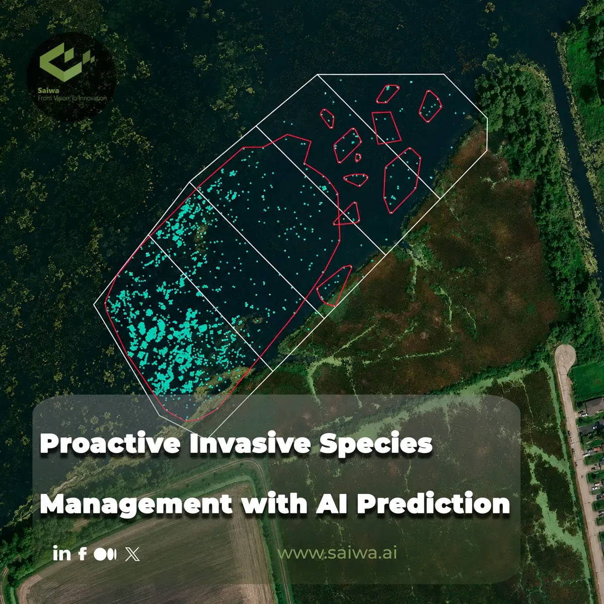
Biological invasions move faster than many conventional monitoring programs. Field surveys remain indispensable, but they are costly to repeat across large, inaccessible, or rapidly changing environments. Artificial intelligence offers a complementary operating model: use ecological records, species traits, geospatial variables, remote-sensing imagery, and invasion histories to estimate where an invasion may occur, identify emerging populations, and direct limited monitoring resources toward the highest-risk locations.
This article examines the technical components of proactive invasive-species management, from machine-learning risk assessment and hybrid spatial modeling to synthetic training data and pre-import screening. It also explains how Sairone applies computer vision, cloud processing, geospatial visualization, and customizable AI services to weed and invasive-plant control. The emphasis throughout is operational: converting heterogeneous ecological data into defensible priorities for surveillance and treatment.
AI Models for Invasion Forecasting
Machine Learning for Predictive Risk Assessment
Machine learning is particularly useful when the primary management objective is accurate prediction rather than a complete mechanistic explanation of an ecological system. Algorithms can analyze nonlinear relationships among many predictors, accommodate large datasets, and be retrained as new observations become available. These properties support iterative risk assessments that evolve with changing environmental conditions and expanding surveillance records.
This capability addresses a practical limitation of early detection and rapid response, or EDRR. Effective EDRR requires frequent, geographically extensive monitoring, yet the necessary labor and funding may exceed the capacity of management organizations. Machine-learning risk estimates can narrow the search area by ranking locations according to their relative vulnerability to establishment. Managers can then allocate surveys and interventions within operational and budget constraints instead of applying equal effort everywhere.
Hybrid Spatial and Ecological Modeling
Machine learning alone does not resolve every aspect of spatial prediction. Ecological observations are geographically structured, and nearby measurements may share spatial relationships that a predictive algorithm does not fully represent. Geostatistical methods such as ordinary kriging explicitly model spatial dependence, but they can become computationally demanding with large samples because kriging requires covariance-matrix inversion.
Hybrid models combine complementary strengths. One published plant-invasion study developed boosted regression tree residual ordinary kriging and LASSO residual ordinary kriging models using the US Forest Inventory and Analysis database. In these workflows, machine learning addressed high-dimensional ecological relationships, while residual kriging modeled spatial structure left unexplained by the predictive component. The study presented this combination as a promising method for analyzing ecological correlations from local to subcontinental scales. Such models are valuable because invasion risk is both ecological and geographic; an effective forecast must account for both dimensions.
Big Data in Invasion Biology
Large-Scale Ecological Data Sources
The expansion of GIS, remote sensing, and environmental databases has changed the scale at which invasion biology can operate. Large datasets allow researchers to study patterns that small, site-specific investigations may not reveal, including ecological relationships that change across spatial scales. They also create a technical challenge: invasion datasets can be complex, multivariable, nonlinear, and high dimensional, requiring models that retain predictive performance beyond the observations used for training.
Data-driven invasion workflows can draw on occurrence records, environmental covariates, remotely sensed imagery, habitat information, species characteristics, and historical introductions. Machine-learning methods are well suited to this environment because they are scalable and comparatively fast to develop. Their automated and iterative structure also allows models to incorporate newly available information, an important feature when datasets have broad coverage and are updated frequently.

Global Databases and Collaborative Platforms
A systematic review reported in a 2025 preprint examined 278 studies applying AI to biological invasions and demography since 1999. Half of those publications appeared during the preceding five years, indicating a rapid increase in research activity. Plants and detection tasks represented major areas of focus, while satellite imagery, drone data, and digital-camera images were among the principal data sources. Because this work is identified as a non-peer-reviewed preprint, its review findings should be interpreted with that publication status in mind.
The same review highlights the role of global databases, image collections, and collaborative platforms in extending access to remote or extensive study areas. Shared resources can reduce repeated field-data collection and make larger datasets available to research teams. Open ecological datasets also create opportunities beyond their original projects. For example, the leafy spurge imagery dataset developed through collaboration between Carnegie Mellon University and MPG Ranch was made publicly available so that other machine-learning researchers could investigate invasive-species detection.
Detecting Invasions with Remote Sensing
Satellite Imagery in Species Monitoring
Satellite observations help researchers monitor areas that would be expensive or physically difficult to survey repeatedly on foot. One reported workflow for mapping invasive ice plant combined frequent, lower-resolution satellite imagery with less frequent, higher-resolution aerial photographs. Researchers used the complementary temporal and spatial characteristics of these sources to track the plant across hundreds of acres of rugged coastal terrain.
This approach illustrates an important design principle. A single image source does not always provide the necessary combination of acquisition frequency, geographic coverage, and spatial detail. Combining satellite and aerial products can produce a more useful monitoring sequence, provided that analysts preserve geographic alignment and account for differences in resolution. Human review remains part of the process: the project’s researchers emphasized that AI should amplify ecological judgment rather than remove domain specialists from decision-making.
Drone and Camera-Based Detection Workflows
Drones and digital cameras provide the finer spatial detail needed to identify plants that may not be distinguishable in coarser imagery. The systematic review found these platforms, alongside satellites, to be primary data sources in AI-based invasion studies. Deep-learning methods were prominent because of their capacity to process complex visual data, while ensemble approaches offered a route to more robust predictions.
An operational image-analysis workflow generally depends on more than classification. Images must be acquired, geographically organized where applicable, annotated for training, processed by a detection or segmentation model, and converted into outputs that managers can inspect. The leafy spurge project shows why this pipeline is difficult for uncommon target species: even online sources may not contain enough examples to build an effective detector. Drone surveys can supply relevant field imagery, but collecting observations across seasons, habitats, and weather conditions remains costly.
Synthetic Data for Rare Species
Generative Methods for Limited Training Sets
Rare or unevenly observed invasive plants create a persistent training-data problem. A model may receive too few positive examples, or its examples may represent only a narrow range of backgrounds and field conditions. Carnegie Mellon researchers and conservation scientists addressed this issue with DA-Fusion, a generative augmentation method used to create additional training images for leafy spurge detection.
Conventional image augmentation often changes existing examples through operations such as cropping or flipping. DA-Fusion extends augmentation by altering the depicted subject or background. Starting from a leafy spurge image in one setting, the method can generate representations in different environments or seasons. The reported experiments produced examples associated with conditions such as snow and spring bloom, reducing the need for ecologists to collect every desired condition directly in the field.
Improving Model Performance with Artificial Images
Synthetic images are useful only when they add relevant diversity to the training distribution. In the leafy spurge work, generative augmentation was designed to improve both the variety and utility of training examples, enabling detection models to learn from limited original data. The method therefore targeted a concrete ecological constraint rather than simply increasing image volume.
This strategy does not eliminate the need for real observations. Authentic drone imagery establishes the visual and environmental characteristics of the target population, while conservation scientists provide the expertise needed to judge ecological plausibility. Synthetic data then broaden the represented conditions around that empirical foundation. The project demonstrates a practical collaboration model: machine-learning researchers develop augmentation and detection techniques, while field specialists define the management problem and validate whether generated data remain relevant.
Spatial Prioritization for Early Response
Risk Mapping for Monitoring Focus
Risk maps convert model predictions into geographically explicit priorities. Instead of treating every lake, field, watershed, or management unit as equally vulnerable, decision-makers can concentrate surveillance where predicted establishment risk is greatest. This is especially important for EDRR because monitoring must be frequent and widespread, but the resources available for it are finite.
Species distribution models already serve as spatial decision-support tools for invasive-species management. Mechanistic models can represent ecological processes but often demand extensive experimentally derived information, development time, and computation. Correlative models require less mechanistic knowledge and are generally faster to train, although static or temporally coarse covariates can limit their ability to represent continuously changing risk. For rapid biosurveillance, the appropriate choice depends on whether explanatory depth or operational speed is the dominant requirement.
Near Real-Time Decision Support
Conventional ecological modeling can take months or years, a schedule poorly aligned with emerging invasions. A practical decision-support workflow must use readily available drivers, update as new data arrive, and return relative risk within the time frame in which managers can still act. Scalable machine-learning pipelines support this requirement through automated training and repeatable processing.
“Near real time” should not imply an unreviewed autonomous decision. Machine-learning models can be complex, and most do not directly incorporate all uncertainty present in the underlying data. Their ecological interpretation may therefore be less straightforward than that of a mechanistic model. A defensible system pairs rapid predictions with data-quality checks, spatial review, and expert evaluation. Speed matters, but so do traceability and the ability to explain why a location received priority.
Pre-Import Invasion Screening
Predicting Problematic Species Before Introduction
Pre-import screening shifts management upstream. Rather than waiting for a species to establish and then determining whether it is invasive, predictive models can estimate its potential to become problematic before import authorization. A machine-learning framework developed for Caribbean islands combined decades of ecological information with patterns from previous introductions to evaluate invasion potential in destination regions.
The researchers trained models with three categories of data: plant ecology and biological characteristics, including reproductive strategy and growth form; invasion history, including whether and where a species had previously caused problems; and habitat-preference traits. Prior invasion history emerged as an important signal. Reproductive flexibility and the number of generations possible within a growing season were also identified as relevant predictors of establishment and invasive behavior.
Data-Driven Alternatives to Expert Questionnaires
Traditional assessments commonly rely on questionnaires completed by experienced experts who gather information and judge whether a plant should be imported. This process has supported biosecurity, but it can be time-intensive and subjective. The machine-learning framework provides a reproducible, data-driven complement that can examine patterns across historical introductions and plant traits before a species reaches a new location.
The approach is not presented as a universal replacement for expert assessment. Its developers note that models trained for one region may require retraining elsewhere because biological systems and regional conditions differ. High-quality, diverse ecological and biological data remain essential, as does fieldwork. The value lies in combining systematic computation with existing biosecurity expertise, then testing whether the learned relationships remain reliable in each intended geography.
Sairone and its Field Application in AI-Driven Precision Agriculture
Cloud-Scale Processing for Multisource Imagery
Sairone is Saiwa’s B2B SaaS platform for AI-assisted agriculture and environmental monitoring. Its services include weed and invasive-plant control, crop-yield estimation, seedling counting, nitrogen estimation, crop-health monitoring, and wildlife-conservation applications. The platform serves agricultural service providers, agronomists, cooperatives, ecologists, and other organizations that need to convert field imagery into operational reports.
Users can submit images, videos, orthomosaics, orthophotos, georeferenced datasets, GeoTIFFs, TIFFs, JPEGs, and PNGs. Sairone provides cloud storage for inputs and generated outputs, supports folder organization and batch submission, and accepts large files and large-scale survey datasets. For GeoTIFF inputs, it extracts geographic metadata, retains the coordinate reference system, and preserves compatibility with GIS and georeferencing workflows. Processing runs on scalable cloud infrastructure rather than depending exclusively on local analysis.
Species Identification and Density Mapping
The Weed and Invasive Plant Control service uses computer vision and machine learning to detect, map, and analyze target vegetation automatically. Its documented species coverage includes Taraxacum, Amaranthus tuberculatus, Amaranthus palmeri, European water chestnut, water soldier, fleabane, and thistle. Each detection can include a confidence score and geographic coordinates, enabling results to be examined as spatially explicit observations rather than as image-level labels alone.
Sairone’s Atlas environment displays detections over aerial and satellite basemaps, supports custom areas and hierarchical field zones, and helps users inspect infestation distribution and patterns. Detection clustering groups identified weeds into manageable zones for treatment planning. A human-in-the-loop validation system allows users to confirm, correct, or approve predictions, while incremental learning is used to support continued model improvement and reduce false-positive detections.
GIS Exports for Operational Field Treatment
The platform converts validated detections into GIS-ready deliverables in GeoJSON, Shapefile, KML, and CSV formats. These exports preserve the spatial structure needed to move analysis into established mapping and treatment-planning environments. Atlas also provides interactive mapping, geographic analytics, zone management, and clustering tools for organizing detections into practical management areas.
The operational endpoint is targeted treatment planning. Rather than presenting detections only as an AI report, Sairone can generate treatment zones for precision spraying and optimized field intervention. This reduces the manual work required to translate scattered detections into coherent geographic units, while leaving agronomic approval and final treatment decisions with the responsible operator.
Custom AI Deployment for Enterprise Workflows
Sairone supports several enterprise delivery models. Customers can use the hosted cloud platform, connect customized APIs to their existing infrastructure, or deploy a White Label implementation adapted to their brand and workflow. Its multi-tenant architecture also supports Back-end as a Service capabilities for agricultural-technology companies.
Saiwa can develop or customize plant-detection models according to a client’s data and operational requirements. Annotation tools support polygons, bounding boxes, multiple classes, custom class colors, GeoTIFF labeling, and precise drawing workflows. Reporting interfaces can expose service usage, processing-time analytics, job status, recent files, annotation projects, storage consumption, and geographic areas configured in Atlas. This flexibility allows the deployment to follow the customer’s field process without forcing every organization into one fixed reporting template.
Conclusion
Proactive invasive-species management depends on connecting prediction to action. Machine learning can rank invasion risk, hybrid models can combine nonlinear ecological relationships with spatial dependence, and remote sensing can extend monitoring across terrain that is difficult to survey consistently. Synthetic augmentation helps address limited image datasets, while pre-import models move risk assessment to a stage where prevention may still be possible.
These systems work best as decision-support infrastructure rather than substitutes for ecological expertise. Reliable deployment requires representative data, geographic validation, explicit review, and outputs that fit management workflows. Sairone demonstrates this operational progression at field scale: ingest multisource imagery, detect and validate target plants, preserve geospatial context, organize detections into treatment areas, and export results for downstream GIS and precision-treatment planning.
Comments
No comments yet!
Table of Contents
No headings were found on this page.