Jun 29, 2026
New AI Transformer Model Enhances Crop Monitoring with Satellite Data
A newly developed AI model combines radar and optical satellite imagery to improve crop monitoring accuracy, offering new possibilities for precision agriculture and data-driven farm management.
- Research and Breakthroughs
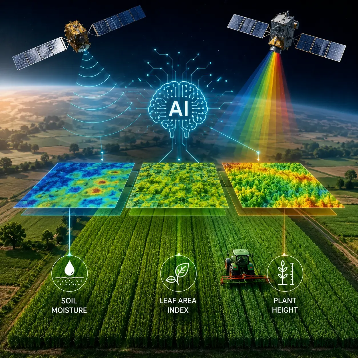
Researchers have introduced a new artificial intelligence model that could make crop monitoring more accurate by combining multiple types of satellite data and refining predictions over time. The study, recently published as a preprint, focuses on estimating key crop indicators for wheat fields, including soil moisture, leaf area index (LAI), and plant height.
The system, called the Iterative Energy-Based Transformer (iEBT), combines imagery from Sentinel-1 radar satellites and Sentinel-2 multi-spectral satellites. Instead of making a single prediction, the model repeatedly updates its estimates using an optimization process designed to improve consistency between soil and crop conditions.
Researchers tested the model using 700 field measurements collected in Varanasi, India, and reported stronger performance than conventional learned baseline approaches. Results showed that different satellite modalities contributed differently: radar data was particularly useful for soil moisture estimation, while optical imagery played a larger role in measuring vegetation conditions.
If validated across more regions and growing seasons, the approach could support precision agriculture applications such as irrigation planning, crop growth monitoring, yield forecasting, and data-driven farm management.
References: