Practical Applications of Agriculture Drones
Here are some of the best practical applications of Agriculture drone services.
Crop Monitoring and Health Assessment
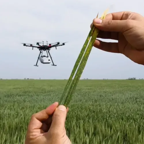
Agriculture drone services equipped with high-resolution cameras and sensors provide farmers with a bird’s-eye view of their fields. This aerial perspective allows for the early detection of crop diseases, nutrient deficiencies, and water stress. Timely intervention based on drone data can prevent widespread crop damage.
Precision Planting and Seed Dispersal
Agricultural drone services equipped with precision seeding technology can disperse seeds with unparalleled accuracy. This not only saves time but ensures optimal plant spacing, contributing to better crop yields.
Irrigation Management and Water Distribution
Water scarcity is a significant concern in agriculture. Drones equipped with thermal imaging and moisture-sensing technologies enable farmers to assess soil conditions and optimize irrigation. This precision in water distribution not only conserves resources but also prevents over-irrigation, which can lead to waterlogging.
Livestock Monitoring and Management
Beyond crops, drones are proving invaluable in livestock management. Equipped with thermal cameras, drones can monitor the health and behavior of livestock. Farmers can quickly identify sick or injured animals, plan grazing patterns, and ensure the overall well-being of their herds.
Enhanced Sensor Technology in Agriculture Drone Services
Agriculture drone services are significantly benefiting from advancements in sensor technology. These instruments provide valuable data for optimizing crop management and increasing yields.
Multispectral Sensors: These sensors capture images in multiple wavelengths beyond the visible spectrum, allowing for detailed analysis of plant health, nitrogen levels, and water stress. By detecting subtle variations in plant vigor, farmers can identify problem areas early on and implement targeted interventions and use all of the potential of Agriculture drone services.
Thermal Imaging: Thermal cameras measure temperature differences, aiding in tasks such as irrigation management, disease detection, and livestock monitoring. By identifying heat signatures, farmers can detect water stress, locate hidden heat sources, and monitor animal health.
LiDAR Sensors: Light Detection and Ranging (LiDAR) technology creates precise 3D maps of the terrain, enabling accurate measurements of crop height, biomass, and topography. This data is essential for optimizing planting, harvesting, and yield estimation.
Hyperspectral Imaging: This advanced technology captures hundreds of narrow spectral bands, providing detailed information about plant physiology, soil composition, and nutrient deficiencies. Hyperspectral imaging offers a deeper understanding of crop conditions and supports precision practices in Agriculture drone services.
Customizable Sensor Packages: The ability to customize sensor payloads based on specific crop needs and farming challenges is becoming increasingly common in Agriculture drone services. This flexibility allows farmers to tailor drone services to their unique requirements, maximizing the return on investment.
Autonomous Tractors
Autonomous tractors, guided by artificial intelligence and GPS technology, have lot to offer for optimized agriculture. Enhancing efficiency, and transforming the landscape of agricultural productivity are the main functions of these machines.
Integration of Drone Technology with Autonomous Tractors
The marriage of agricultural drone services technology with autonomous tractors is a game-changer in modern agriculture. Drones can survey fields, gather data, and transmit information to autonomous tractors. These tractors, in turn, can execute tasks such as plowing, planting, and harvesting with unmatched precision and efficiency.
Precision Plowing, Seeding, and Harvesting
Autonomous tractors guided by drone data can operate with remarkable precision. They can plow fields with optimal depth, plant seeds at precise intervals, and harvest crops at the peak of maturity. This level of precision minimizes resource use and contributes to sustainable farming practices.
Enhancing Overall Farm Productivity
The integration of drone technology and autonomous tractors is not just about efficiency—it’s about enhancing overall farm productivity. With less reliance on manual labor and more data-driven decision-making, farmers can achieve higher yields and better economic outcomes.
Precision Agriculture Drone Services
Equipped appropriately, precision agriculture drone services open diverse agnostic applications through specialized data capture tailored to informing various farm use cases:
High resolution drone field images clearly depict terrain details, irrigation infrastructure defects or zonation needs aiding better land planning and resource allocation.
Time series multispectral drone images enable tracking crop growth, yield prediction based on temporal analytics viewing historical patterns and assessing fertilization needs by spectral signals from plants in combinations enhancing decisions over manual guesses.
Livestock herd monitoring, tagging and health assessment speed up exponentially using drones instead of time-consuming manual inspection.
With appropriate sensors, drones also detect crop pests infestations, water leaks and soil issues for preventative maintenance. The expansive views make spatial modeling and predictive analytics possible to levels unmatched by ground surveys.
Drone Data Analytics
But raw drone gathered images require extensive analytics to convert pixel insights into executable farm actions – an added service component from quality providers:
Photogrammetry techniques stitch images into geographically referenced ortho-mosaics and 3D terrain models supporting measurements for planning.
AI powered image recognition classifies ground features like crop varieties, counts plants, delineates field zones, and flags spatial anomalies for easy visualization.
Platform dashboards contain processing chains converting raw images into usable NDVI, elevation and canopy cover maps while comparing against historical data for temporal analytics.
Prescriptive analytics through agronomic modeling provides direct actionable interventions for pests, irrigation, fertilization etc. tailored to local soil, crop and weather conditions using drone captured data for key inputs.
Integration of Farm Drone Solutions with Other Precision Agriculture Technologies
To unlock the full potential of farm drone solutions, integration with other precision agriculture technologies is crucial. By combining drone data with information from Internet of Things (IoT) sensors, GPS systems, and farm management software, farmers can achieve a holistic and interconnected approach to data-driven farming.
IoT sensors deployed in fields can provide real-time data on soil moisture, temperature, and other environmental conditions, complementing the aerial data collected by drones. GPS systems can aid in precise navigation and mapping, ensuring accurate data collection and analysis. Farm management software can integrate drone data with other farm records, enabling comprehensive decision-making and resource allocation.
This integration of farm drone solutions with other precision agriculture technologies creates a powerful ecosystem of data and insights. Farmers can leverage advanced analytics, machine learning algorithms, and decision support systems to optimize their operations, from seed selection and planting to irrigation, pest management, and harvesting. By combining these technologies, farmers can achieve unparalleled levels of efficiency, sustainability, and profitability.
The Compelling ROI of Agricultural Drone Services
Forward-thinking agricultural enterprises are increasingly recognizing the transformative potential of agricultural drone services. While the upfront costs might be a consideration, the long-term return on investment (ROI) presents a compelling argument for adoption. This technology offers a potent combination of cost savings and yield optimization, ultimately translating to a significant boost in farm profitability.
Measurable Cost Reductions
One of the most quantifiable benefits of agricultural drone services lies in reduced labor expenditure. Traditionally labor-intensive tasks like field scouting, crop health monitoring, and irrigation management can be automated with these aerial platforms. This reallocation of human resources allows farmers to focus on strategic planning, market analysis, and other value-added activities.
Enhanced Yield Potential
Early detection of crop stress or disease through high-resolution drone imagery enables timely intervention, minimizing yield losses. `Additionally, agricultural drone services equipped for precision planting ensure optimal plant spacing, fostering a healthier and more productive crop stand.
Data-Driven Resource Management
Thermal imaging and specialized sensors carried by agricultural drones provide valuable insights into soil moisture levels. This empowers farmers to implement targeted irrigation strategies, preventing water waste and optimizing resource utilization. Similarly, AI drones can pinpoint areas requiring fertilizer or pest control, ensuring precise application and minimizing unnecessary use of these resources.
The combined effect of reduced labor costs, increased yields, and improved resource management translates to a significant efficiency boost for farms. This not only enhances financial performance but also promotes sustainable agricultural practices by minimizing resource waste.
Edge Computing in Agriculture Drone Services
Edge computing is revolutionizing agriculture drone services by enabling real-time data processing directly on the drone, minimizing latency and enhancing decision-making. Traditionally, data captured by drones needed to be transmitted to central servers for processing, which could delay actionable insights. With edge computing, agriculture drone services can analyze data on the spot, providing farmers with immediate feedback on crop health, pest infestations, and soil conditions.
The integration of edge computing into agriculture drone services allows for more efficient resource management. For instance, drones equipped with edge computing capabilities can assess crop conditions in real time and instantly adjust irrigation patterns or identify areas needing fertilization. This immediacy helps prevent resource wastage and optimizes crop yield.
Moreover, edge computing enhances the precision of agriculture drone services by enabling more sophisticated analytics. For example, drones can process multispectral and hyperspectral imaging data on-site, identifying subtle changes in plant health that require urgent attention. This capability is crucial in precision agriculture, where timely interventions can significantly impact crop productivity.
Agriculture drone services also benefit from increased autonomy due to edge computing. Drones can make independent decisions about flight paths, monitoring focus areas based on real-time data analysis, which reduces the need for constant human supervision and intervention.
Read More: Revolutionize Your AI | Unleash the Power of Edge ML!
Energy Efficiency and Renewable Integration
Energy efficiency and renewable integration are becoming increasingly important in modern agriculture, and agronomic drone services are playing a pivotal role in this transformation. As farms look to reduce their environmental impact and operational costs, the adoption of advanced drone technologies offers innovative solutions for achieving these goals.
Solar-Powered Drones
Solar-powered drones are a significant advancement in agronomic drone services, allowing for extended flight times and reduced reliance on traditional energy sources. By harnessing solar energy, these drones can perform prolonged monitoring and data collection without the need for frequent recharging. This energy-efficient approach not only lowers the operational costs of agronomic drone services but also aligns with sustainable farming practices.
Monitoring Renewable Energy Installations
Agronomic drone services are also instrumental in the monitoring and maintenance of renewable energy installations on farms, such as solar panels and wind turbines. Drones equipped with high-resolution cameras and thermal sensors can inspect these installations for performance issues, damage, or inefficiencies. Regular drone inspections help ensure that renewable energy systems operate at peak efficiency, supporting the farm's overall energy sustainability.
Reducing Carbon Footprint
Integrating energy-efficient technologies into agronomic drone services contributes to a lower carbon footprint for farms. By employing drones that utilize renewable energy and by improving the efficiency of renewable installations, farms can significantly reduce their greenhouse gas emissions. This not only benefits the environment but also enhances the farm's reputation for adopting green technologies and sustainable practices.
Weather Monitoring and Prediction in Agriculture
Weather monitoring and prediction are crucial in modern agriculture, helping farmers to make informed decisions based on current and Forecasted weather conditions. Agriculture drone services have become an essential tool for gathering detailed, real-time data and predicting weather patterns to support crop management.
Real-time Data Collection: Agriculture drone services with meteorological sensors collect important data on temperature, humidity, wind speed, and atmospheric pressure. This information gives farmers precise, location-specific weather insights for effective decision-making.
Microclimate Detection: By flying over various field section, agriculture drone services can detect microclimatic variations, helping farmers optimize growing conditions by adjusting temperature, moisture, and other environmental factors to suit specific crop needs.
Predictive Analysis: The data gathered by agriculture drone services can be fed into predictive models, allowing farmers to anticipate short-term weather changes and plan irrigation, fertilization, and harvesting accordingly.
Risk Management in Extreme Weather: During severe weather conditions, agriculture drone services can monitor conditions in real-time, providing alerts that allow farmers to implement protective measures, reducing potential damage to crops.
Resource Efficiency: With frequent weather updates, farmers using agriculture drone services can fine-tune the use of water, fertilizers, and pesticides, fostering sustainable practices and minimizing waste.
Integrating agriculture drone services in weather monitoring not only strengthens resilience to weather variability but also promotes sustainable and efficient farming practices, leading to increased yields and healthier crops.
Economic Benefits of Farm Drone Services for Small-Scale Farmers
Farm drone services are transforming agriculture by making sophisticated technology accessible to small-scale farmers. Traditionally, precision farming tools were financially inaccessible to smaller operations due to high costs. However, drones are bridging this gap by offering affordable, efficient, and scalable solutions. Here’s how small-scale farmers are benefiting:
Cost-Effective Operations: Farm drone services reduce the need for labor-intensive tasks such as manual crop scouting and irrigation checks. With drones, farmers are able to survey their entire field in minutes, cutting costs significantly.
Enhanced Yield Monitoring: Drones equipped with multispectral cameras provide accurate data on crop health, enabling farmers to make timely decisions. This capability enables farmers maximize their yield potential while minimizing waste.
Precision Application of Resources: Farm drone services allow precise application of fertilizers, pesticides, and water thereby ensuring the efficient and sustainable use of resources. This targeted approach contributes to the conservation of natural resources and the reduction of the environmental impact of farming practices.
Improved Accessibility to Technology: Many small-scale farmers cannot afford to own drones outright. Farm drone services offer rental or on-demand solutions, making this advanced technology more accessible without a significant upfront investment.
In addition to these direct benefits, adopting farm drone services helps small-scale farmers stay competitive in the evolving agricultural landscape. By using this technology, they can improve productivity, reduce expenses, and secure better market positions. Farm drone services are not just tools but a gateway to a more sustainable and profitable future for small-scale farming.
Agriculture Drone services for Greenhouse and Vertical Farming
Agriculture drone services are revolutionizing greenhouse and vertical farming by providing efficient solutions for monitoring, automation, and resource management. This technology enhance productivity, reduce costs, and promote sustainable farming practices.
Greenhouse Farming
Automated Monitoring: Drones equipped with advanced sensors and cameras track temperature, humidity, and light levels, ensuring optimal plant growth.
Disease Detection: Using infrared imaging, agriculture drone services can identify plant stress and early disease symptoms, allowing for prompt intervention.
Precision Spraying: Drones accurately apply fertilizers, pesticides, and water, reducing waste and promoting eco-friendly farming.
Inventory Management: By scanning plant growth and yield, drones help farmers optimize space usage and predict harvest cycles.
Vertical Farming
Real-Time Data Collection: Drones provide crucial insights into plant health, growth patterns, and nutrient deficiencies.
Pollination Assistance: Some drones mimic natural pollinators, improving pollination rates in controlled environments.
Automated Harvesting: AI-powered drones assist in identifying ripe crops, reducing labor costs and increasing efficiency.
Climate Control Support: Agriculture drones help regulate temperature and humidity, ensuring stable growth by monitoring environmental conditions.
Agriculture drone services are making greenhouse and vertical farming more efficient, scalable, and sustainable. By integrating drones in agriculture, farmers can optimize their operations and ensure healthier crop yields, ultimately shaping the future of modern agriculture.
Addressing the Challenges of Agricultural Drone Services
While agriculture drone services offer incredible potential for revolutionizing farming practices, it's crucial to acknowledge and address the inherent challenges. Overcoming these hurdles is key to widespread adoption and maximizing the benefits of this technology. Here are some critical challenges facing the industry:
Battery Life and Flight Time Limitations: Current drone battery technology restricts flight times, often to 30 minutes or less. This limits the area a single drone can cover in one charge, requiring multiple batteries or charging breaks for larger farms. This directly impacts the efficiency of agriculture drone services, especially for extensive operations.
Data Processing and Analysis: Drones generate massive amounts of data, requiring significant processing power and specialized software. Farmers may lack the expertise or resources to effectively analyze this data and translate it into actionable insights. User-friendly software and cloud-based processing solutions are essential.
Connectivity and Infrastructure: Reliable internet connectivity is crucial for real-time data transfer and remote drone operation. Many rural areas lack the necessary infrastructure, hindering the deployment of agriculture drone services in these regions. Exploring alternative communication technologies and offline processing capabilities is vital.
Weather Dependency: Drone operations are highly susceptible to weather conditions. Strong winds, rain, and extreme temperatures can ground drones, disrupting data collection and delaying time-sensitive tasks. Developing more weather-resistant drones and incorporating weather forecasting into operational planning are necessary steps.
Effectively tackling these challenges will pave the way for the broader and more impactful implementation of agriculture drone services, unlocking their full potential to enhance agricultural productivity and sustainability.
The Future of Agricultural Drone Sprayers
Agricultural drone sprayers are already transforming crop protection and treatment, but their potential extends far beyond today's applications. As drone technology evolves and integrates with other precision agriculture tools, we can expect even more groundbreaking advancements:
Autonomous Operation
Imagine agricultural drone sprayers operating autonomously, guided by real-time data and AI algorithms. These intelligent drones would scan fields and identify areas with great accuracy in need of treatment, and deliver solutions with pinpoint accuracy.
Data-Driven Agriculture
Agricultural drone sprayers could become a key component of the data-driven agriculture system. Data from drones, combined with field sensors and weather stations, would provide a comprehensive picture of crop health, allowing for proactive treatment strategies. Imagine drones equipped with advanced sensors not only spraying crops but also detecting early signs of problems.
Increased Efficiency
Agricultural drone sprayers with increased payload capacities could deliver larger quantities of supplies, reducing the number of spraying runs needed. This translates to significant time savings for farmers, allowing them to cover more ground in less time and dedicate resources to other crucial tasks.
Networked Technology
The integration of drone technology with other autonomous farm equipment, like self-driving tractors, could create a network of interconnected machines working together to optimize crop production. Imagine drones scouting fields and sending data to tractors for targeted planting or harvesting, all working in seamless coordination.
The future of agriculture is a future of precision and sustainability, and agriculture drone sprayers are at the forefront of this movement. As these versatile aerial tools continue to develop, they promise to revolutionize the way we grow food, ensuring a more efficient, sustainable, and abundant future for agriculture.
Precision Weed Management with Agriculture Drone Services
Weeds are a major problem for farmers, competing with crops for vital resources and reducing yields. Traditional weed control methods, such as blanket herbicide application, have some disadvantages like inefficiency, high prices, and environmentally unfriendly. This is where precision weed management, powered by agriculture drone services, offers a game-changing solution. The importance of drone in agriculture is becoming undeniable, especially in tackling challenges in the process of weed control.
Drones equipped with high-resolution cameras, particularly multispectral sensors, can fly over fields, capturing detailed images that differentiate between crops and various weed species. This is a major upgrade from manual scouting.
Accurate Weed Mapping: Drones create precise maps showing the location and density of weed infestations. Advanced image processing using AI, can even identify specific weed types, enabling targeted treatment.
Targeted Herbicide Application: Instead of spraying entire fields, farmers can use drone data to apply herbicides only where needed. This significantly minimizes the environmental impact and reduces chemical usage and cost. The importance of drones in agriculture is clear when it comes to promoting sustainable practices.
Early Detection: Drones can spot weed problems before they become widespread, allowing for timely intervention and preventing major yield losses. This proactive approach is crucial.
Labor cost reduction: By automating the process of detecting and mapping, the importance of drones in agriculture is also reflected in the reduction of human labor.
Monitoring Treatment Effectiveness: After applying herbicides, drones can monitor the treated areas, assessing effectiveness and identifying any spots requiring further attention.
Privacy and Data Security with Agricultural Drone Services
As agricultural drone services become a regular part of modern agriculture, the vast amount of data generated raises concerns about privacy and data security. These devices gather a huge amount of valuable and sensitive information about your fields, crops, and equipment. Protecting this information is vital for maintaining farm integrity, safeguarding operational strategies, and retaining a competitive advantage.
Types of Sensitive Data: Drones map precise field boundaries, monitor subtle crop health variations, assess specific soil conditions, and capture detailed images of farm infrastructure, including buildings and equipment locations. This constitutes significant operational intelligence.
Addressing Security Vulnerabilities: Without robust safeguards, this detailed farm data could be vulnerable to unauthorized access, cyber breaches, or competitive misuse. Implementing secure data storage solutions, often involving encryption and strict user access controls, is vital when utilizing Agriculture drone services.
Managing Privacy Implications: While focused on fields, aerial surveillance can inadvertently capture images near property lines or farm dwellings. Operators and service providers must be mindful of potential privacy intrusions and operate ethically and within legal boundaries.
Clarifying Data Ownership and Usage: Farmers need explicit agreements with service providers defining data ownership, control, and usage rights. Partnering with reputable Agriculture drone services providers who offer transparent data privacy and security policies is essential for trust and control.
Ensuring Secure Transmission: Data must be transmitted securely from the drone to analysis platforms, employing protocols that minimize the risk of interception during this critical transfer phase.
Proactively addressing data security protocols and respecting privacy concerns are non-negotiable for building trust and ensuring the responsible, widespread adoption of Agriculture drone services. This allows farmers to fully leverage technological benefits without compromising their valuable operational information.