Eliminate Noxious Weed Compliance Gaps and Reduce Reclamation Costs
for US Mining Operations
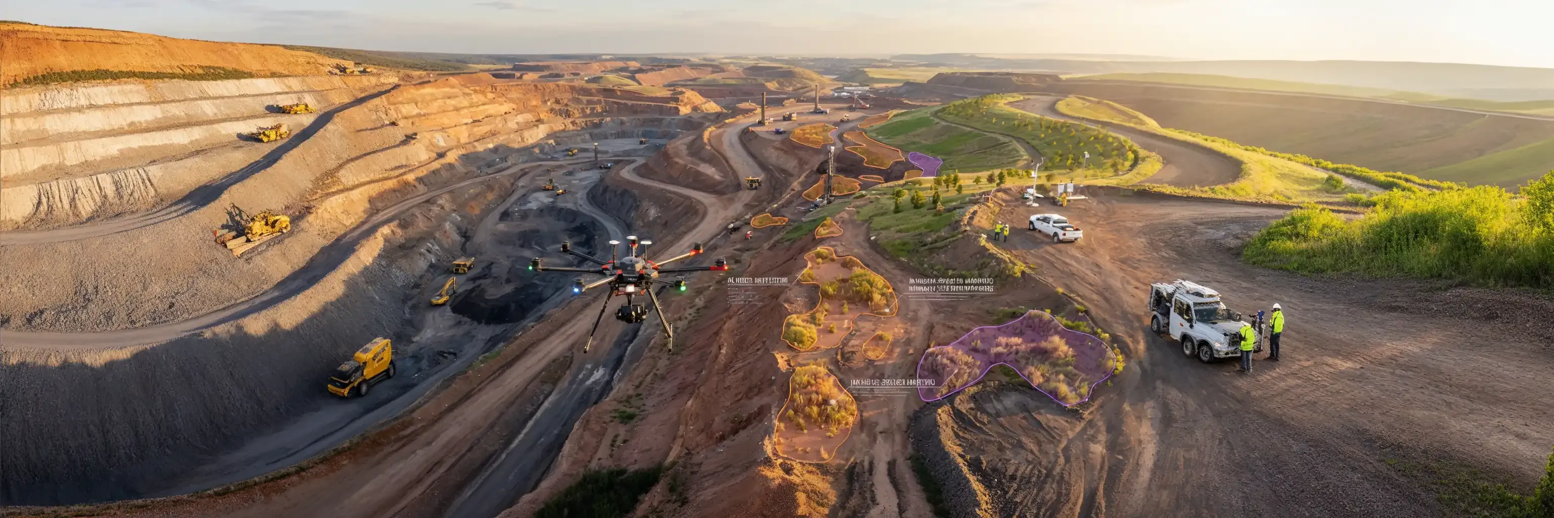
AI-powered drone surveillance detects and maps noxious weeds across your entire operation—providing the systematic documentation that prevents bond forfeitures, accelerates reclamation approval, and protects against regulatory violations before state inspectors, BLM field officers, or county weed boards arrive.
Eliminate Noxious Weed Compliance Gaps and Reduce Reclamation Costs
for US Mining Operations
AI-powered drone surveillance detects and maps noxious weeds across your entire operation—providing the systematic documentation that prevents bond forfeitures, accelerates reclamation approval, and protects against regulatory violations before state inspectors, BLM field officers, or county weed boards arrive.
Mining operations relying on quarterly ground surveys monitor less than 15% of operational footprints, leaving compliance gaps that trigger penalties averaging $75,000+ per violation plus mandatory cost recovery. Sairone provides complete coverage across thousands of acres, with plant-level species identification that manual surveys and NDVI analysis cannot match.
97%+ Species Identification Accuracy
10x Coverage vs. Ground Surveys
BLM & USFS Compatible Documentation
Multi-State Operations
Bond Release Acceleration
Why Traditional Monitoring Leaves US Mining Operations Exposed
Mining environmental managers face an impossible mandate: demonstrate comprehensive noxious weed compliance across operational footprints spanning thousands to tens of thousands of acres using ground survey teams that realistically cover 50-150 acres per day. The math doesn't work—and regulators, bondholders, and adjacent landowners know it.
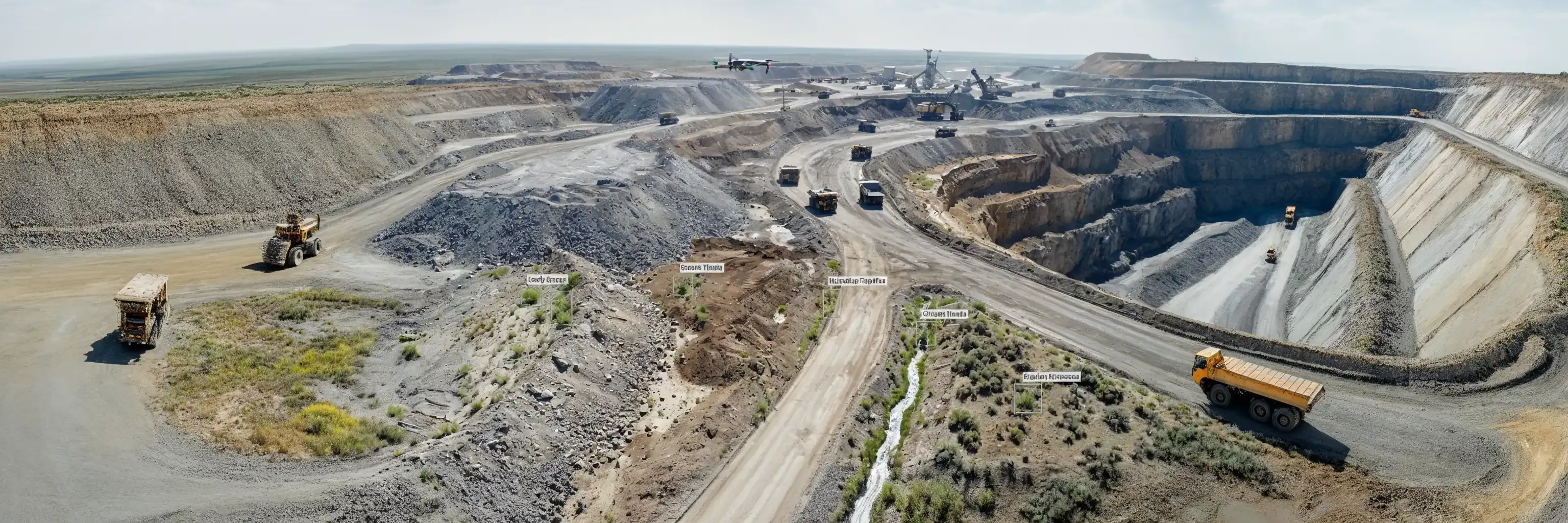
Plant-Level Species Identification at Industrial Scale
Aerial Survey
Your drone team captures high-resolution imagery (RGB, multispectral) across your operational footprint
AI Analysis
AI Analysis (Days 2-3) Imagery processed through Sairone’s trained computer vision models
Actionable Deliverables
Actionable Deliverables (Day 4-5) Comprehensive reporting package ready for multiple uses
Documentation Meeting Federal and State Requirements
US mining operations navigate complex federal-state regulatory frameworks where noxious weed management intersects with mine permitting, environmental compliance, and reclamation approval. Sairone provides comprehensive documentation satisfying requirements across all jurisdictional levels.
The Technology and Expertise Difference
Why Western US Mining Operations Choose Sairone
Seamless Integration with Mining Operations
Getting Started Process
Phase 1: Baseline Survey
Weeks 1-2
Initial flight covering entire operational footprint establishes current conditions for all noxious weed species present. Generates priority target list for immediate management attention. Provides regulatory reporting baseline documentation.
Phase 2: Treatment Verification
Weeks 3-8
Field crews address priority infestations identified in baseline. Follow-up survey documents treatment effectiveness. Establishes monitoring protocol for ongoing surveillance.
Phase 3: Ongoing Monitoring
Months 3+
Quarterly or semi-annual surveys maintaining continuous surveillance. Change detection tracking population trends (expanding, stable, or controlled). Annual reporting packages ready for regulatory submissions.
Calculate Your Monitoring ROI and Compliance Risk Exposure
Don't wait for state mine inspectors, BLM compliance officers, county weed boards, or adjacent landowner lawsuits to discover the infestations your quarterly ground surveys are missing.
Provide your operation's acreage, current monitoring approach, and state(s) of operation. Receive customized analysis showing:
- Cost comparison vs. your current monitoring program
- Coverage improvement potential
- Regulatory risk reduction quantification
- Estimated timeline to first survey results
See Sairone's plant-level species identification in action with analysis of your existing drone imagery or sample imagery from similar mining operations in your region.
Comprehensive PDF featuring:
- Federal and state regulatory framework overview
- State-by-State noxious weed requirements (NV, MT, WY, CO, ID, UT, AZ, NM)
- Technology comparison (Sairone vs. NDVI vs. ground surveys)
- Case studies from western US mining operations
- BLM/USFS documentation standards and integration
Western Mining Coverage
Serving mining operations across all western states and Alaska
GIS Standards Compliance
Compatible with BLM, USFS, and state agency GIS standards
Regulatory Coordination
County weed control board coordination and defensible documentation
Advanced Species Detection
15+ noxious weed species detection library with ongoing expansion
Technical & Compliance Support
US-based technical support and regulatory compliance consultation
Consulting Integration
Integration with major environmental consulting firms serving mining sector