Invasive Species Compliance
for Mining & Energy Operations
Regulatory expectations for spatial coverage and documentation quality have outpaced what manual surveys can deliver. There's a better way to protect your permits, your bonds, and your bottom line.
Invasive Species Compliance
for Mining & Energy Operations
Regulatory expectations for spatial coverage and documentation quality have outpaced what manual surveys can deliver. There's a better way to protect your permits, your bonds, and your bottom line.
The Monitoring Gap No Ground Crew Can Close
How Sairone Works
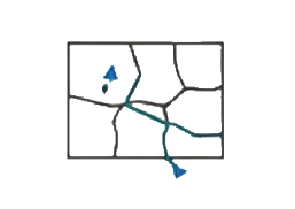
Capture
Fly any drone you already own — DJI, XAG, Autel, Wingtra — over mine sites, reclamation areas, tailings perimeters, haul road corridors, and buffer zones. No specialized hardware required.

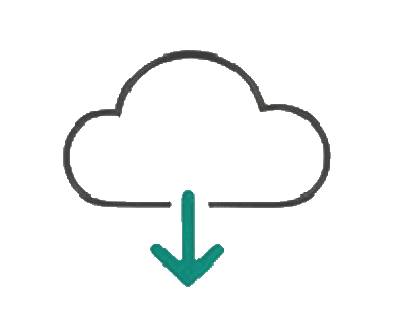
Upload & Process
Upload imagery to Sairone's secure cloud platform. Our AI detects, classifies, and maps target species automatically with confidence scores for each detection.
Generate Outputs
Receive audit-ready polygon maps, species-level heatmaps, and compliance-formatted reports in GIS-compatible formats — shapefiles, GeoJSON, KML — ready for regulatory submission or integration into your environmental management system.
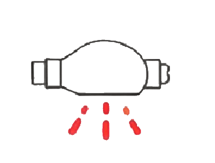
Apply Treatment
Load prescription files directly into spray equipment for targeted, GPS-guided, documented interventions.
Monitor & Report
Re-fly to verify treatment efficacy and export timestamped compliance documentation for permit renewals, bond release applications, government audits, and stakeholder reporting.

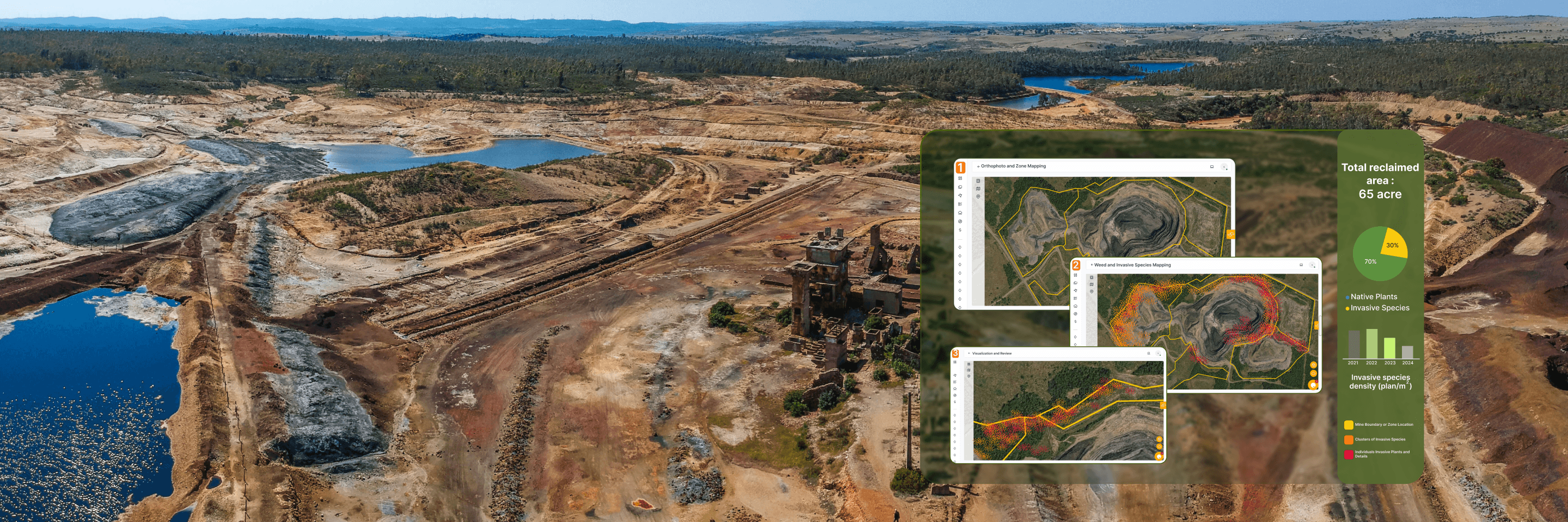
Sairone replaces partial ground coverage with AI-powered drone analysis across your full operational footprint — hundreds or thousands of acres per survey, completed in hours rather than weeks. Unlike NDVI-based vegetation analysis that only flags general stress, Sairone distinguishes target species from surrounding vegetation and bare substrates across the full range of conditions present at mine sites — from exposed waste rock and early-stage reclamation to dense riparian buffers and mature revegetation. Every survey generates georeferenced detection maps, species-specific population data, timestamped documentation, and GIS-compatible files ready for regulatory submission.
The Sairone Advantage
Transforming Environmental Compliance into Strategic Capital
| Feature | Manual Ground Surveys | Sairone Drone Intelligence |
|---|---|---|
| Coverage | Sample-based(Partial) | 100% Total Footprint |
| Speed | Days or weeks on foot | Completed in hours |
| Consistency | Varies by site conditions | Machine-level repeatability |
| Record-Keeping | Field notes and GPS waypoints | Spatially defensible compliance record |
| Scalability | Cost scales with area | Per-acre cost drops with scale |
A Capability Multiplier for Your Practice
Environmental consultants face the same structural constraint as their mining clients: regulatory expectations for spatial coverage and documentation quality have grown faster than the budget available for manual field surveys. The result is scope pressure, timeline compression, and the ongoing challenge of defending a monitoring record that was never designed to be spatially complete. Sairone gives consulting firms a drone AI processing capability they can deploy across their client portfolio without building it in-house. You collect the imagery — or coordinate with a certified drone operator on site — and Sairone delivers the species maps, shapefiles, and compliance reports that anchor your monitoring program.
What this means for your practice:
You can quote larger survey scopes at competitive per-acre rates. You deliver spatial documentation that holds up under regulatory scrutiny and reduces liability exposure on bond release applications. You differentiate from competitors still relying entirely on manual transects. And you build a multi-temporal data asset across client sites that makes your monitoring program genuinely defensible year over year.
We work with consulting firms as partners. If you're interested in discussing a preferred pricing structure for multi-site portfolios or a white-label arrangement, we'd like to hear from you.
Your Priority Species — Including the Ones We Don't Have Yet
Sairone detects and maps invasive and noxious weed species commonly listed under provincial, state, and federal reclamation and compliance obligations. Our current model library covers species frequently required across Canadian and US mining jurisdictions.
More importantly: if your priority species isn't in our library, we build the model for you. Working from your own site imagery and ground-truth validation data, our team develops custom detection models rapidly — purpose-built for your specific species, substrate conditions, and site type. Mining companies and consulting firms with jurisdiction-specific noxious weed lists are exactly the clients this capability is designed for.
Species currently in active development or deployment:
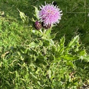
Scientific Name: Cirsium Arvense
Canada Thistle
Canada thistle (Cirsium arvense) — priority species under Alberta's Weed Control Act, BC's Weed Control Act, and Ontario's Weed Control Act, and a listed noxious weed across western US mining states.
Built for the Regulations That Govern Your Operation
Canada
Ontario — Ontario's Mining Act and O. Reg. 240/00 require progressive rehabilitation and mine closure plan compliance, with vegetation condition forming part of site assessment for financial assurance release. Ontario's Weed Control Act designates noxious species operators must actively control across their footprint.
British Columbia — BC's Health, Safety and Reclamation Code under the Mines Act (Section 9.13.1) explicitly requires measures to minimize the establishment of noxious weeds on mine sites. BC's Weed Control Act and Invasive Plants Regulation designate controlled and prohibited invasive plants requiring active management as a condition of reclamation.
Alberta — Alberta's Environmental Protection and Enhancement Act (EPEA) and the Conservation and Reclamation Regulation require operators to return disturbed land to equivalent land capability and obtain a reclamation certificate from the Alberta Energy Regulator. Alberta's Weed Control Act designates noxious and nuisance weeds requiring control across all disturbed land including mine sites, pipeline rights-of-way, and well pads.
Federal / CER — Pipeline operators under Canada Energy Regulator jurisdiction must manage vegetation on pipeline rights-of-way in compliance with environmental protection plans filed as project approval conditions. Invasive species monitoring and control is a standard CER condition for major pipeline projects.