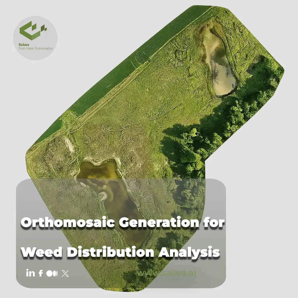
Orthomosaic Generation for Weed Distribution Analysis
Learn how to create high-accuracy orthomosaics for AI weed mapping using drone photogrammetry. Discover processing workflows (Pix4D, WebODM)
Written by Amirhossein
Reviewed by Boshra
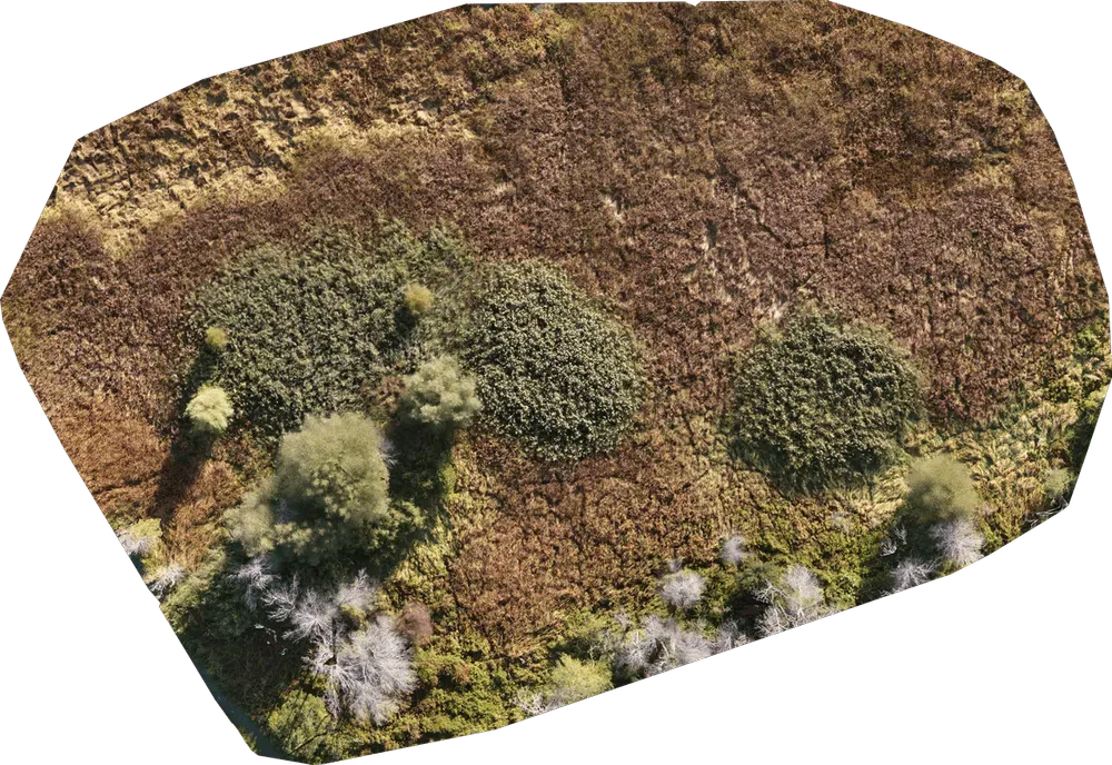
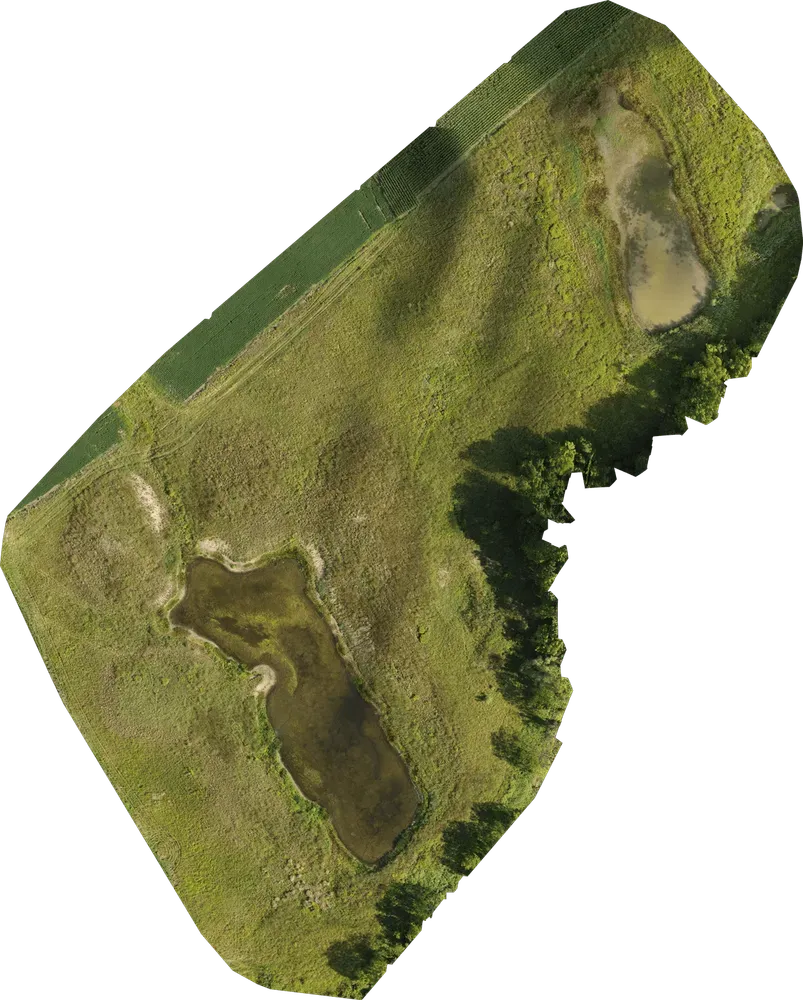
Creating accurate, high-resolution maps of agricultural fields is the foundational step for site-specific weed management. While single drone images provide a limited perspective, an orthomosaic—a geometrically corrected (orthorectified) composite of hundreds of aerial images—delivers a seamless, map-accurate representation of an entire field. This continuous view enables AI models to analyze weed distribution patterns, calculate exact geographic coordinates for each weed, and generate the variable-rate prescription maps required by modern sprayers.
This guide details the technical workflows, software options, and AI integration strategies for generating and utilizing agricultural orthomosaics in 2026, based on established photogrammetry standards and recent field data.
Fundamentals of Agricultural Orthomosaic Generation
Orthomosaic generation is not simple photo stitching. While photo stitching glues images together at their edges, orthorectification removes perspective distortions caused by the camera lens, camera angle, and terrain elevation variations. The result is an image with a uniform scale, similar to a satellite map, where precise distance and area measurements can be made.
The Photogrammetry Pipeline
The generation process relies on photogrammetry algorithms to build a 3D understanding of the field. The workflow requires identifying thousands of matching keypoints across multiple overlapping images to construct a 2.5D or 3D Digital Surface Model (DSM). The original images are then projected onto this terrain model to correct their perspective.
Because the orthomosaic is built upon the DSM, the accuracy of the final weed map is directly tied to the quality of this underlying elevation data. Errors or noise in the point cloud will manifest as distortions or artifacts in the final orthomosaic, potentially causing AI models to misidentify crop rows or weed patches.
Flight Parameters for Accurate Mapping
Generating a distortion-free orthomosaic requires specific data acquisition protocols. The fundamental requirement is high image overlap: a minimum of 70% front overlap and 70% side overlap is standard for agricultural mapping to ensure sufficient keypoint matching.
Flight altitude also dictates the Ground Sampling Distance (GSD)—the physical size represented by one pixel. For early-season weed detection using RGB sensors, a spatial resolution of 1–3 cm per pixel is often required, necessitating lower flight altitudes (typically 30–50 meters). When using RTK (Real-Time Kinematic) drones, each image is georeferenced with centimeter-level precision, which significantly improves the spatial accuracy of the final orthomosaic without relying heavily on ground control points.
Software Platforms: Processing Orthomosaics for Agriculture
Selecting the right processing software impacts turnaround time, output quality, and operational costs. The market offers a mix of localized processing software, cloud solutions, and open-source alternatives.
Commercial Solutions: Pix4Dmapper and Pix4Dfields
Pix4Dmapper is an industry standard for highly detailed, survey-grade photogrammetry, offering extensive manual control over tie points and dense point cloud generation. However, for agriculture, Pix4Dfields has become the preferred localized solution.
Pix4Dfields utilizes processing algorithms optimized specifically for agricultural terrain. Its "Fast Processing" mode generates orthomosaics rapidly, which is critical when farmers need turnaround within hours for time-sensitive herbicide applications. A recent addition, "Accurate Processing," provides better pixel geolocation (reducing distortions near elevation changes) but requires longer processing times. The software also leverages GPU acceleration—utilizing NVIDIA CUDA cores—to significantly reduce stitching times for both RGB and multispectral datasets.
Open-Source Alternatives: WebODM
For operations seeking to avoid monthly software subscriptions, WebODM (OpenDroneMap) provides a capable open-source alternative. WebODM can process both RGB and multispectral datasets to create orthomosaics, vegetation indices, and elevation models. While cost-effective, users often find its visual alignment workflow less streamlined than commercial options, sometimes requiring manual entry of coordinate data, which can slow down processing times.

Sensor Selection: RGB vs. Multispectral Orthomosaics
The choice of drone sensor determines the spectral data contained within the orthomosaic, directly influencing the weed detection methodology.
Sensor Type | Cost Profile | Resolution | Typical Output | Primary Weed Mapping Use Case |
RGB (Standard Camera) | Low | High (1-2 cm GSD) | TGI, Visual Assessment | Green-on-Brown spot spraying, high-contrast weed detection |
Multispectral | High | Moderate (3-5 cm GSD) | NDVI, NDRE | Green-on-Green detection, crop health analysis |
RGB Orthomosaics for Green-on-Brown Applications
High-resolution RGB sensors (e.g., 20-megapixel cameras) are highly effective for mapping weeds in fallow fields or pre-emergence scenarios (Green-on-Brown). By applying vegetation indices based on visible light—such as the Triangular Greenness Index (TGI)—practitioners can easily threshold the orthomosaic to separate green vegetation pixels from bare soil pixels.
Multispectral Orthomosaics for Complex Environments
When mapping weeds within an actively growing crop canopy (Green-on-Green), multispectral sensors (e.g., DJI Mavic 3 Multispectral) become essential. These sensors capture Near-Infrared (NIR) and Red-Edge light bands, enabling the generation of NDVI (Normalized Difference Vegetation Index) maps. Because different plant species reflect NIR light differently based on cellular structure, multispectral orthomosaics provide the spectral data necessary for AI models to differentiate a green weed from a green crop.
AI Integration: From Orthomosaic to Weed Distribution Map
Once the orthomosaic (typically a large GeoTIFF file) is generated, it serves as the input layer for Artificial Intelligence analysis. Manual visual inspection of a multi-hectare orthomosaic is impractical; deep learning models are required to automate the detection process.
The Role of Sairone in AI Weed Detection
Platforms like Sairone by Saiwa bridge the gap between raw orthomosaics and actionable agronomic data. Sairone provides a cloud-based web service designed for no-code AI computer vision processing.
The workflow is highly streamlined:
Upload: Farm operators upload the stitched GeoTIFF orthomosaic directly to the platform.
AI Processing: Sairone's machine learning models scan the entire georeferenced image. Depending on the model deployed, it can perform semantic segmentation (identifying weed patches) or instance segmentation (identifying individual plants like Canada Fleabane or Kochia).
Output Generation: The system returns precise weed distribution coordinates.
Because the original orthomosaic was georeferenced during the photogrammetry phase, the AI output possesses accurate geographic coordinates for every detected weed.
Generating Variable-Rate Prescription Maps
The ultimate goal of orthomosaic generation and AI analysis is to create a prescription map (task map) that tells agricultural machinery exactly where and how much herbicide to apply.
Conclusion
Orthomosaic generation is a critical prerequisite for advanced weed distribution analysis. By transforming hundreds or thousands of individual overlapping drone images into a single, map-accurate geospatial layer, farmers and agronomists provide the ideal canvas for AI computer vision models. Whether utilizing fast-processing engines like Pix4Dfields or routing GeoTIFFs through cloud-based AI platforms like Sairone, the integration of orthomosaics, AI detection, and variable-rate task maps offers a proven pathway to reducing chemical costs and advancing sustainable, site-specific weed management.
Comments
No comments yet!
Table of Contents
No headings were found on this page.