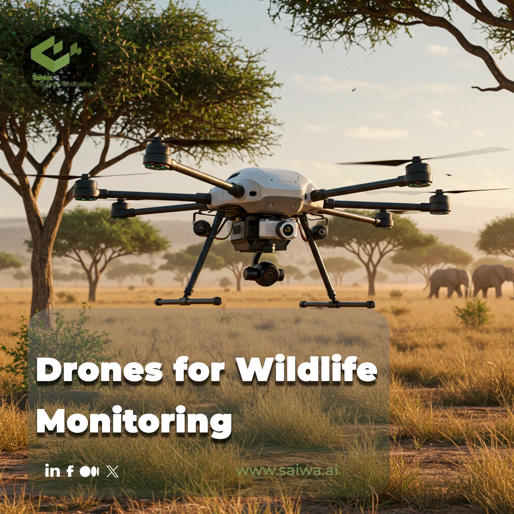
Drones for Wildlife Monitoring - From Thermal Imaging to AI-Powered Insights
Explore how drones enhance wildlife monitoring through aerial surveys, tracking animal movements, and supporting conservation with real-time data.
Written by Maryam
Reviewed by Boshra
The integration of unmanned aerial vehicles (UAVs) into ecological studies marks a paradigm shift from traditional, often invasive, field methods. These aerial platforms provide unprecedented access to remote terrains and deliver high-fidelity data with minimal disturbance. Advanced platforms like Saiwa's Sairone are at the forefront, transforming raw drone imagery into actionable conservation intelligence.
This article delves into the core technologies, diverse applications, and future trajectory of drone-based wildlife monitoring, offering a comprehensive guide to this transformative approach to ecological stewardship.
What Are Wildlife Drones and How Do They Work?
Wildlife drones are specialized UAVs equipped with sensors and cameras designed for ecological research and conservation. They operate remotely or autonomously to gather aerial data on animals, their behaviors, and their habitats without direct human intrusion, providing a safe and efficient data collection method.
Drone Types Used in Wildlife Monitoring
The selection of a drone platform is dictated by the specific monitoring objective. The three primary types offer distinct advantages:
Fixed-Wing Drones: Ideal for covering vast areas, making them suitable for tracking long-range migrations or mapping large habitats.
Multirotor Drones (e.g., Quadcopters): Offer stable hovering capabilities, perfect for detailed inspections, vertical surveys, and precise species counts in smaller zones.
Hybrid VTOL Drones: Combine the benefits of both, offering vertical takeoff and landing with the endurance of fixed-wing models for complex terrains.
Applications of Drones for Wildlife Monitoring
The adaptability of UAV technology has unlocked a broad spectrum of applications, revolutionizing how conservation scientists and ecologists gather crucial field data. The use of Drones for Wildlife Monitoring allows researchers to observe ecosystems without influencing them, leading to more accurate and unbiased insights. From counting populations to fighting poaching, the practical uses are expanding rapidly. Let’s look at some key applications in more detail:
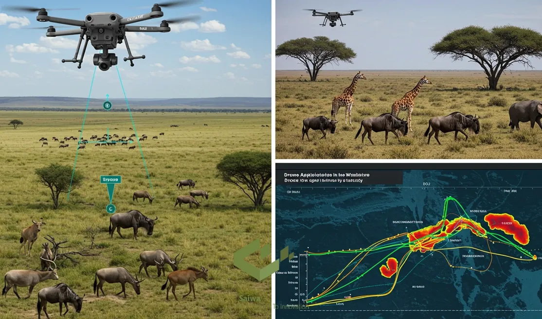
Tracking Animal Movements and Behavior: Drones enable the observation of animals in their undisturbed, natural state. By operating at a safe altitude, they can trail individuals or herds without causing stress, yielding authentic data on social interactions, foraging patterns, and territory use.
Population Surveys and Species Counts: Drones have proven to be a game-changer for censuses. Studies show that drone-based surveys can achieve accuracy rates between 43% and 96% higher than traditional ground-based counts, which are often hindered by observer bias and logistical challenges. This precision is vital for managing species quotas and assessing population health.
Monitoring Migrations: Fixed-wing and hybrid drones are particularly effective at tracking large-scale migrations across vast and often inaccessible landscapes. This data is critical for understanding migratory routes and protecting vital corridors from habitat fragmentation.
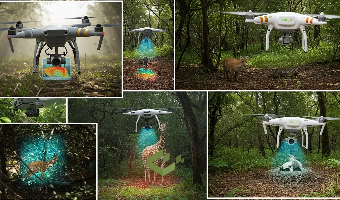
Thermal Imaging and Nocturnal Monitoring: Equipped with thermal cameras, drones can detect the heat signatures of animals. This capability is invaluable for locating elusive, nocturnal, or well-camouflaged species, and has become a cornerstone of modern anti-poaching patrols by identifying illegal human activity at night.
Key Technologies Powering Wildlife Drone Monitoring
A suite of sophisticated technologies underpins the effectiveness of modern drones, each contributing a unique layer of data. Understanding these core components is key to appreciating their power.
High-Resolution and Thermal Imaging
The primary data capture tools are cameras. High-resolution RGB (Red, Green, Blue) cameras capture fine visual details with stunning clarity, essential for species identification and habitat assessment.
Thermal imaging sensors, on the other hand, detect infrared radiation (heat). This allows them to "see" animals through dense foliage, under the cover of darkness, or even distinguish them based on subtle temperature differences, making them indispensable for comprehensive surveys.
GPS Navigation and Mapping
Onboard Global Positioning System (GPS) receivers are fundamental to drone operations. They enable precise autonomous flight along pre-programmed routes, ensuring systematic and repeatable coverage of a survey area. Critically, GPS technology geotags every single photo, video, or sensor reading with precise geographic coordinates. This transforms raw data into scientifically rigorous, spatially accurate maps of animal distributions and habitat features.
Multispectral Imaging and LiDAR Scanning
Going beyond the visible spectrum, multispectral sensors analyze plant health by capturing data from different light wavelengths. This is used to assess vegetation density and vitality, providing a direct measure of habitat quality and food availability.
LiDAR (Light Detection and Ranging), in contrast, uses laser pulses to create highly detailed 3D topographical maps of the terrain. This technology can penetrate forest canopies to map the ground below, offering unparalleled insights into habitat structure.
AI and Machine Learning for Automated Detection
Perhaps the most transformative technology in this space is the application of artificial intelligence. Manually analyzing thousands of high-resolution images is a monumental task. The advanced discipline of AI in wildlife conservation leverages machine learning algorithms to automate this process.
These AI systems can be trained to automatically identify specific species, count individuals in a herd, and flag anomalies, drastically reducing manual analysis time and eliminating human error. This is a core focus in the field of Drones for Wildlife Monitoring.
Benefits of Using Drones in Wildlife Monitoring
The widespread adoption of drone technology in conservation is not a passing trend; it is driven by a clear set of tangible advantages over legacy field methods. These benefits enhance not only the quality and precision of the data collected but also the efficiency and safety of the entire research process. The following points outline the most impactful of these advantages:
Reduced Disturbance to Wildlife: By operating from a significant altitude and often featuring low-noise propellers, drones can monitor animals without causing the stress or behavioral alterations commonly associated with human presence. This non-invasive approach ensures the data reflects natural animal behavior.
High-Fidelity Data Acquisition: Drones collect uniform, precise, and georeferenced data consistently across vast or difficult-to-access areas. This eliminates the variability and biases inherent in ground-based surveys conducted by multiple human teams, leading to more reliable and scientifically robust datasets.
Cost-Effectiveness: While the initial investment in high-quality drone equipment can be significant, the long-term operational savings are substantial. Drones drastically reduce the need for large field teams, expensive vehicles or aircraft charters, and weeks of labor, ultimately lowering the per-project cost of data collection.
Improved Safety for Researchers: Field research can be hazardous, exposing scientists to risks ranging from treacherous terrains and extreme weather to encounters with dangerous animals. Drones remove the human element from the point of data collection, allowing operators to conduct their work from a safe and secure location.
Challenges and Ethical Considerations in Wildlife Drone Monitoring
Despite the clear benefits, the deployment of drones in sensitive ecological contexts is not without its difficulties. Responsible and effective use requires operators to navigate several operational, technical, and ethical challenges. It is crucial for conservation professionals to be aware of the following considerations:
Battery Life and Flight Limitations: The majority of commercially available drones, particularly multirotor models, have flight times limited to 30-45 minutes. This restricts the potential range of a single mission and requires careful logistical planning for battery swaps, especially in remote areas.
Data Processing: Drones generate a massive volume of high-resolution visual data. Storing, managing, and analyzing this "data deluge" requires significant computational power and specialized expertise. For related large-scale analyses, such as weed detection in agricultural settings, developers often turn to platforms like Fraime to access powerful, ready-to-use image processing services.
Regulatory Compliance: The airspace is a regulated domain. Drone operators must adhere to strict national and local aviation regulations, which often include limitations on flight altitude, distance from people, and operation near airports. Securing the necessary permits and licenses is non-negotiable for legal and safe operation.
Minimizing Disturbance to Wildlife: While generally less disruptive than humans, drones can still cause stress to certain species if flown too close or too aggressively. Ethical operation demands careful flight planning, maintaining a respectful distance, and monitoring animal behavior for any signs of distress to ensure their well-being remains the top priority. This is the cornerstone of responsible Drones for Wildlife Monitoring.
Read Also : Wildlife Detection Systems - Enabling Smarter Monitoring and Species Protection
The Future of Drones in Wildlife Monitoring
The trajectory of drone technology in conservation science points toward an even more integrated and intelligent future. Continuous innovation is steadily addressing current limitations and unlocking entirely new capabilities that were once the realm of science fiction.
The evolution of Drones for Wildlife Monitoring is being actively shaped by the convergence of hardware and software advancements.
Advancements in AI and Machine Learning
The role of artificial intelligence is expanding far beyond simple object detection. The next generation of AI in this field will focus on predictive analytics, learning to anticipate animal behavior, identify signs of disease or distress, and forecast habitat changes based on subtle environmental cues, offering a proactive approach to conservation.
Emerging Swarm Drone Technology
Swarm technology, where multiple drones operate together in a coordinated, autonomous group, promises to revolutionize large-scale surveys. A single operator will be able to deploy a "swarm" to cover a massive area like a synchronized team, gathering comprehensive, multi-layered data with unparalleled efficiency and speed. This will enable true ecosystem-scale monitoring in real-time.
Drones in Emergency Wildlife Response
In the aftermath of natural disasters such as wildfires, floods, or hurricanes, time is of the essence. Drones can be deployed rapidly into affected zones to assess the extent of habitat damage, locate surviving animal populations in need of rescue, and help emergency teams plan their response efforts more effectively and safely.
Sairone’s Role in Advancing Wildlife Monitoring Through Drone Innovation
Saiwa's Sairone platform stands at the confluence of drone technology and artificial intelligence, engineered specifically to solve the "data deluge" challenge for ecologists and environmental managers.
Sairone’s powerful AI-powered solution suite automates the analysis of high-resolution drone imagery for wildlife and habitat conservation. It translates immense volumes of complex visual data into clear, concise, and actionable insights. By processing datasets that would traditionally take over 50 hours of manual expert review in just a matter of minutes, Sairone empowers conservation teams to bypass the analytical bottleneck and make faster, more accurate, and critically timed data-driven decisions to protect vulnerable species and ecosystems.
Conclusion
Unmanned aerial vehicles have unequivocally transcended their novelty status to become an indispensable tool in the conservationist's toolkit. They provide a safe, remarkably efficient, and scientifically rigorous means of data collection that was previously unattainable. The true revolution, however, lies in the synergy of drones with powerful AI analysis platforms like Sairone, which transform this potential into tangible, real-world outcomes.
Note: Some visuals on this blog post were generated using AI tools.
Comments
No comments yet!
Table of Contents
No headings were found on this page.