Drone Metal Detectors: How AI helps Revealing the Underground
Unearth lost treasures with Drone Metal Detectors! compare top models & discover how drones can transform your metal detecting experience.
Written by Amirhossein
Reviewed by Boshra
Traditional ground-based metal detection requires manual labor to survey just a few acres per day, a process that is time-consuming, dangerous in contaminated areas, and really expensive for large-scale operations. Archaeological surveys, landmine clearance, and utility mapping face operational bottlenecks that delay projects and increase costs.
Drone-mounted metal detection systems are transforming these challenges by combining electromagnetic sensors with unmanned aerial vehicles. These systems survey hundreds of acres daily while keeping operators at safe distances from potential threats.
This article explores how drone metal detectors work, the technologies enabling their capabilities, and their applications across industries from archaeology to infrastructure management.

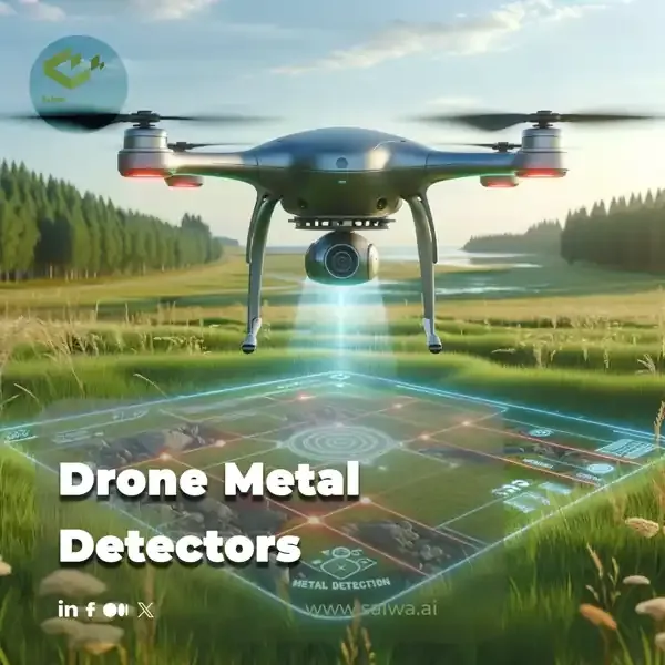
What Are Drone Metal Detectors?
Drone metal detectors are unmanned aerial systems equipped with electromagnetic sensors that identify metallic objects beneath the ground surface from airborne positions. Unlike traditional handheld or vehicle-mounted detectors that require direct ground contact, these aerial platforms fly systematic patterns while scanning terrain for metal signatures through electromagnetic induction or magnetic field disturbances.
The technology integrates established metal detection principles with drone mobility, enabling rapid surveying of large or inaccessible areas. Sensors mounted on the drone's underside generate electromagnetic fields that interact with buried metals, producing detectable signals that indicate metal presence, type, and approximate depth.
This combination transforms metal detection from a slow, labor-intensive ground process into an efficient aerial operation suitable for diverse applications.
How Drone Metal Detectors Work
Drone metal detection systems operate through integrated electromagnetic sensing and aerial positioning:
- Electromagnetic Field Generation: A transmitter coil within the sensor creates a primary electromagnetic field that penetrates the ground surface as the drone flies overhead at controlled altitudes.
- Metal Object Interaction: When this electromagnetic field encounters conductive materials like buried metal, it induces eddy currents within the object that generate secondary electromagnetic fields opposing the original.
- Signal Detection and Processing: The sensor's receiver coil detects these secondary electromagnetic signatures, analyzing their characteristics to identify metal presence, approximate size, and composition.
- GPS Georeferencing: Integrated navigation systems record the precise location coordinates of each detection, enabling accurate mapping of metal object positions across surveyed areas.
- Data Transmission and Analysis: Real-time data streams to ground control stations where algorithms process signals, filter false positives from ground mineralization, and generate detection visualizations for operator review.
This automated workflow enables systematic coverage of vast areas while maintaining detection consistency impossible with manual methods.

Where Drone Metal Detectors Are Being Used
Drone-mounted metal detection delivers transformative capabilities across sectors requiring efficient subsurface metal identification:
- Archaeological Surveys: Rapid scanning of potential dig sites identifies buried artifacts, tools, and structures without excavation. Drones cover entire archaeological zones in days rather than months, enabling researchers to prioritize excavation efforts based on detection density patterns and target promising locations efficiently.
- Landmine Detection and Clearance: Aerial surveying locates unexploded ordnance and landmines across contaminated zones without exposing personnel to detonation risks. Detection teams use drone data to map hazardous areas precisely, planning safe clearance operations that protect humanitarian workers and accelerate land rehabilitation.
- Infrastructure and Utility Mapping: Construction projects use drone detectors to locate buried pipes, electrical cables, and other utilities before ground-breaking activities. Accurate subsurface mapping prevents costly damage to existing infrastructure, reduces project delays, and ensures worker safety during excavation operations.
- Mineral Exploration: Geological surveys employ drone metal detectors for preliminary resource assessment, identifying areas with mineral deposit indicators. This aerial reconnaissance directs subsequent ground-based exploration efficiently, reducing costs associated with extensive manual surveying of remote terrain.
Read Also: AI-Based Drone Operation| AI in Drones use cases
Tools Enabling Drone Metal Detectors
Several specialized technologies enable effective aerial metal detection:
- Very Low Frequency (VLF) Sensors: These induction loop detectors operate at low frequencies, effectively identifying both ferrous and non-ferrous metals at shallow to moderate depths. Their lightweight design suits most commercial drones while providing good discrimination between metal types.
- Pulse Induction (PI) Sensors: PI detectors deliver superior depth penetration compared to VLF systems, particularly effective in highly mineralized soil conditions. Though heavier and requiring more powerful drones, they excel at detecting deeply buried objects and large metal masses.
- Magnetometers: These sensors detect disturbances in Earth's magnetic field caused by ferrous metals, useful for locating large iron objects like vehicles or ordnance. Limited metal type discrimination restricts applications compared to electromagnetic sensors.
- GPS Navigation Systems: Precision positioning technology enables accurate georeferencing of detections, systematic flight path execution, and repeatable survey coverage for monitoring applications over time.
Advantages and Limits
While drone metal detectors offer impressive efficiency and coverage for large areas, they also face drawbacks.
Key Advantages
Drone-based metal detection delivers substantial operational improvements over traditional ground methods:
- Enhanced Personnel Safety: Operators remain at safe distances from potential hazards like unexploded ordnance, contaminated soil, or unstable terrain, eliminating exposure risks inherent to manual detection work.
- Rapid Area Coverage: Drones survey hundreds of acres daily compared to a few acres with ground-based methods, dramatically reducing project timelines and enabling large-scale operations previously considered impractical.
- Access to Difficult Terrain: Aerial platforms reach areas inaccessible to ground teams, including steep slopes, dense vegetation, flooded zones, or environmentally sensitive habitats where foot traffic would cause damage.
- Cost Efficiency: Despite higher initial equipment investment, reduced labor requirements, faster surveying speeds, and minimized project delays generate significant cost savings over project lifecycles.
- Real-Time Data Integration: Immediate sensor data transmission enables on-site decision-making, allowing operators to adjust survey parameters, investigate anomalies promptly, or redirect resources based on detection patterns.
Possible Limits
Organizations deploying drone metal detection systems must address several operational considerations:
- Payload Limitations: Drone carrying capacity constrains sensor size and weight, potentially limiting detection depth or capabilities compared to larger ground-based systems. Battery life restrictions reduce flight duration and survey area per mission.
- Weather Dependencies: Wind affects flight stability and sensor positioning accuracy, while precipitation can attenuate electromagnetic signals. Adverse conditions may delay surveys or require mission rescheduling.
- Ground Mineralization Interference: Highly mineralized soil or geological features generate electromagnetic signatures that create false positive detections, requiring advanced signal processing and ground-truthing to verify targets.
- Data Processing Expertise: Interpreting sensor data accurately demands understanding of electromagnetic principles, metal properties, and environmental factors affecting detection. Operators need specialized training for reliable results.
Saiwa’s Drones for Any Purposes
Using our cloud-based services including generic AI and ML services at Fraime and more specific agricultural, green-house and environmental service at Sairone, it is straight-forward to process video-streams that were captured with different drones or make orthophotos out of them and then analyze the resulting Tiff files. In this way, the objects of interest like crops, wild animals, invasive species and more, can be monitored automatically and without manual human requirements. Finally, using the geo-locations we can provide various shape-files, point clouds or csv files ideal for sending to spray drones. Even though, recently we focused our business to the green fields, still our platform and services are generic and can be employed in other applications including metal detection.
Conclusion
Drone-mounted metal detectors transform subsurface metal identification from slow, hazardous ground operations into rapid, safe aerial surveys that cover extensive areas efficiently. The technology combines proven electromagnetic detection principles with drone mobility and AI-enhanced data processing to deliver capabilities unattainable through traditional methods.
As we have mentioned, applications besides agriculture, green-house or environment is not at our main interest in Saiwa but our services and open APIs may be used for various applications. Using our related experiences, we believe the core challenge in aerial metal detection is not generating electromagnetic signals but correctly interpreting them in variable soil and magnetic conditions that can be handled by accurate AI and ML services.
By integrating PI/VLF sensor outputs with our cloud-based inference pipelines, one may apply adaptive noise suppression, modeling, and frequency-domain signal decomposition to isolate true metallic responses from mineralization artifacts. Real-time fusion of flight telemetry, altitude variance, and sensor phase-shift data enables dynamic recalibration during flight, improving depth estimation and reducing false positives. Robust AI post-processing is the primary factor that elevates drone-based metal detection from raw signal capture to reliable, georeferenced detection suitable for operational decision-making.
Note: Some visuals on this blog post were generated using AI tools.
References (5)
Comments
No comments yet!
Table of Contents
No headings were found on this page.