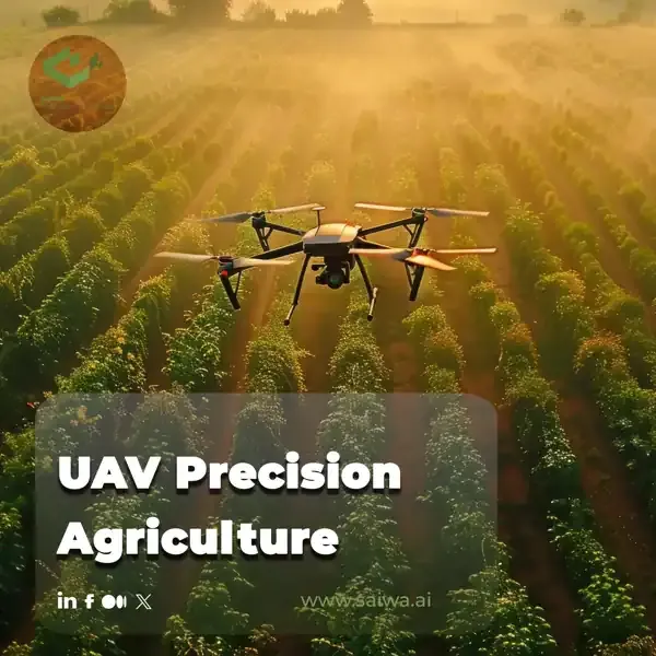
The integration of unmanned aerial vehicles (UAVs) into modern farming practices is a transformative development in precision agriculture. This integration enables enhanced crop management, optimized resource utilization, and increased yields. This innovative approach employs advanced sensors and imaging systems to gather high-resolution data, thereby providing farmers with actionable insights for the implementation of more efficient and sustainable practices.
Sairone is an integrated AI/ML drone platform designed by Saiwa for use in agricultural, greenhouse, and ecological fields. Sairone employs artificial intelligence and machine learning to analyze the high-resolution data collected by unmanned aerial vehicles (UAVs), transforming the raw data into precise, actionable insights. By integrating with an array of drone types, Sairone augments precision agriculture through the optimization of processes such as planting, fertilization, irrigation, and pest control, thereby facilitating more efficient and sustainable farming practices.
This article explores the multifaceted world of UAV precision agriculture, highlighting its key components, benefits, and applications. We look at the types of agricultural drones, essential sensors, and software tools that drive this technology. We also discuss the advantages over traditional methods, environmental sustainability, and future trends shaping the industry. Discover how UAVs, in conjunction with Sairone, are transforming agriculture into a smarter and more efficient practice for the future.

What is UAV Precision Agriculture?
The integration of technology into agriculture has ushered in a new era of efficiency and sustainability, and at the forefront of this revolution are unmanned aerial vehicles (UAVs), commonly known as drones. UAV precision agriculture represents a paradigm shift from traditional farming practices, leveraging aerial technology to optimize crop management, enhance resource utilization, and maximize yields.
UAV precision agriculture encompasses the use of drones equipped with advanced sensors and imaging systems to collect high-resolution data about crops and farmland. This data, processed and analyzed using specialized software, provides farmers with actionable insights to make informed decisions regarding planting, fertilization, irrigation, pest control, and harvesting.
Read Also: Leveraging Drones in Agriculture for a New Era of Data-Driven Farming
Key Components of UAV Precision Agriculture

Several key components work in synergy to enable effective UAV precision agriculture:
Unmanned Aerial Vehicles (UAVs): These platforms, ranging from fixed-wing to multi-rotor designs, are chosen based on specific farm needs and payload capacity.
Sensors and Imaging Systems: Multispectral cameras, thermal sensors, LiDAR (Light Detection and Ranging), and hyperspectral sensors capture a wide range of data, including crop health, soil conditions, and water stress indicators.
Software and Data Processing Tools: Sophisticated software platforms process the raw data collected by UAVs, generating maps, 3D models, and analytical reports that provide actionable insights to farmers.
Data-Driven Decision Making: The heart of UAV precision agriculture lies in utilizing the data-driven insights to optimize farm management practices, leading to increased efficiency, reduced waste, and improved yields.
UAVs vs. Traditional Agricultural Methods
The adoption of UAVs in agriculture offers significant advantages over traditional farming methods, revolutionizing how farmers manage their operations.
Efficiency and Accuracy
Traditional Methods: Manual scouting of fields, often subjective and time-consuming, can lead to delayed detection of crop stress or pest infestations.
UAV Technology: Drones cover vast areas rapidly, providing high-resolution imagery and data that enable early detection of issues, allowing for timely interventions and minimizing potential losses.
Cost Analysis
Traditional Methods: Labor-intensive tasks, such as manual spraying and fertilization, can be costly, and blanket applications often lead to over-usage of resources.
UAV Technology: Precision applications targeted only at areas requiring treatment minimize input costs, reduce waste, and optimize resource utilization, leading to significant cost savings over time.
Environmental Impact
Traditional Methods: Over-application of fertilizers and pesticides can lead to soil degradation, water contamination, and harm to beneficial insects and wildlife.
UAV Technology: Targeted applications minimize chemical usage, reducing the environmental footprint of farming and promoting sustainable agricultural practices.
Labor Requirements
Traditional Methods: Many farming tasks require significant manual labor, which can be challenging to find and manage, particularly during peak seasons.
UAV Technology: Automating tasks like crop scouting, spraying, and seeding reduces the reliance on manual labor, freeing up farmers to focus on other critical aspects of their operations.
UAV Technologies in Agriculture

Types of Agricultural Drones
Fixed-Wing Drones: These aircraft offer longer flight times and are suitable for covering large fields, but they require runways for takeoff and landing.
Multi-Rotor Drones: Highly maneuverable and capable of vertical takeoff and landing, these drones are ideal for smaller fields and precision applications.
Hybrid Drones: Combining the advantages of both fixed-wing and multi-rotor designs, these drones offer versatility and extended flight times.
Essential Sensors and Cameras
RGB Cameras: Capture standard visual images for crop monitoring, field mapping, and visual inspection.
Multispectral Cameras: Detect light in different wavelengths, providing insights into plant health, chlorophyll content, and stress indicators not visible to the naked eye.
Thermal Cameras: Detect temperature variations, identifying irrigation issues, stressed plants, and even livestock health problems.
LiDAR Sensors: Use laser pulses to create detailed 3D maps of the terrain, vegetation, and infrastructure, valuable for irrigation planning and field analysis.
Hyperspectral Sensors: Capture hundreds of narrow spectral bands, providing detailed information about plant physiology, soil composition, and disease detection.
Read Also: Fields from Above | Innovations in Agricultural Drone Mapping
Software and Data Processing Tools
Flight Planning Software: Allows farmers to create optimized flight paths for their drones, ensuring complete coverage of the field and efficient data collection.
Data Processing Software: Processes the raw data captured by UAV sensors, generating maps, 3D models, and analytical reports.
Farm Management Software: Integrates UAV-collected data with other farm data sources, providing a comprehensive platform for data analysis, decision making, and farm management.
Applications of UAVs in Farming
Crop Monitoring and Health Assessment
Plant Health Monitoring: Multispectral imagery analyzes plant vigor, chlorophyll content, and stress indicators, enabling early detection of diseases, nutrient deficiencies, or pest infestations.
Weed Detection: Drones identify and map weed locations, allowing for targeted herbicide applications, minimizing chemical usage, and reducing herbicide resistance.
Stand Count and Gap Analysis: Assessing plant emergence and identifying gaps in the field early on allows for timely replanting or adjustments to seeding rates.
Soil and Field Analysis
Soil Mapping: Drones equipped with multispectral or hyperspectral sensors create maps of soil properties, such as organic matter content, moisture levels, and nutrient composition.
Topography and Drainage Analysis: LiDAR sensors generate detailed elevation maps, identifying areas prone to water accumulation or erosion, informing drainage system design and irrigation planning.
Field Boundary Mapping: Accurately mapping field boundaries simplifies farm management, enables precise area calculations, and facilitates record-keeping.
Read Also: Drone LiDAR Mapping | The Future of Data Acquisition
Precision Spraying and Seeding
Variable Rate Application: Drones equipped with spraying or seeding systems adjust application rates based on real-time data, optimizing input use and minimizing waste.
Targeted Spraying: Identifying and treating only specific areas affected by pests or diseases reduces chemical usage, minimizes environmental impact, and prevents the development of resistance.
Seed Planting: Drones can plant seeds in difficult-to-reach areas or on steep slopes, improving planting efficiency and reducing soil disturbance.
Irrigation Management
Irrigation Scheduling: Thermal imagery identifies areas with water stress, allowing for targeted irrigation, conserving water, and optimizing plant growth.
Leak Detection: Drones equipped with thermal cameras can detect leaks in irrigation systems, minimizing water loss and preventing potential damage to crops.
Water Resource Management: Data on soil moisture levels and crop water requirements helps optimize irrigation scheduling, improving water use efficiency and reducing water consumption.
Yield Forecasting
Crop Yield Estimation: Analyzing plant health, growth stages, and historical data, drones can provide accurate yield predictions, aiding in marketing decisions and logistics planning.
Crop Growth Stage Monitoring: Tracking crop development throughout the growing season helps optimize harvesting times, ensuring peak quality and minimizing losses.
Crop Damage Assessment: Quickly assessing damage caused by storms, hail, or pests allows for timely interventions and insurance claims processing.
Benefits of Using UAVs in Agriculture
Increased Efficiency and Productivity
Time Savings: Automating tasks like crop scouting and spraying significantly reduces the time required for these operations.
Improved Accuracy: Data-driven insights and precision applications optimize resource utilization, leading to higher yields and reduced input costs.
Enhanced Decision Making: Real-time data and analytics empower farmers to make informed decisions, responding to changing conditions quickly and effectively.
Cost Reduction and Resource Optimization
Reduced Input Costs: Precision applications minimize the use of fertilizers, pesticides, and water, leading to significant cost savings.
Labor Optimization: Automating tasks reduces the reliance on manual labor, addressing labor shortages and optimizing workforce allocation.
Minimized Crop Losses: Early detection of crop stress, pests, or diseases allows for timely interventions, minimizing potential losses and maximizing yields.
Environmental Sustainability
Reduced Chemical Usage: Targeted applications minimize the environmental impact of pesticides and herbicides, protecting water resources and beneficial insects.
Improved Water Conservation: Optimizing irrigation practices conserves water, a critical resource in many agricultural regions.
Reduced Soil Compaction: Lightweight drones minimize soil compaction compared to heavy machinery, promoting healthy soil structure and reducing erosion.
Data-Driven Decision Making
Actionable Insights: Data collected by UAVs provides valuable insights into crop health, soil conditions, and resource utilization, enabling data-driven decision making.
Predictive Analytics: Analyzing historical data and trends helps anticipate potential issues and optimize farm management practices for future seasons.
Improved Record-Keeping: Digital data collected by UAVs facilitates accurate record-keeping, simplifying reporting requirements and enabling traceability.
Economic Impact of UAV Precision Agriculture

Market Size and Growth Projections
The global market for agricultural drones is experiencing rapid growth, driven by increasing adoption by farmers worldwide. Market projections indicate significant expansion in the coming years, creating new opportunities for drone manufacturers, software developers, and service providers.
Job Creation and Skill Development
The rise of UAV precision agriculture is creating new job opportunities in areas such as drone operation, data analysis, and software development. This emerging sector requires a skilled workforce, leading to a demand for educational programs and training initiatives focused on UAV technologies and their applications in agriculture.
Impact on Small vs. Large-Scale Farming
While initially perceived as a technology primarily beneficial for large-scale farms, UAV precision agriculture is becoming increasingly accessible to smaller farms as well. The declining cost of drones and the availability of affordable service providers are making this technology more attainable for farmers of all sizes.
Potential for Improving Global Food Security
UAV precision agriculture has the potential to play a significant role in addressing global food security challenges. By increasing yields, reducing waste, and optimizing resource utilization, this technology can contribute to producing more food with fewer resources, addressing the growing demand for food as the global population continues to rise.
Implementing UAV Technology on Your Farm
Choosing the Right UAV System
Selecting the appropriate UAV system depends on factors such as farm size, terrain, specific applications required, and budget. Consulting with experts in UAV precision agriculture can help farmers choose the right drone, sensors, and software solutions tailored to their needs.
Training and Certification Requirements
Operating UAVs for commercial purposes often requires specific training and certification, varying depending on local regulations. Farmers and their employees need to be properly trained in drone operation, safety procedures, and data privacy regulations.
Integration with Existing Farm Management Systems
Integrating UAV-collected data with existing farm management software is crucial for maximizing the value of this technology. This integration enables seamless data flow, providing a comprehensive view of farm operations and facilitating data-driven decision making.
Best Practices for UAV Operations
Pre-Flight Checks: Conducting thorough pre-flight inspections of the drone and its systems ensures safe and reliable operation.
Flight Planning: Creating optimized flight paths maximizes efficiency and ensures complete coverage of the field.
Data Security: Implementing measures to protect sensitive farm data collected by UAVs is crucial to maintain privacy and prevent unauthorized access.
Weather Considerations: Flying drones in appropriate weather conditions ensures data accuracy and safe operation.
Challenges and Limitations of Agricultural UAVs
Regulatory Hurdles
The rapidly evolving nature of UAV technology presents challenges for regulators, and regulations regarding drone use in agriculture vary widely across different countries and regions. Navigating these regulations and obtaining necessary permits can be complex and time-consuming for farmers.
Technical Limitations
Battery Life: Limited flight times of drones can restrict the area covered in a single flight, particularly for larger farms.
Data Processing and Storage: Processing and storing large volumes of data collected by UAVs requires significant computing power and storage capacity.
Weather Dependence: UAV operation can be affected by adverse weather conditions such as rain, wind, or fog, potentially delaying data collection.
Data Management and Privacy Concerns
The increasing use of UAVs in agriculture raises concerns about data privacy and security. Ensuring the responsible collection, storage, and use of farm data is crucial to maintain public trust and prevent potential misuse of this information.
Case Studies
Large-Scale Crop Monitoring
Large agricultural companies are using UAVs to monitor vast fields of crops, detecting stress, disease, and irrigation issues early on. This data-driven approach enables timely interventions, maximizing yields and optimizing resource utilization across large operations.
Vineyard Management
In the viticulture industry, drones are being used for vineyard mapping, assessing vine health, and monitoring grape maturity. This precision viticulture approach helps optimize irrigation, fertilization, and harvesting, resulting in higher quality grapes and improved wine production.
Livestock Monitoring
Drones equipped with thermal cameras are being used to monitor livestock herds, detecting sick or injured animals, monitoring grazing patterns, and even counting animals in large pastures. This technology improves animal welfare, reduces labor costs, and enhances overall herd management.
Forestry Applications
UAVs are playing an increasingly important role in forestry management, monitoring forest health, detecting pests and diseases, assessing fire damage, and even planting trees in remote or difficult-to-reach areas. This technology contributes to sustainable forest management and conservation efforts.
Future of UAV Precision Agriculture
The future of UAV precision agriculture is bright, with continued technological advancements and increasing adoption by farmers worldwide. Key trends shaping the future of this sector include:
Artificial Intelligence (AI) Integration: AI algorithms will play an increasingly important role in analyzing UAV-collected data, providing more sophisticated insights and automating decision-making processes.
Sensor Fusion and Data Analytics: Combining data from multiple sensors and integrating it with other farm data sources will provide a more comprehensive understanding of farm ecosystems.
Swarm Technology: Deploying multiple drones simultaneously to cover larger areas or perform complex tasks will further enhance efficiency and data collection capabilities.
Robotics Integration: Integrating UAVs with ground-based robots for tasks like autonomous spraying, weeding, and harvesting will further automate farm operations.
Conclusion
The advent of unmanned aerial vehicles (UAVs) in precision agriculture is transforming the manner in which food is cultivated. These devices offer farmers a potent instrument for augmenting efficiency, sustainability, and profitability. As technology continues to advance and become more readily available, unmanned aerial vehicles (UAVs) will assume an increasingly pivotal role in shaping the future of agriculture. This will lead to the development of a more sustainable, efficient, and productive food system that will benefit future generations.
Note: Some visuals on this blog post were generated using AI tools.