AI and Natural Disaster Prediction: How Machine Learning Saves lives
Sep 17, 2023
Aug 24, 2026
Written by: Maryam Rajaei
Reviewed by: Boshra Rajaei, PhD
Written by: Maryam Rajaei
Reviewed by: Boshra Rajaei, PhD
According to the United Nations Office for Disaster Risk Reduction (UNDRR), between 2015–2023 the average annual number of disaster-related deaths (excluding COVID-19) was around 41,700. Old forecasting methods struggle with the complex, chaotic nature of events like hurricanes, wildfires, and earthquakes, often providing insufficient lead time for effective evacuation and response. Manual analysis of meteorological data cannot process the vast information streams needed for accurate predictions.
Artificial intelligence is changing disaster forecasting by analyzing massive datasets that overwhelm conventional approaches. Machine learning algorithms detect subtle patterns in satellite imagery, seismic data, and atmospheric conditions that precede catastrophic events. These AI-powered systems enable earlier warnings, more precise risk assessments, and targeted emergency responses that save lives.
This blog explains how AI enhances natural disaster prediction across multiple hazard types. You'll learn about the core technologies powering these systems, their real-world applications, and the advantages they offer over traditional methods.
AI-powered natural disaster prediction uses machine learning algorithms to analyze environmental data and forecast hazardous events before they occur. Unlike traditional physical models that rely on established equations and limited variables, AI systems learn from historical disaster patterns to identify precursor conditions across multiple data sources simultaneously.
These systems process inputs ranging from satellite imagery and weather station readings to seismic sensors and ocean buoys. By recognizing combinations of factors that preceded past disasters, AI models can flag similar conditions in real-time and generate probabilistic forecasts. This capability is particularly valuable for complex events where multiple environmental variables interact in nonlinear ways that challenge conventional modeling approaches.
AI disaster prediction systems operate through a multi-stage process that transforms raw environmental data into actionable warnings:
Data Collection and Integration: Sensors, satellites, weather stations, and IoT devices continuously gather meteorological and atmospheric measurements across monitored regions.
Data Preprocessing: AI algorithms and Convolutional Neural Networks clean, normalize, and harmonize diverse data formats, filling gaps and removing noise to create consistent datasets for analysis.
Pattern Recognition and Training: Deep learning models Like RNN trained on historical disasters learn to identify precursor conditions, correlating factors like temperature anomalies, pressure changes, or ground deformation with subsequent events.
Probabilistic Forecasting: The system generates predictions with associated confidence levels, indicating likelihood, timing, severity, and potential impact zones for predicted disasters.
Continuous Model Refinement: Machine learning models improve accuracy over time by incorporating feedback from actual disaster outcomes, adapting to climate changes and emerging patterns not present in historical data.
This automated workflow processes information volumes impossible for human analysts to handle manually, enabling faster and more comprehensive risk assessment.
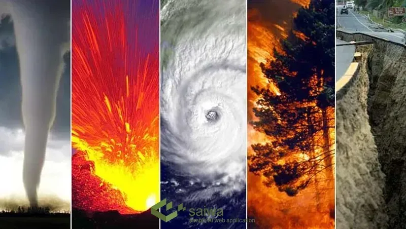
AI technologies deliver measurable improvements in forecasting capabilities in diverse natural disaster fields, changing how communities prepare for and respond to environmental threats.
Industry-Specific Use Cases
Agriculture: AI predicts droughts and floods by analyzing soil moisture and precipitation patterns, allowing farmers to adjust crop cycles and reduce losses.
Insurance: Insurers leverage AI to assess risk profiles and design policies based on predictive models analyzing disaster frequency, severity, and geographic vulnerability.
Urban Planning: City planners utilize AI simulations to design infrastructure resilient to earthquakes, hurricanes, and floods, optimizing building codes and emergency infrastructure placement.
Emergency Response: AI systems optimize evacuation routes and resource allocation by processing real-time data on road conditions, population density, and hazard progression.
Energy Sector: AI forecasts power grid disruptions caused by natural disasters, enabling utility companies to implement preemptive measures and minimize service interruptions.
When extreme weather events such as hurricanes, unexpected frost, or sudden torrential floods occur, the agricultural sector faces immediate, devastating impacts. Traditional post-disaster crop damage assessment has always relied on slow, manual field scouting, which delays crucial insurance payouts and emergency resource distribution. However, modern AI frameworks have fundamentally altered this timeline by fusing Unmanned Aerial Vehicle (UAV) drone operations with deep learning architectures to execute rapid, non-invasive disaster evaluations.
During the critical hours immediately following a flood, autonomous drones equipped with multispectral sensors map the affected acreage. Rather than manually interpreting RGB imagery, convolutional neural networks (CNNs) process the data in real-time to generate Normalized Difference Vegetation Index (NDVI) mapping. These models assess the spectral reflectance of the surviving canopy, calculating the exact percentage of crop loss down to the pixel. Furthermore, hybrid neural network models that combine high-resolution hyperspectral drone imagery with ground-level IoT soil sensors allow agronomists to instantly map post-flood nutrient runoff, specifically targeting acute nitrogen deficiencies in standing crops like wheat or maize.
AI-powered drone systems are not limited exclusively to the aftermath of a disaster; they actively shape the response during the crisis. Drones currently possess the computational capacity to monitor real-time changes in river levels, levee integrity, and agricultural drainage systems during severe storms. By running onboard edge-AI algorithms, these aerial units detect hydrological anomalies and predict specific overflow scenarios with a level of speed and spatial accuracy that traditional satellite or ground-based systems cannot match. This real-time intelligence is vital for triggering automated flood warnings and rerouting emergency rescue paths before disaster strikes vulnerable rural farming communities.
Real-World Success Stories
AI enhances natural disaster prediction by analyzing massive datasets to forecast events faster and accurately. However there are some limitations to consider.
AI-powered disaster prediction delivers substantial improvements over traditional forecasting methods:
Massive Data Processing: AI systems analyze petabytes of multi-source environmental data simultaneously, identifying correlations across variables that manual analysis would miss entirely.
Earlier Warning Times: Pattern recognition capabilities detect precursor conditions sooner than conventional models, providing additional hours or days for evacuation and preparation that directly reduce casualties.
Localized Risk Assessment: High-resolution inputs enable predictions at neighborhood or building level rather than broad regional forecasts, allowing targeted responses that optimize resource allocation.
Data Limitations: Accurate prediction depends on vast, high-quality datasets, yet many disaster-prone regions lack consistent data collection infrastructure. Incomplete historical records, gaps in sensor networks, and inconsistencies in satellite imagery can compromise model accuracy, especially in developing nations.
Model Generalization and Transferability: Machine learning models trained on one region’s environmental conditions often fail when applied to another with different terrain, climate, or infrastructure. Creating adaptive, region-agnostic models remains a major research challenge.
Real-Time Integration and Scalability: Processing continuous streams of satellite, IoT, and meteorological data demands immense computational power. Limited bandwidth, latency issues, and hardware constraints can delay critical predictions when every minute matters.
Interpretability and Trust: Deep learning systems often operate as “black boxes,” providing results without clear explanations. Disaster management teams need transparent, interpretable outputs to justify evacuation decisions and maintain public trust in AI-generated alerts.

As disaster management requirements become increasingly urgent and data volumes grow exponentially, artificial intelligence for natural disaster prediction is shifting from traditional statistical modeling toward advanced multimodal foundation models, real-time edge processing, and high-resolution aerial reconnaissance. While early machine learning frameworks focused primarily on isolated historical datasets and centralized cloud processing, modern disaster forecasting platforms integrate cutting-edge paradigms to enhance early-warning accuracy and operational response times.
Traditional disaster prediction models often analyze weather patterns, seismic telemetry, or hydrological data in separate, siloed pipelines. Modern systems leverage multimodal foundation models and advanced deep learning architectures—such as spatial-temporal transformers—to synthesize diverse data streams simultaneously. By unifying satellite imagery, radar telemetry, atmospheric pressure logs, and ground sensor data into a single neural network, these models can forecast complex phenomena like flash floods, severe storms, and wildfire propagation with unprecedented lead times and spatial precision.
In disaster-prone regions or active emergency zones, communication infrastructure is frequently compromised, rendering cloud-dependent systems unreliable. To ensure continuous operational resilience, modern disaster response platforms deploy Edge AI architectures. By running optimized deep learning models directly on local hardware—such as remote IoT sensor nodes, automated weather stations, and emergency response vehicles—agencies can execute real-time anomaly detection and risk assessment locally at the point of data acquisition. This edge-based inference eliminates network latency and guarantees critical alert generation even during total internet blackouts.
When disasters strike, macro-scale satellite imagery can sometimes lack the localized resolution required for immediate search and rescue or damage assessment. Unmanned aerial vehicles (UAVs) equipped with high-resolution optical, thermal, and LiDAR sensors bridge this gap. Utilizing specialized aerial platforms, emergency responders capture sub-centimeter imagery of disaster zones instantly. Computer vision algorithms running on these drones analyze structural collapses, flood boundaries, and wildfire perimeters in real time, transmitting actionable intelligence to command centers before ground teams arrive.
By combining multimodal forecasting intelligence, resilient edge computing, and rapid aerial remote sensing, modern AI-driven disaster prediction platforms empower communities and emergency services to transition from reactive crisis management to proactive, data-backed mitigation.
AI transforms natural disaster prediction from a data-limited, physics-constrained challenge into a pattern recognition problem that leverages expanding environmental monitoring capabilities. Machine learning systems already demonstrate superior forecasting accuracy for hurricanes, wildfires, and floods compared to conventional methods, with potential to extend these improvements across all hazard types.
From our perspective at Saiwa Inc., the future of disaster prediction will depend more and more on AI/ML systems capable of operating reliably in low-connectivity and data-scarce environments. Platforms like Sairone—which combine edge-based inference, high-resolution geospatial analysis, and continuous model adaptation from drone and satellite imagery—demonstrate how localized, real-time intelligence can complement large-scale predictive models. By integrating on-site observations with broader environmental forecasts, AI can provide more precise, context-aware warnings that improve response effectiveness, particularly in remote agricultural and ecological regions where traditional monitoring infrastructure is limited.
Note: Some visuals on this blog post were generated using AI tools.

Fraud is a major threat to individuals, businesses, and the economy, costing billions of dollars each year. As fraudsters develop more sophi

Machine learning models are very important and are used for many things, such as data science, marketing, finance, retail, and other things.

This article discusses the idea of two well-liked sub-categories of Artificial Intelligence, i.e., Machine Learning vs Deep Learning. Additi

Machine learning automates processes and generates insightful data from various texts like surveys, emails, customer service tickets, social

Machine learning has emerged as a transformative technology across industries, allowing systems to learn from data to make automated predict

Machine learning models have become integral across various applications, from image recognition and natural language processing to autonomo
Be the first to share your thoughts
Start the conversation by sharing your thoughts
Share this article
Help others discover this content
Get expert insights, product news, and industry trends delivered straight to your inbox.
No spam, unsubscribe anytime. We respect your privacy.
