Phragmites
Controlling Phragmites
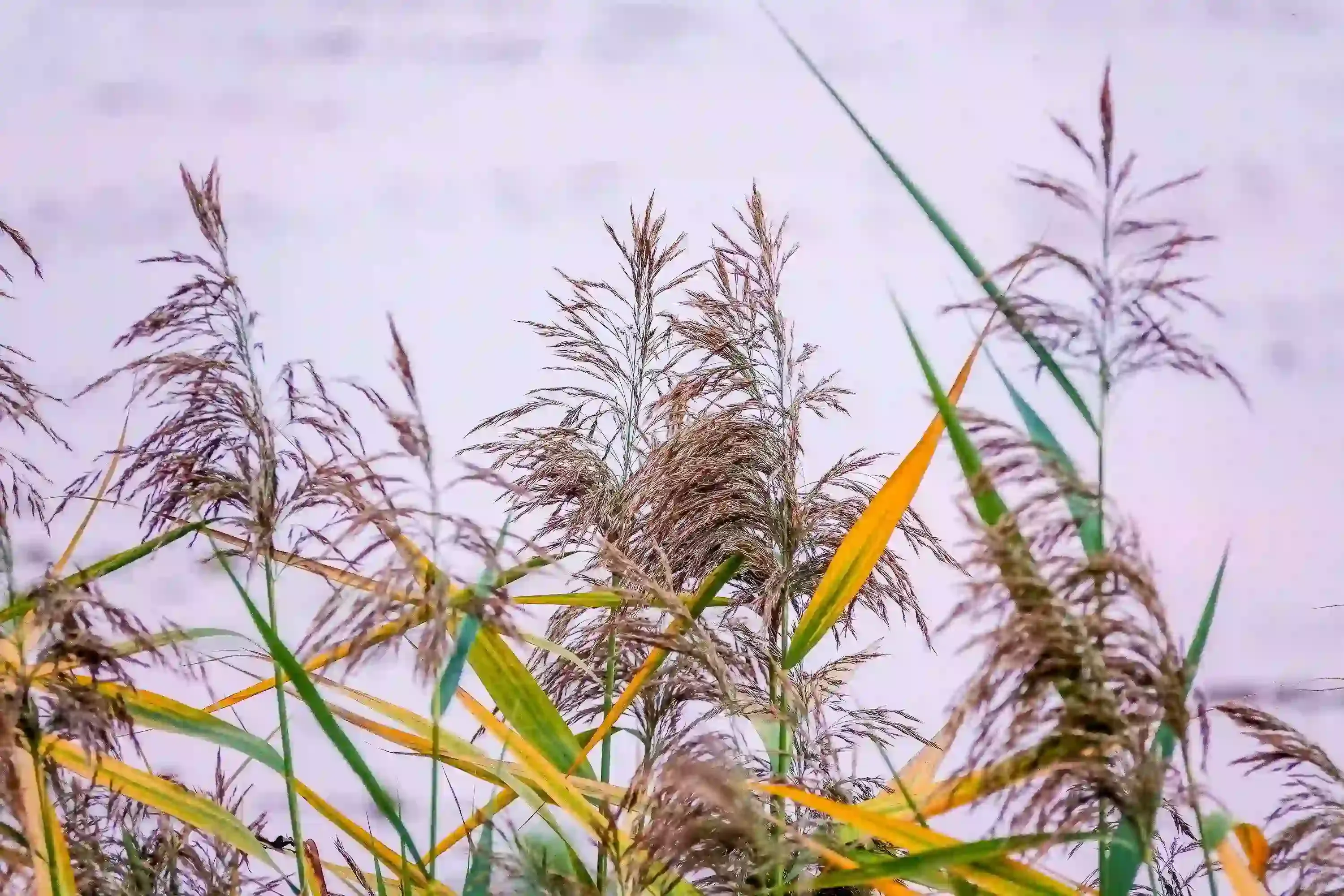
Phragmites australis, commonly known as common reed, is a tall perennial grass commonly found in wetlands, marshes, shorelines, drainage ditches, riverbanks, and other moist environments. Invasive strains of Phragmites have spread aggressively in many regions, especially in disturbed habitats affected by human activity. Dense colonies are often found in coastal marshes, freshwater wetlands, roadside drainage systems, and agricultural waterways, where they can rapidly outcompete native vegetation.
Phragmites is widely distributed across North America, Europe, Asia, Africa, and Australia. In North America, invasive European lineages have spread extensively throughout Canada and the United States, particularly in the Great Lakes region and coastal wetlands. Its ability to tolerate different water levels, salinity conditions, and climates has made it one of the world’s most successful invasive wetland plant species.
The ecological impacts of invasive Phragmites can be significant. The species forms dense monocultures that reduce biodiversity by displacing native wetland plants and altering wildlife habitats. It can also change wetland hydrology, affect nutrient cycling, increase fire risk due to dry biomass accumulation, and negatively impact fish, birds, amphibians, and other wildlife. Because of these impacts, early detection and monitoring of Phragmites infestations are critical for wetland conservation and invasive species management programs.
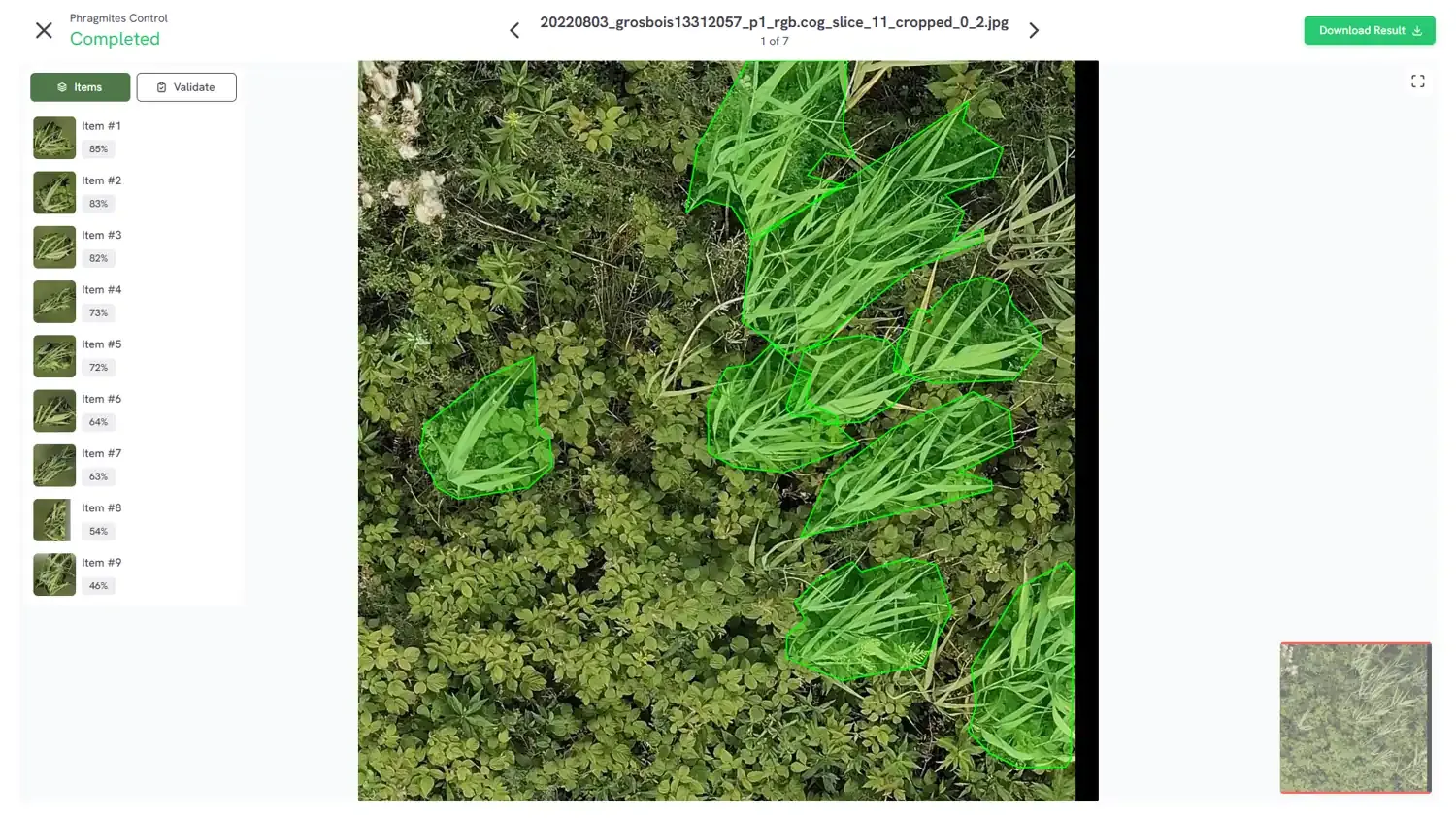
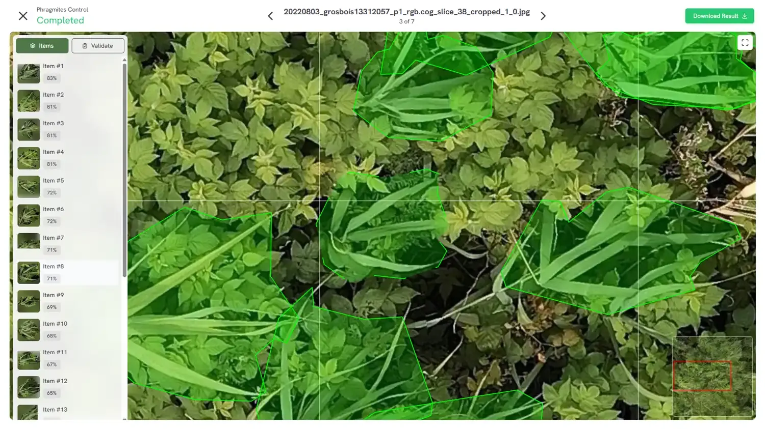
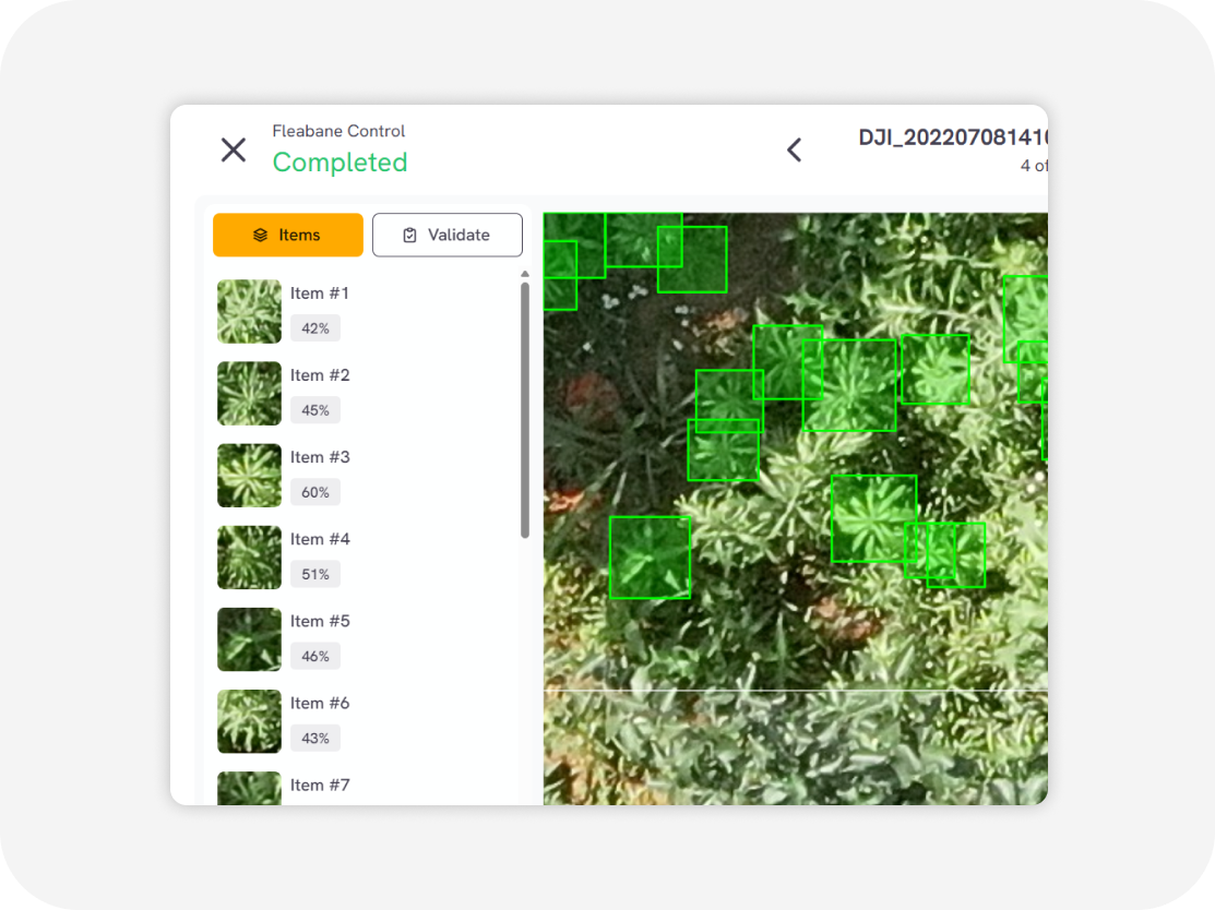
Example of processing and outputs
A variety of outputs are available
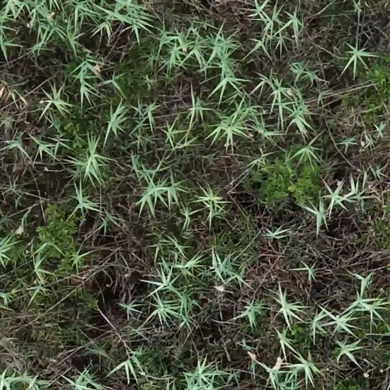
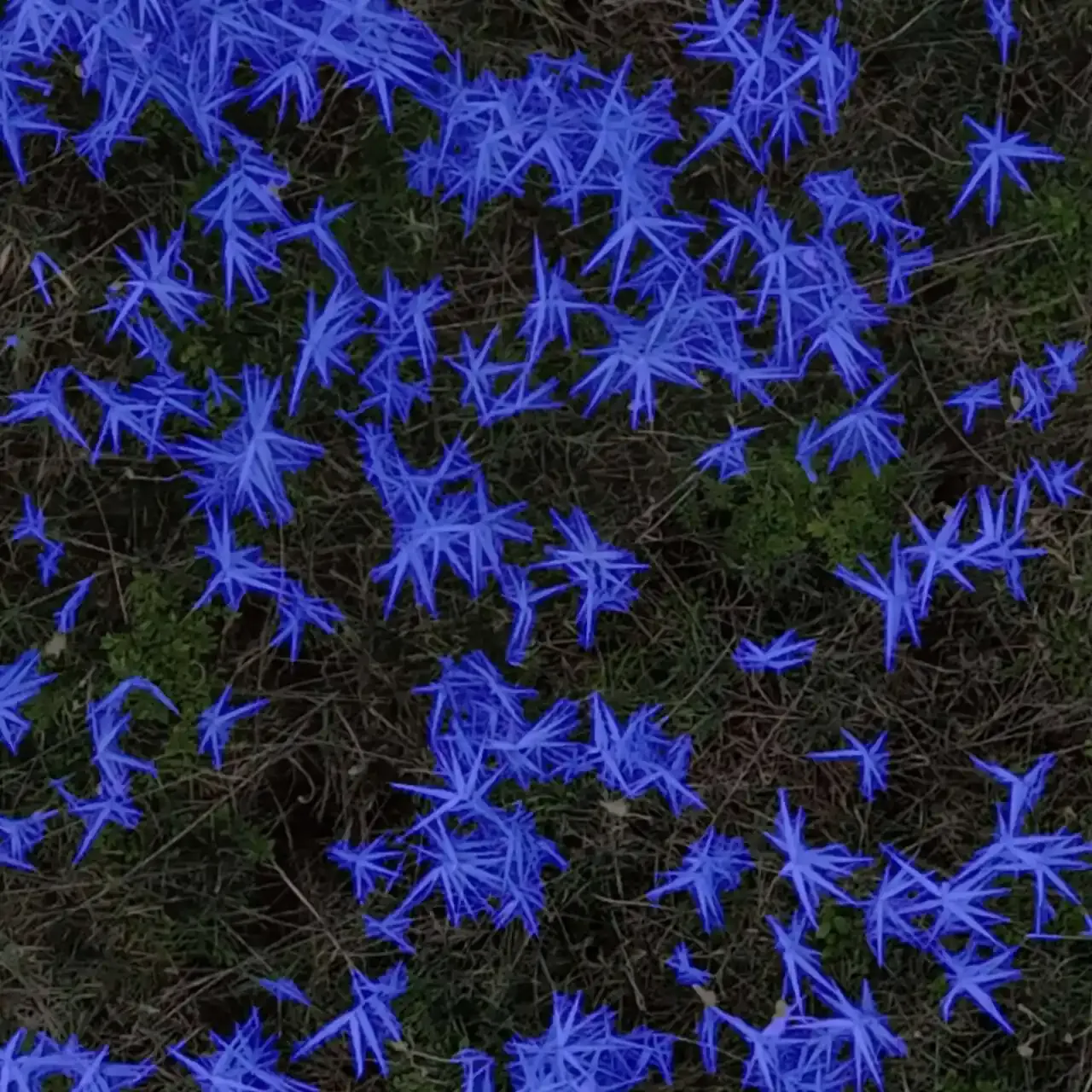
We employ a cutting-edge, real-time object detection model to identify Phragmites and other invasive species efficiently. This model is designed to balance high-speed inference with accuracy, making it ideal for real-time applications.
Phragmites Detector
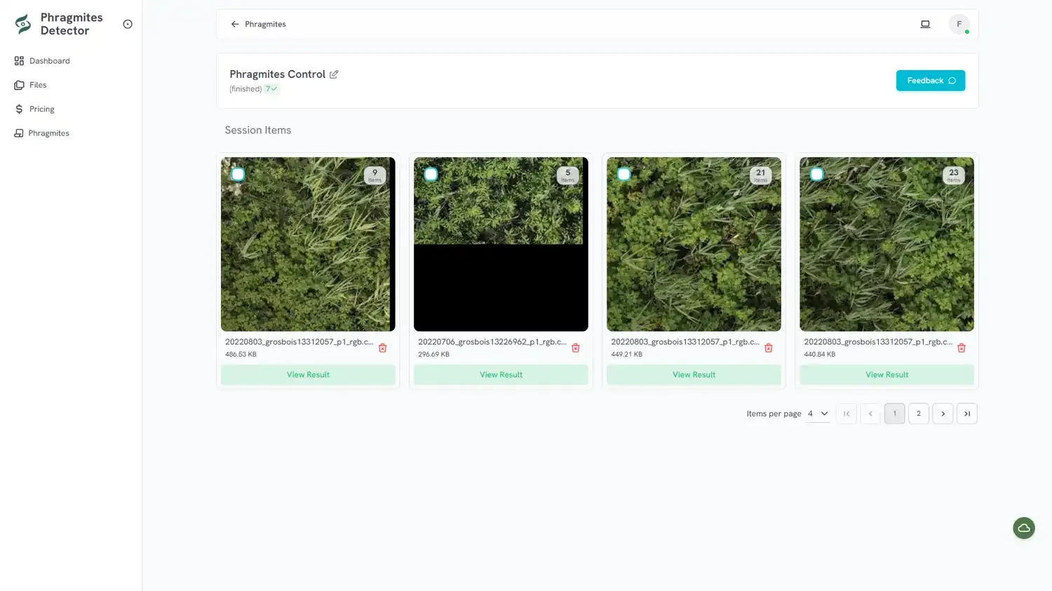
How it works?
Easy to use online cloud-based web service
Upload Images/videos
Aerial videos/images in various formats Orthophoto/TIFF images RGB, multispectral, thermal Surveillance (CCTV) cameras Agricultural machinery camera
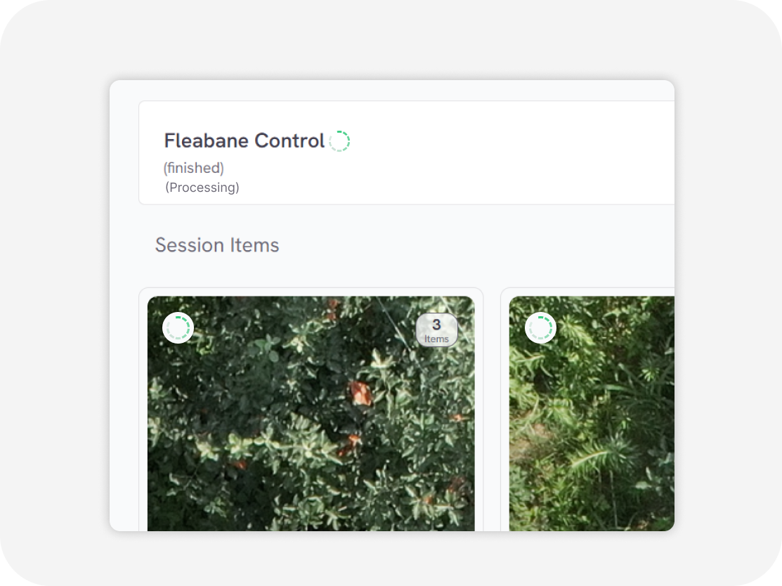
Processing
in second
Download output
Weed distribution map with GIS data Weed clustering map with GIS data (GeoJSON, Shapefile, KML, CSV)
Flexible Service Delivery
API Integration
Seamlessly connect Sairone’s advanced AI services to your existing systems through modular, easy-to-use APIs.
Fully White-Labeled Solutions
Get a tailor-made version of Sairone—branded, customized, and built specifically for your unique business needs.
Online Web Application
Use our powerful online platform with scalable cloud processing and budget-friendly