Sairone Conservation Technology | AI-Powered Invasive Species Monitoring
Sairone Conservation Technology | AI-Powered Invasive Species Monitoring
Protecting Ecosystems Through AI-Powered Precision
Sairone's conservation and invasive species management solutions empower environmental stewards, Private marina operators and waterfront property managers, Cottage associations and lake stewardship organizations, land managers, and conservation organizations with precision drone technology designed to protect and restore natural ecosystems.
Breaking the Endless Monitoring Loop
Most conservation districts, wetland restorers, and invasive-species contractors we talk to are stuck in the same exhausting cycle:
Manual field surveys consume weeks
Sending crews into chest-deep swamps, steep ravines, or navigating boats for days on end—surveying only a fraction of the total area that needs monitoring. For those flying drones, how do you process all the footage you get?
Hand-flagging misses the majority
Field crews can only flag a small percentage of European water chestnut, knotweed, phragmites, or kudzu infestations, leaving vast areas undetected and untreated.
Treatment is all-or-nothing
Teams either blanket-spray everything—killing native species and risking waterway contamination—or hand-pull what they found and watch the rest explode the following year.
This reactive approach wastes resources, damages ecosystems, and never gets ahead of the invasion. There has to be a better way.
Precision Detection, Strategic Action
We built Sairone to break that loop. Our platform transforms invasive species management from endless field surveys to strategic, data-driven interventions.
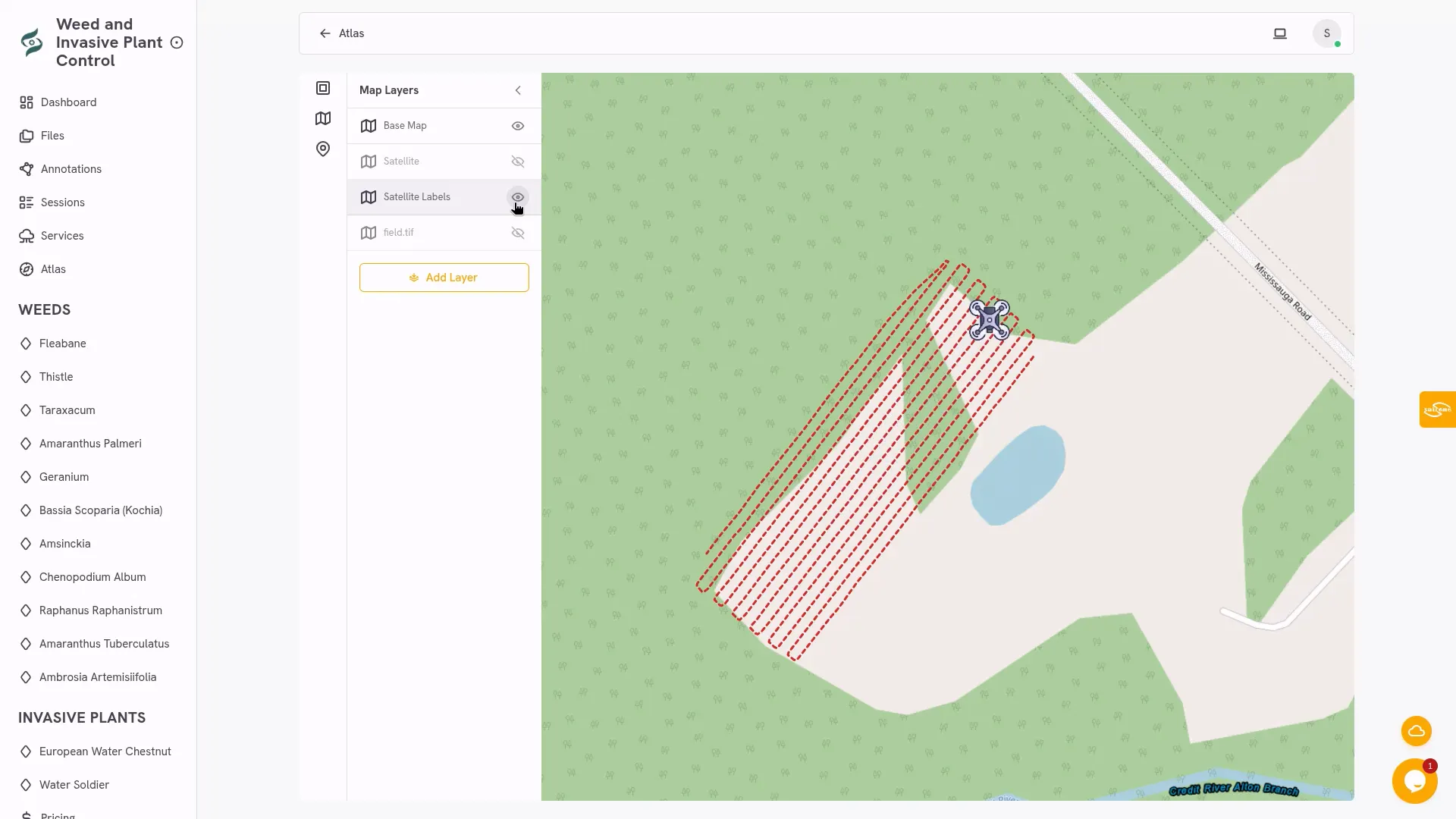
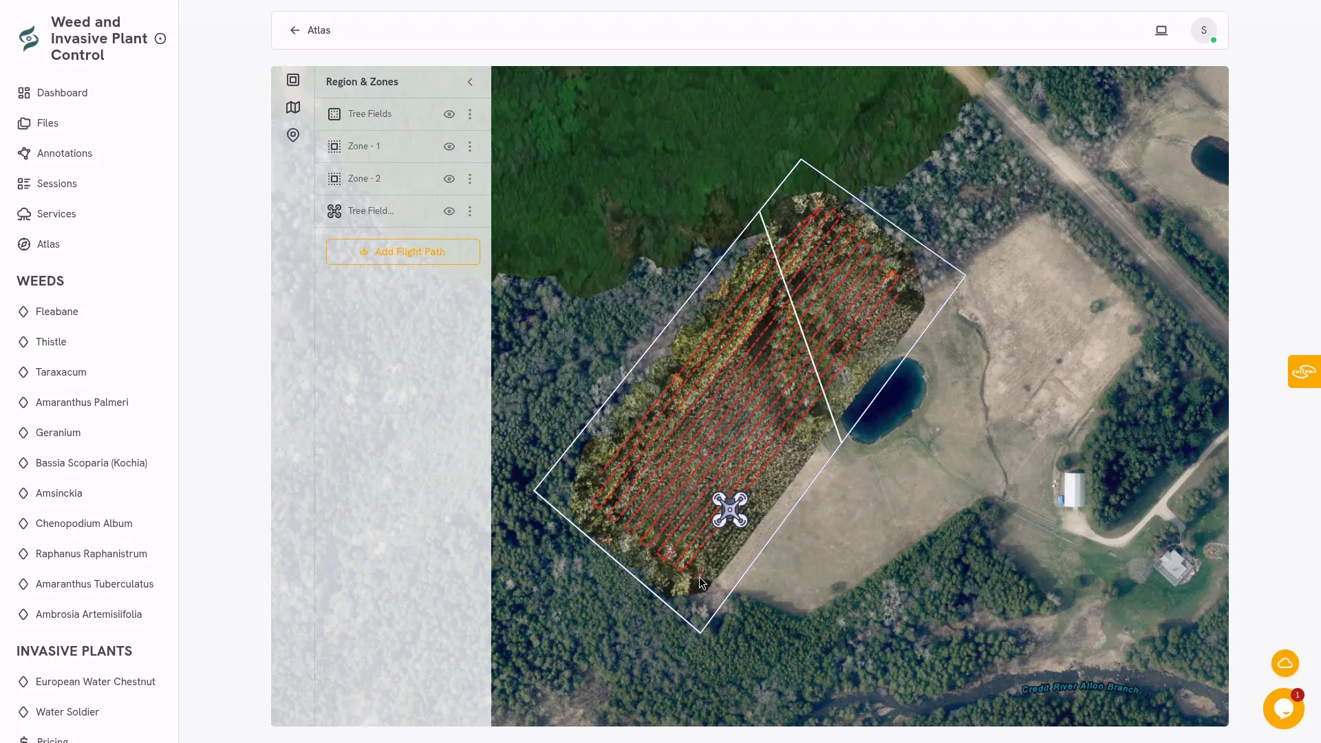
Fly Any Drone You Own
Use your existing XAG, DJI, Autel, Wingtra, or even Mavic 3 drone to capture aerial imagery over your site. No expensive specialized hardware required.
Upload to Sairone Platform
Upload your drone footage directly to our secure cloud platform. Our AI processes thousands of images in minutes—work that would take field crews weeks.
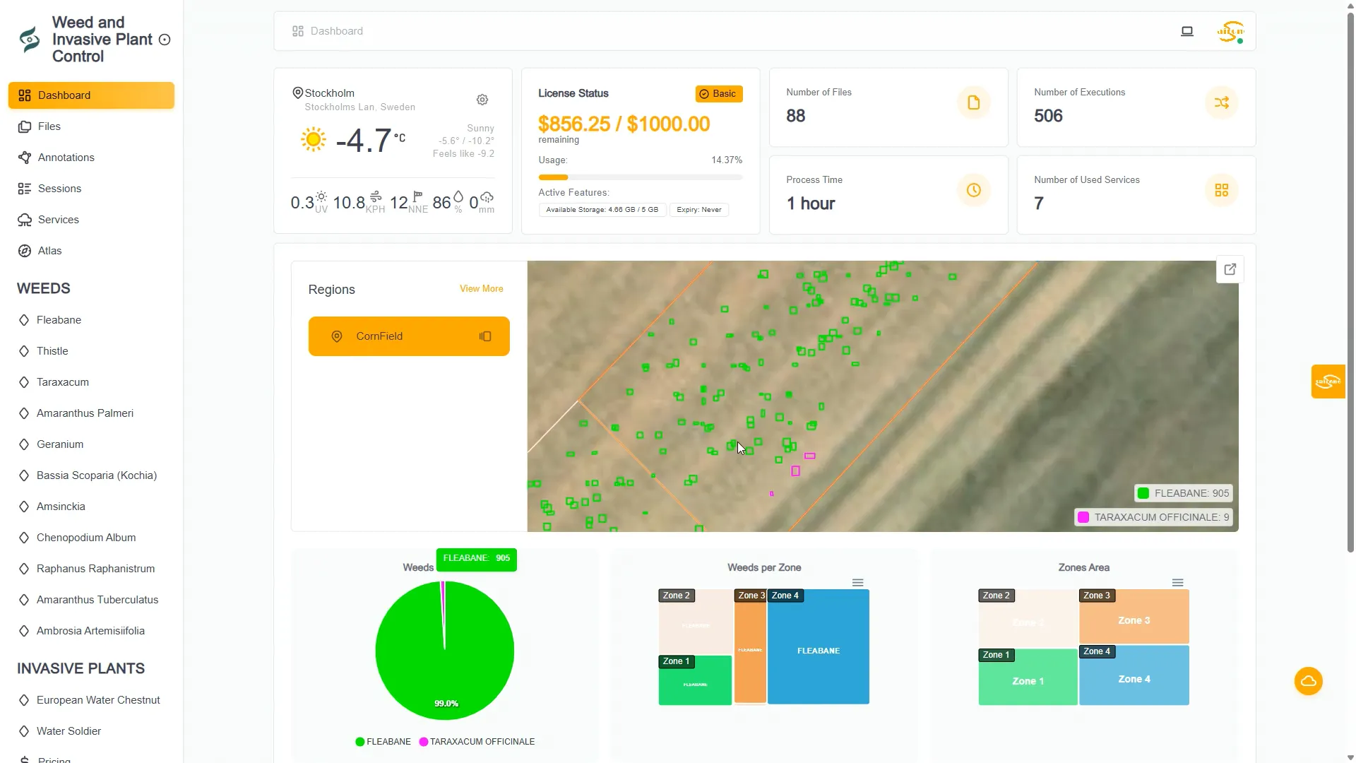
Receive Actionable Intelligence
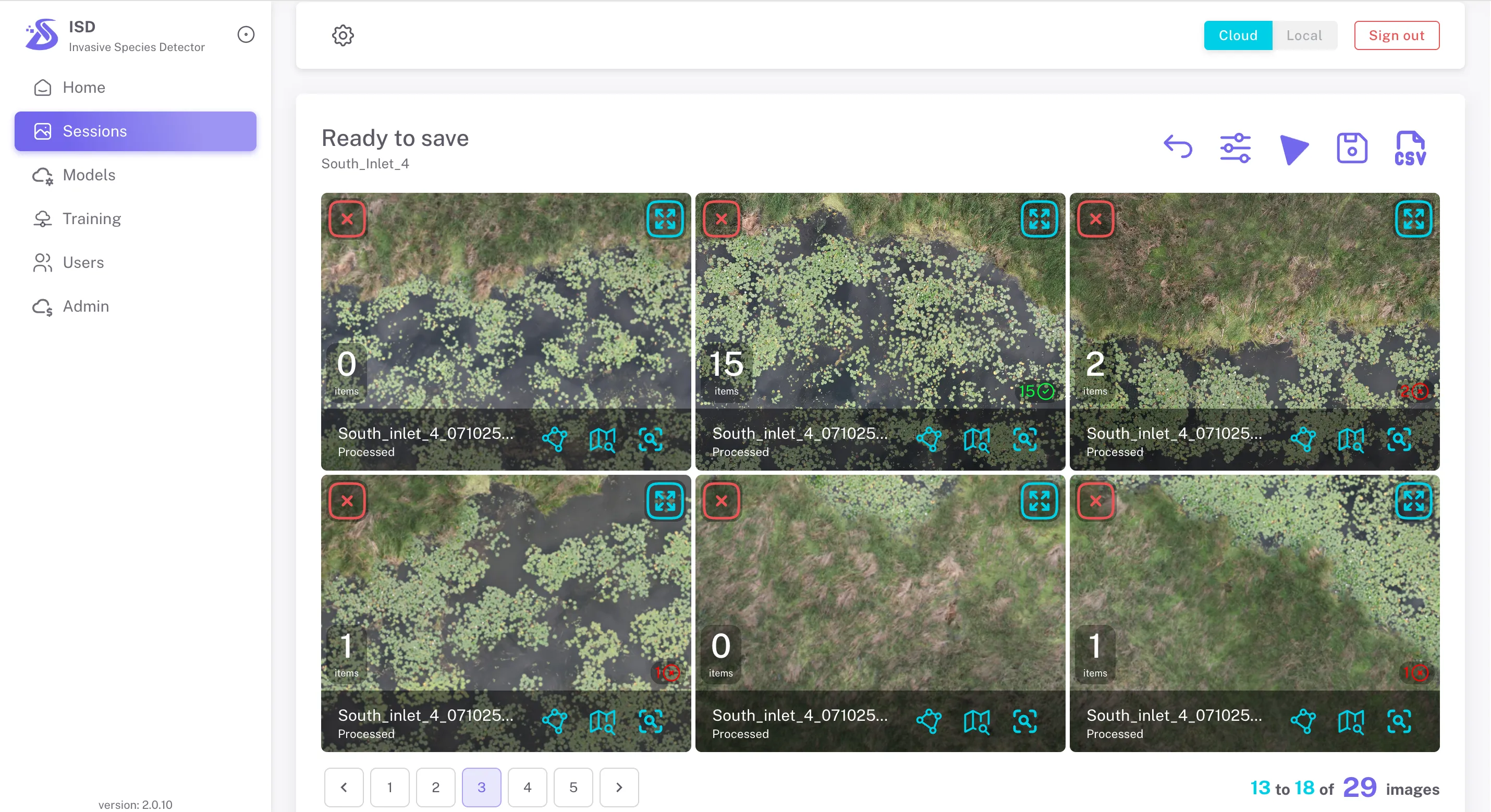
Get back a plant-by-plant map of every targeted invasive species with species-level identification, precise polygon clusters ready for spot-spray drones or backpack crews, and clean shapefiles and PDF reports that satisfy regulators and grant reviewers.
Treat Only What Matters
Target invasive species and noxious weeds with surgical precision, avoiding native vegetation and minimizing chemical use while maximizing ecological impact.
No steep learning curve
No lock-in contracts
No new hardware required
Just upload → map → treat → prove compliance. Transform conservation from reactive crisis management to proactive, data-driven ecosystem protection.
Sairone's conservation and invasive species management solutions empower environmental stewards, Private marina operators and waterfront property managers, Cottage associations and lake stewardship organizations, land managers, and conservation organizations with precision drone technology designed to protect and restore natural ecosystems. Our advanced aerial imaging and AI-powered analysis capabilities enable rapid identification, mapping, and monitoring of invasive plant species and noxious weeds across vast landscapes that would be impossible to survey efficiently on foot or by boat. The platform delivers georeferenced data that pinpoints exact infestation locations, measures spread patterns over time, and quantifies vegetation density to support strategic intervention planning. By providing detailed species classification and distribution maps, Sairone helps conservation teams prioritize treatment areas, optimize resource allocation, and plan precision herbicide applications that minimize chemical use while maximizing ecological impact. The technology supports both preventative monitoring programs and active eradication campaigns, enabling early detection of new invasions before they become established and tracking the effectiveness of remediation efforts through multi-temporal analysis. Whether managing nature preserves, protecting endangered habitats, controlling roadside invasives, or restoring degraded lands, Sairone's drone solutions transform conservation work from reactive crisis management to proactive, data-driven ecosystem protection that delivers measurable results while reducing costs and environmental impact.
Award-Winning Conservation Technology
Our groundbreaking work in invasive species detection has earned recognition from leading conservation organizations and research institutions, validating our commitment to protecting Canada's most precious ecosystems through cutting-edge technology.
Critical Invasive Species We Monitor
Sairone's AI platform is trained to detect and map the most ecologically destructive invasive aquatic and wetland plants threatening Canadian ecosystems. Our species-level identification capabilities enable conservation teams to respond rapidly, target interventions precisely, and track the spread of invasions over time with unprecedented accuracy.
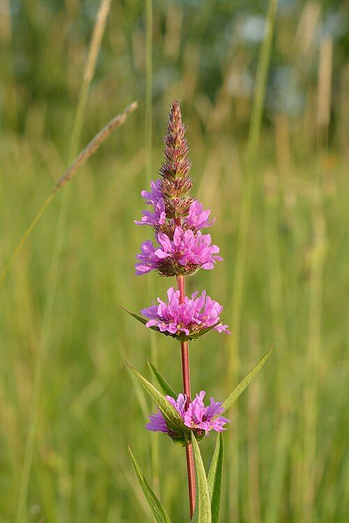
Scientific Name: Lythrum salicaria
Category: Aquatic Invasive
Purple Loosestrife
Purple loosestrife is an aggressive perennial that has colonized millions of acres of wetlands, lakeshores, and riverbanks across Canada and the United States.
A single mature purple loosestrife plant can produce over 2.5 million seeds annually, which remain viable in soil for years, creating persistent seed banks that make eradication extremely challenging. The plant's dense root system and rapid growth rate allow it to outcompete native wetland vegetation including cattails, sedges, and native flowering plants that provide critical food and habitat for waterfowl, amphibians, and invertebrates. Our AI can distinguish purple loosestrife from native look-alikes such as fireweed and blazing star, enabling precise mapping of infestation boundaries and early detection of new satellite populations before they establish.
Ecological Impact: Destroys critical waterfowl nesting habitat, eliminates native plant diversity, alters wetland hydrology, and degrades water quality. Listed as noxious weed in multiple provinces.
Protecting Lakes, Shorelines, and Waterfront Properties
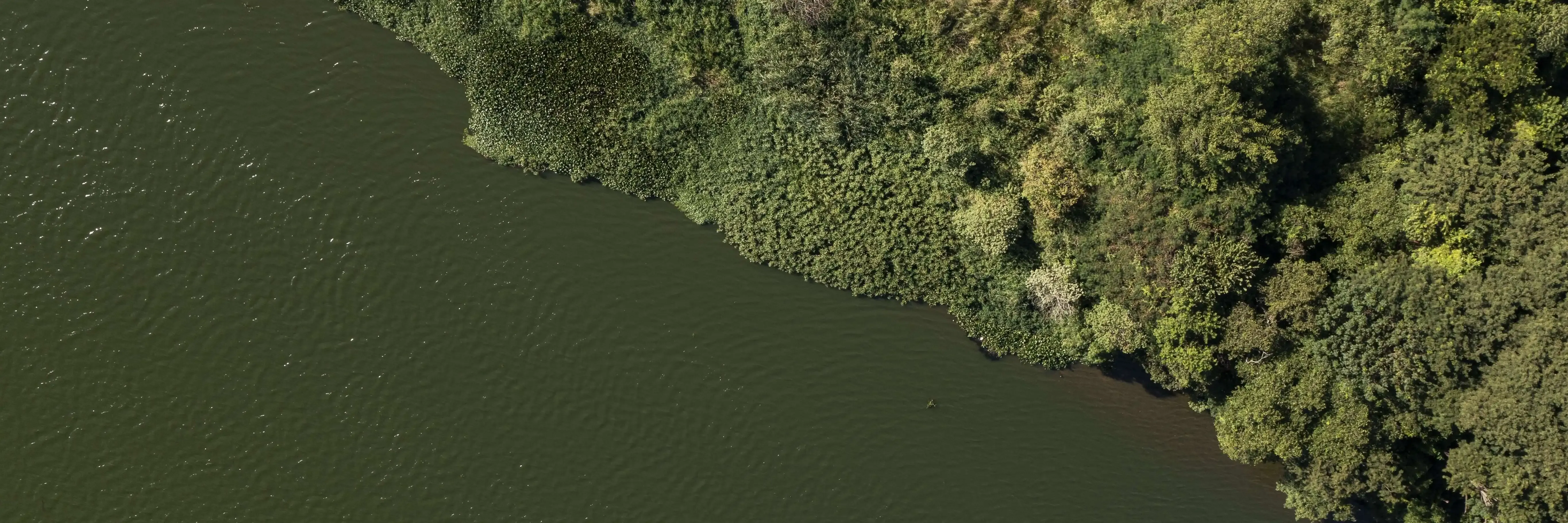
Invasive aquatic species don't stop at conservation area boundaries. Eurasian watermilfoil, European water chestnut, phragmites, and purple loosestrife spread into private marinas, cottage waterfronts, and recreational lakes — reducing property values, degrading water quality, fouling boat propellers, and closing swimming areas. Private marina operators, cottage associations, and lake stewardship groups are increasingly turning to drone-based mapping to get ahead of infestations before they become unmanageable. Sairone gives waterfront communities the same species-level detection and precision mapping tools used by Canada's leading conservation organizations — without requiring in-house technical expertise or specialized hardware.
If you manage a marina, waterfront property, or lake association and have drone footage of your shoreline, we'll map your invasive species for free. Imagery captured at approximately 70 metres altitude with 2/3 overlap is all we need. You get back species-level weed maps and shapefiles ready to hand to your herbicide applicator or dock management contractor.
How Sairone's Technology Works
Our proprietary artificial intelligence platform combines cutting-edge computer vision, deep learning neural networks, and geospatial analysis to deliver species-level invasive plant detection and monitoring that was previously impossible with traditional field survey methods. Sairone's technology scales conservation efforts across thousands of hectares while providing the precise, actionable data environmental managers need to protect ecosystems effectively.
Protecting Wetlands with AI Innovation
Watch how Sairone's partnership with Ducks Unlimited Canada is revolutionizing invasive species management across critical waterfowl habitats. This video showcases our technology in action, demonstrating the precision detection capabilities that enable conservationists to protect thousands of hectares of wetland ecosystems more effectively than ever before.
The video highlights real-world deployment across DUC conservation sites, illustrating how our drone-based AI platform identifies invasive Phragmites, purple loosestrife, and other aggressive species with species-level accuracy. See how field teams use Sairone's geospatial data to plan targeted removal efforts, track treatment effectiveness, and prevent re-establishment of invasive populations. Video Highlights:
Aerial Survey Operations
Watch our drone platforms capture ultra-high-resolution imagery across wetland conservation areas
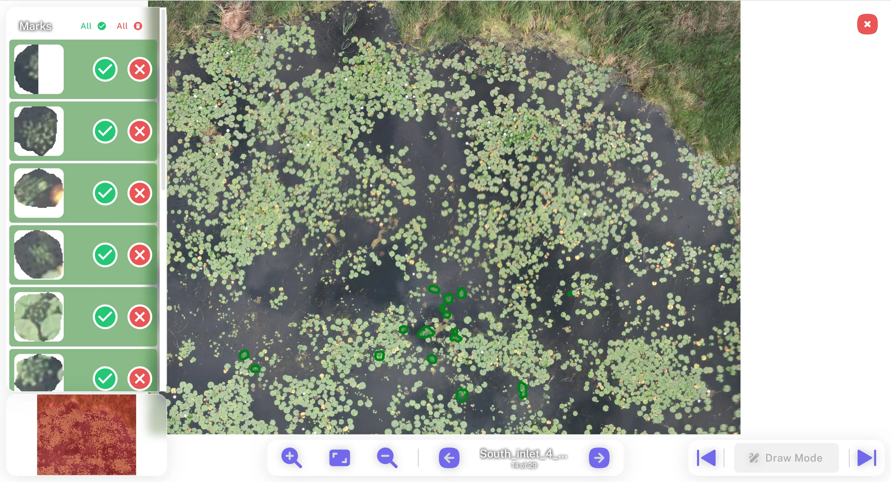
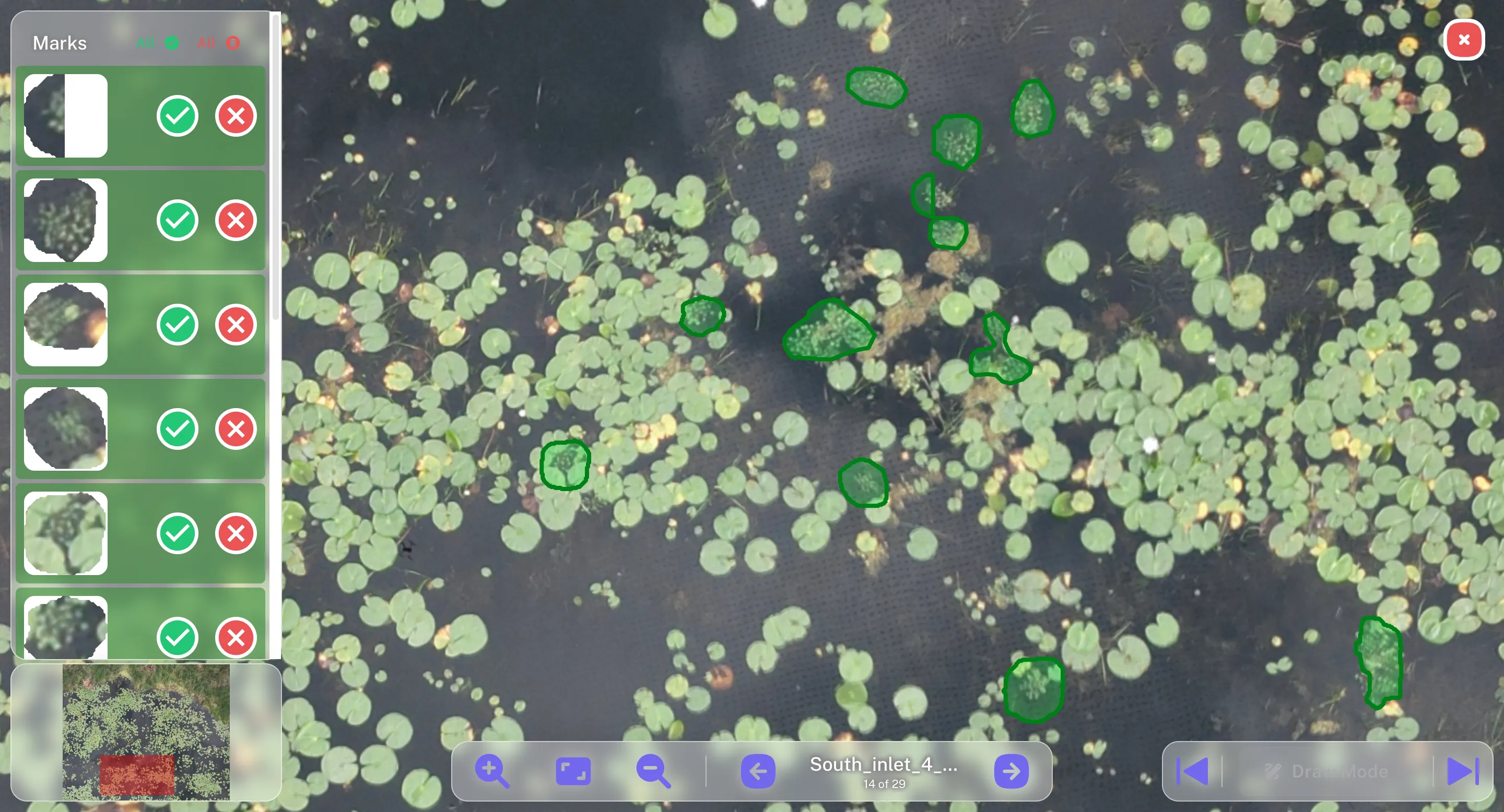
AI Detection Process
See how our algorithms identify and map invasive species in real-time
Conservation Impact
Learn how field teams use Sairone's data to protect critical waterfowl habitat
Protect Your Ecosystems with Precision Technology
Join leading conservation organizations, watershed authorities, and environmental stewards who trust Sairone to detect and monitor invasive species across thousands of hectares. Get early detection intelligence, precise intervention maps, and the data you need to demonstrate conservation outcomes. What You Get:
Free Consultation
Discuss your conservation challenges with our team
Custom Demo
See our technology deployed on your site
Pilot Program
Start with a targeted pilot to prove ROI