Detect Water Soldier RGB Drone Monitoring And Tracking
Status: Delivered (Started in Sun Dec 01 2024 and Finished in Wed Dec 31 2025)
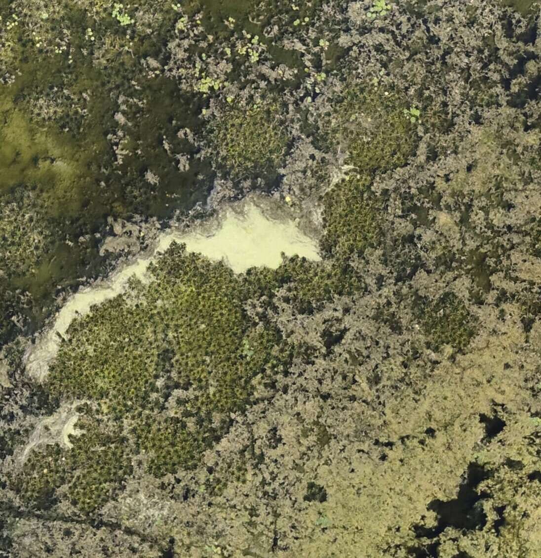
In late 2024, Saiwa Co and Ducks Unlimited Canada launched a project to enhance UAV-based detection and surveillance of the invasive aquatic plant Water Soldier (Stratiotes Aloides) using advanced image processing and deep learning. The team addressed challenges from dense and submerged vegetation, environmental noise, and irregular plant shapes by reformulating the task as semantic segmentation. The project delivered a robust model achieving 95.52% pixel accuracy, enabling accurate monitoring of both isolated plants and dense colonies, supporting early intervention, efficient management, and a scalable foundation for future multispectral enhancements.

About Ducks Unlimited Canada (DUC)
It’s been 85 years since DUC established our first wetland restoration project in Canada. Help us celebrate the people, projects and partners that have helped us reach this milestone, and are helping create an unlimited future for all of us.
Ducks Unlimited Canada is a passionate community of people who believe that nature is the foundation of strong communities, a prosperous economy and a sustainable future that supports the hopes and dreams of the next generation. Together, we conserve and restore some of the most valuable and threatened landscapes on the planet.
Overview
Late 2024, in a collaboration between Saiwa Co and Ducks Unlimited Canada, a project was started that focused on enhancing the detection and surveillance of Water Soldier through advanced image processing and deep learning techniques. For the first year, the project was planned in four phases, and up to then three phases were successfully finished and delivered to the client.
Problem Statement
Water Soldier (Stratiotes Aloides), a fast-spreading aquatic invasive species, posed significant challenges to biodiversity, waterway management, and economic activities. Native to Europe and northwest Asia, this plant had established itself in ecosystems like the Trent-Severn Waterway in Ontario, Canada. The plant grew in shallow waters, forming dense mats that overshadowed native vegetation, disrupted aquatic food chains, and modified water chemistry. These changes could harm phytoplankton populations and other aquatic organisms critical to the ecosystem. Furthermore, its sharp, serrated leaves posed physical risks to swimmers and hindered recreational activities like boating and fishing.
The economic implications were profound. For example, the United States spent over $100 million annually to manage invasive aquatic plants. Traditional management methods, such as large-scale herbicide application, had shown limited success, particularly with the recurring reappearance of Water Soldier downstream. This persistent problem highlighted the need for innovative solutions that could detect and monitored infestations efficiently, allowing for early intervention and precise management strategies. Drone-based imaging combined with machine learning offered a scalable and cost-effective solution. By leveraging high-resolution imagery, drones could access difficult-to-reach areas and captured comprehensive data on Water Soldier infestations. This approach not only addressed the limitations of manual detection but also provided a pathway to proactive management that could prevent further spread to critical water systems, such as the Great Lakes.
These challenges led us to reformulate the problem as a semantic segmentation task, which ultimately provided a more reliable solution for dense aquatic vegetation detection.
Project Goal
The purpose of this project was to advance Ducks Unlimited Canada’s capability of UAV-based surveillance of Water Soldier through machine learning. The scope of the project contained plants that were completely visible on the water surface, a significant part of the plant was emersed in the RGB domain or submerged while it was visible in the RGB domain due to the clarity of the water.
Solution
Detecting Water Soldier in aerial imagery presented technical challenges due to the plant's interaction with its environment. Dense vegetation often overlapped with other aquatic plants, making it difficult to isolate Water Soldier in drone-captured images. Additionally, environmental factors such as varying water clarity, light reflections, and shadows introduced noise into the imagery. Submerged plants, which were less visible and exhibited muted spectral signatures, added another layer of complexity.
These challenges demanded advanced methods that could handle variability in scale, orientation, and environmental conditions. Traditional object detection methods often fell short in such scenarios, as they were designed for standard objects with consistent visibility. Emerging deep learning models, such as YOLO and SegDecNet, had demonstrated significant promise by automating the detection process and improving accuracy. However, they required extensive computational resources, which limited their deployment on resource-constrained platforms like drones.
This constraint emphasized the need for lightweight, real-time solutions, which were specifically optimized for such use cases. After analyzing the various models and methods, we employed a customized method that handled irregularly shaped and rotated objects, such as Water Soldier mats in aerial imagery. Moreover, the integration of pretrained models allowed for faster deployment and better generalization, reducing the reliance on extensive labeled datasets.
Outcome
The project successfully delivered a robust semantic segmentation model for detecting Water Soldier (Stratiotes aloides) in high-resolution UAV imagery.
After reformulating the task from object detection to semantic segmentation, a model was trained on a carefully annotated dataset of UAV images. The final model achieved 95.52% pixel accuracy and effectively identifies both isolated plants and dense colonies, overcoming the limitations previously observed with object-level detection approaches.
By enabling accurate region-based monitoring, this solution supports early intervention strategies and more efficient management of invasive aquatic vegetation. The framework also establishes a scalable foundation for future enhancement using multispectral imagery to further improve detection of submerged vegetation.