Drones and GIS Mapping | Best Drones for Aerial Precision
Discover the top drones for GIS mapping, enhancing accuracy in aerial data collection. Learn how drones and GIS mapping revolutionize mapping
Written by Maryam
Reviewed by Boshra
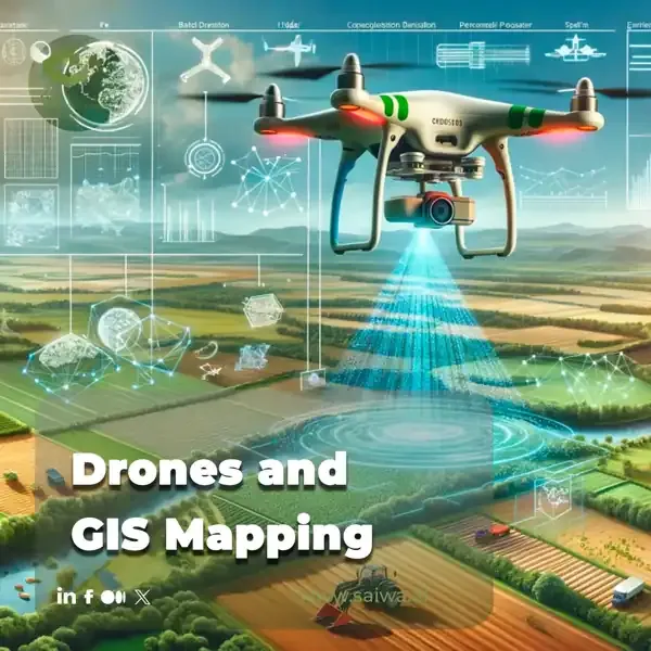
Geographic Information Systems (GIS) have transformed spatial data collection, analysis, and visualization, benefiting several fields including urban planning, environmental management, agriculture, and disaster response. Traditionally, GIS mapping relied on satellite imagery, aerial photography, and ground surveys; however, drones (UAVs) have revolutionized this process, offering greater detail, flexibility, and cost-efficiency.
Drones, equipped with sophisticated sensors and high-resolution cameras, offer a versatile platform for capturing precise geospatial data, thereby enhancing the accuracy and efficiency of GIS applications.
Sairone, developed by Saiwa, builds upon these capabilities through the integration of artificial intelligence and machine learning, with a particular focus on applications in agriculture, greenhouse management, and ecological fields. The integration of Sairone with drones facilitates more efficient data collection and analysis, thereby enhancing decision-making and operational outcomes in a range of sectors.
This article examines the interrelationship between drones and GIS mapping, with a focus on the technology, its applications, benefits, and ongoing challenges.

What is GIS (Geographic Information System) Mapping?
GIS mapping involves much more than simply creating maps. It encompasses the creation, management, analysis, and visualization of geographically referenced information, providing a comprehensive framework for understanding and interacting with the world around us.
A GIS is a powerful system that integrates hardware, software, and data to facilitate the capture, storage, manipulation, analysis, management, and presentation of all types of geographically referenced information. Such information is frequently represented as layers within a GIS, thereby enabling users to visualize and analyze disparate aspects of the geographic landscape, including, for example, elevation, land use, population density, infrastructure networks, and environmental features.
By analyzing these layers and their interrelationships, GIS mapping enables us to understand spatial relationships, patterns, and trends, providing valuable insights for informed decision-making across a wide range of disciplines. GIS data can represent various features on the Earth's surface, including natural features like mountains, rivers, forests, and coastlines, as well as human-made features like roads, buildings, pipelines, power lines, and other infrastructure.
Read Also: GIS in Agriculture | Revolutionizing the Industry with Data-Driven Insights
Key Components of GIS Mapping

Data Acquisition: This crucial first step involves gathering spatial data from various sources, including satellite imagery, aerial photography (increasingly from drones), ground surveys using GPS and other instruments, LiDAR scanning, and even crowdsourced data. The choice of data acquisition method depends on the specific application, required accuracy, and available resources.
Data Storage: The effective management of data is a crucial aspect of GIS mapping, particularly in light of the vast quantities of data that are generated in this field. Geospatial data is typically stored in structured formats within geodatabases, which facilitate the efficient organization, retrieval, and manipulation of the data.
Data Analysis: The true power of GIS lies in its analytical capabilities. Spatial analysis operations permit users to extract meaningful information and insights from geospatial data. Such insights may be used to identify areas at risk of flooding, to optimize transportation routes, or to analyze the distribution of species.
Data Visualization: Maps, charts, 3D models, and other visualizations are essential for communicating spatial information effectively. GIS software provides powerful tools for creating compelling visualizations that convey complex geospatial data in an accessible and understandable format.
How Drones and GIS Mapping Work Together
The combination of drones and GIS represents a highly effective and powerful synergy. Drones serve as a highly versatile and efficient platform for acquiring high-resolution spatial data, which can be seamlessly integrated into GIS software for advanced analysis and visualization. The process typically comprises the following steps:
Flight Planning
This critical initial stage involves defining the flight path, altitude, overlap, and other parameters for the drone mission, taking into account factors such as the specific area of interest, desired ground sampling distance (GSD) or resolution, flight regulations, and potential obstacles. Careful flight planning ensures efficient data collection and minimizes risk.
Data Acquisition
The drone is equipped with an array of sensors, including high-resolution RGB cameras, multispectral sensors for the analysis of vegetation health, thermal cameras for the detection of temperature variations, and LiDAR scanners for the generation of 3D point clouds. During the flight, the drone autonomously follows the pre-programmed flight path and captures the requisite data.
Data Processing
The raw data acquired by the drone needs to be processed to create accurate and usable geospatial datasets. This typically involves geo-referencing the images or point clouds to a specific coordinate system, orthorectifying the imagery to remove geometric distortions, and mosaicking multiple images together to create a seamless orthomosaic.
Data Integration
The processed drone data is then imported into GIS software, where it can be combined with other geospatial datasets, such as existing maps, elevation models, or demographic data. This integration allows for a more comprehensive and holistic analysis of the area of interest.
Analysis and Visualization
Within the GIS environment, various spatial analysis operations can be performed on the integrated data, such as calculating areas, distances, slopes, or creating viewsheds. The results of the analysis can then be visualized through maps, charts, 3D models, and other visual representations to communicate the findings effectively.
How Drones Enhance GIS Mapping

The deployment of drones offers several significant advantages that serve to enhance the capabilities of GIS mapping:
High Resolution and Unprecedented Detail
Drones are capable of capturing imagery and data at exceptionally high resolutions, often down to centimeter-level detail, thereby providing highly detailed information about the ground surface and features that may not be discernible in satellite imagery or traditional aerial photography. The high-resolution data permits precise measurements, accurate feature identification, and a more profound comprehension of the landscape.
Flexibility and Unmatched Accessibility
Drones can access areas that are difficult to reach or hazardous, such as steep slopes, dense forests, disaster zones, or environmentally sensitive areas. This provides valuable data that would be challenging, costly, or even impossible to collect using traditional methods. The accessibility of drones expands the possibilities of GIS mapping, allowing for data collection in previously inaccessible locations.
Cost-Effectiveness
The use of drones for data acquisition can prove to be a considerably more cost-effective approach than traditional aerial surveys conducted with manned aircraft, particularly when dealing with smaller areas or targeted applications. The reduced expenditure associated with drone operations facilitates the acquisition of high-resolution data to a greater extent, thereby making it more accessible to a broader spectrum of users.
Rapid Deployment and On-Demand Data Acquisition
The deployment of drones is a rapid and straightforward process, enabling the swift acquisition of data in situations where time is of the essence. This may include disaster response, environmental monitoring, or the monitoring of rapidly changing construction sites. The expeditious deployment of these devices allows for the prompt collection of data, thereby facilitating informed decision-making.
Reduced Risk to Personnel
Drones can be used to collect data in hazardous environments, such as disaster zones, industrial sites, or areas with unstable terrain, reducing the risk to personnel who would otherwise have to conduct ground surveys in these potentially dangerous locations.
Types of Drones Used in GIS Mapping
Various types of drones are employed in GIS mapping, each with its own unique strengths, limitations, and suitability for specific applications:
Fixed-Wing Drones
Fixed-wing drones, which resemble small airplanes, are ideal for covering large areas quickly and efficiently because of their aerodynamic design and long endurance. They are typically used for large-scale mapping projects such as agricultural surveys, infrastructure inspections, or regional mapping initiatives.
Multirotor Drones
Multirotor drones, including quadcopters, hexacopters, and octocopters, offer exceptional maneuverability, hovering capabilities, and vertical take-off and landing (VTOL) functionality. These characteristics make them well-suited for detailed mapping of smaller areas, complex structures, or close-range inspections, where precise positioning and control are essential.
Hybrid Drones
Hybrid drones represent a synthesis of the advantages inherent to both fixed-wing and multirotor designs, offering both extended flight times and vertical take-off and landing (VTOL) capabilities. This hybrid approach offers enhanced versatility for missions that necessitate both extensive area coverage and precise maneuvering in specific locations.
Applications of Drone-Based GIS Mapping
Drone-based GIS mapping is being used in a growing number of industries and disciplines. It's transforming workflows and providing valuable insights:
Agriculture
Drones equipped with multispectral or hyperspectral sensors have the potential to facilitate a range of agricultural monitoring activities, including the assessment of crop health, the evaluation of irrigation requirements, the detection of nutrient deficiencies, and the generation of precision agriculture maps for the targeted application of fertilizer or other interventions.
Read More: Leveraging Drones in Agriculture for a New Era of Data-Driven Farming
Environmental Monitoring
Drones are an invaluable tool in the field of environmental monitoring, facilitating the mapping of deforestation, the tracking of wildlife populations, the assessment of environmental damage from pollution or natural disasters, the monitoring of coastal erosion, and the study of glacier melt.
Urban Planning
The use of drones in urban planning has enabled the creation of three-dimensional models of cities, as well as the monitoring of urban development and sprawl, the planning of infrastructure projects, the assessment of traffic flow, and the analysis of urban heat islands.
Construction and Engineering
In the construction and engineering sectors, drones are utilized for a variety of purposes, including infrastructure inspection, construction progress monitoring, creation of as-built surveys, documentation of site conditions, and generation of three-dimensional models of buildings and other structures.
Disaster Response
Drones are invaluable tools for disaster response, enabling rapid assessment of damage after natural disasters, mapping floodplains, supporting search and rescue operations, and providing real-time situational awareness to emergency responders.
Mining and Quarrying
Drones are employed in mining and quarrying operations for a variety of purposes, including the mapping of mining areas, the monitoring of stockpile volumes, the assessment of environmental impact, and the assurance of worker safety.
Archaeology and Cultural Heritage
The use of drone-based mapping is transforming the fields of archaeology and cultural heritage preservation. This technology enables researchers to map archaeological sites, document historical structures, create three-dimensional models of cultural heritage sites, and monitor sites for changes or damage.
Advantages of Using Drones in GIS Mapping

The use of drones in GIS mapping offers numerous advantages over traditional methods:
Increased Accuracy and Unprecedented Detail
High-resolution imagery and Drones collect data to provide much more accurate and detailed maps than traditional methods, allowing for precise measurements, detailed feature identification, and a deeper understanding of the terrain.
Improved Efficiency and Unrivaled Speed
The use of drones for data collection allows for the rapid acquisition of information, which can lead to a notable reduction in project timelines, enhanced efficiency, and the ability to process data more expediently.
Enhanced Safety and Risk Mitigation
Drones can access otherwise inaccessible locations, eliminating the need for personnel to enter locations that may present a danger to them. As a result, the use of drones can enhance data collection safety and reduce the risks associated with data collection.
Cost-effectiveness and Resource Optimization
Drone-based mapping can be substantially more cost-effective than traditional aerial surveys using manned aircraft, especially for smaller areas or targeted applications, making high-resolution data acquisition more accessible and budget-friendly.
Flexibility, Adaptability, and On-Demand Deployment
Drones can be easily deployed and adapted to various mapping needs and environmental conditions, making them a highly versatile tool for a wide range of applications and project requirements.
Challenges with Drones in GIS and Mapping
Despite the numerous advantages, several challenges remain in the effective and responsible use of drones for GIS mapping:
Regulatory Restrictions and Compliance
The operation of drones is subject to a multitude of regulations and restrictions, the specifics of which can vary considerably depending on the location, type of operation, and classification of the airspace in question. It is of the utmost importance for those engaged in drone operations to remain informed about and comply with these regulations in order to ensure the safety, legality, and responsibility of such operations.
Data Processing and Management
The processing and management of substantial quantities of Drones collect data can be a significant computational challenge, necessitating the use of dedicated software, robust computing resources, and expertise in data management and processing techniques.
Battery Life and Limited Flight Time
A limitation of drone flight time is the duration for which the battery can sustain the aircraft, which is dependent upon the size of the mapping area or length of mission duration. It is of the utmost importance to implement meticulous flight planning and effective battery management strategies in order to achieve optimal coverage and efficiency.
Weather Dependence and Operational Constraints
The efficacy of drone operations can be significantly compromised by adverse weather conditions, including strong winds, precipitation, snowfall, and extreme temperatures. Such conditions can restrict the usability of drones in certain scenarios and necessitate a cautious evaluation of weather forecasts and operational constraints.
Data Accuracy and Quality Control
The assurance of accuracy and quality in drone-acquired data necessitates meticulous planning, precise sensor calibration, rigorous data processing, and robust quality control procedures. Proper calibration, ground control points (GCPs), and accurate georeferencing are indispensable for the acquisition of high-quality and reliable geospatial data.
Conclusion
Drones have emerged as a transformative technology in GIS mapping, offering unparalleled levels of detail, flexibility, cost-effectiveness, and accessibility, thereby revolutionizing the manner in which spatial information is collected, analyzed, and interpreted.
By providing a powerful and versatile platform for acquiring high-resolution geospatial data, drones enhance the accuracy, efficiency, and overall capabilities of GIS mapping applications across a diverse spectrum of industries and disciplines. While challenges remain in terms of regulations, data management, and technological limitations, the ongoing advancements in drone technology, sensor development, data processing techniques, and artificial intelligence are continuously expanding the capabilities and applications of drone-based GIS mapping.
As drone technology continues to evolve and mature, its seamless integration with GIS will further revolutionize the way we collect, analyze, and understand spatial information, paving the way for more informed decision-making, innovative solutions, and a deeper understanding of our world.
Note: Some visuals on this blog post were generated using AI tools.
Comments
No comments yet!
Table of Contents
No headings were found on this page.