Soil Analysis with Drones | Enhancing Agricultural Efficiency

Soil Analysis with Drones | Enhancing Agricultural Efficiency

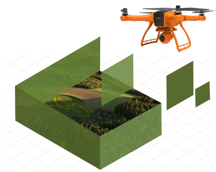
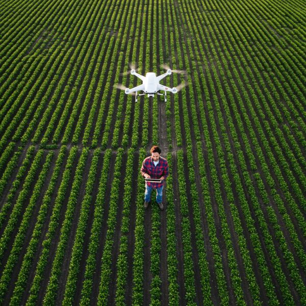
Precision agriculture, a management strategy that uses technology to optimize farming practices, has advanced considerably with the integration of drones. These unmanned aerial vehicles (UAVs) transform various agricultural applications, including soil analysis. Traditional soil analysis methods, which involve labor-intensive sampling and extensive laboratory work, provide valuable insights but can be time-consuming and costly. Drones, equipped with advanced sensors and imaging capabilities, offer an efficient, rapid, and cost-effective alternative, revolutionizing how farmers assess and manage soil health.

Sairone, an artificial intelligence and machine learning platform developed by Saiwa, is specifically tailored for agriculture, greenhouse management and ecological applications. Sairone can be seamlessly integrated with a wide range of drones, enhancing their capabilities by providing customized insights that meet the specific needs of each field. This powerful tool is particularly relevant for soil analysis, enabling precise monitoring and management practices to ensure optimal use of resources and better crop yields.

This article explores Soil Analysis with Drones, delving into its methodologies, benefits, and limitations, and examining how platforms like Sairone are transforming the future of precision agriculture.

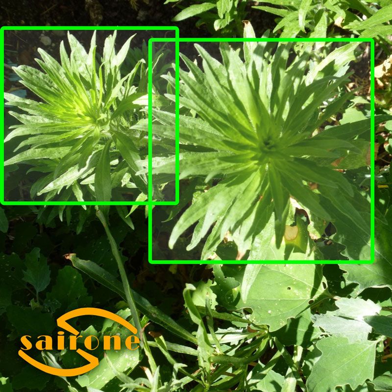
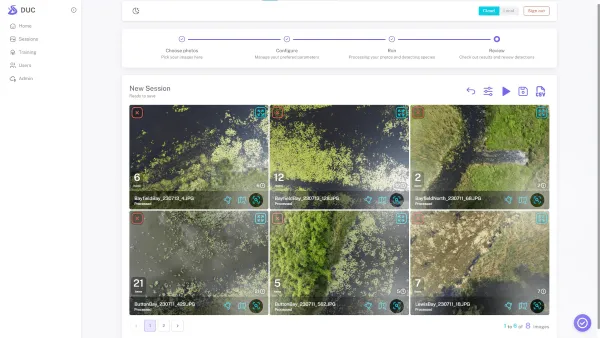
Crop Detection

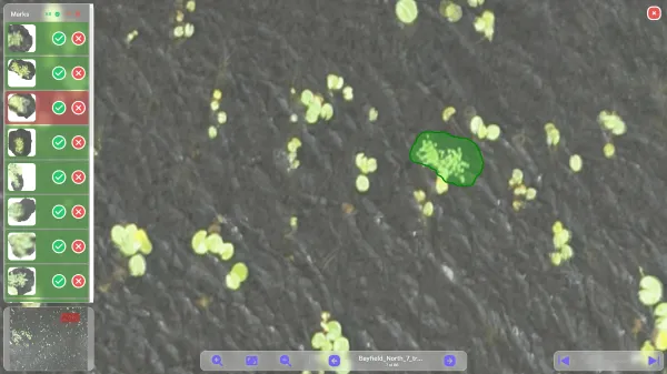
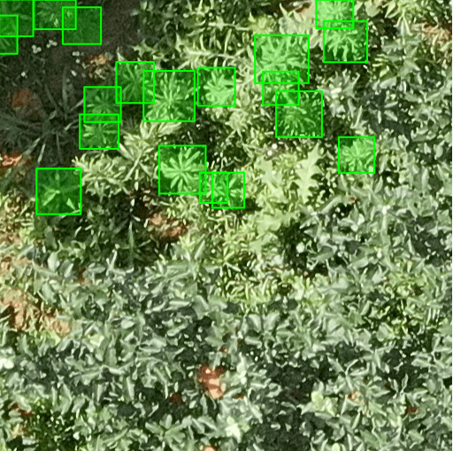
Sairone crop detection service utilizes drone imaging and AI to accurately identify and monitor various crop types, helping farmers optimize yield predictions and resource management for improved agricultural efficiency.

How Drones Are Growing the Agricultural Industry with Soil Analysis

Drones are significantly impacting the agricultural industry, offering a wide range of applications beyond soil analysis. These include crop monitoring, pest and disease detection, irrigation management, and targeted spraying of fertilizers and pesticides.

By providing high-resolution aerial imagery and multispectral data, drones enable farmers to obtain a comprehensive view of their fields, identify areas of stress or underperformance, and make informed decisions to optimize crop production.

This data-driven approach enhances efficiency, reduces input costs, and minimizes environmental impact. In the context of soil analysis, drones offer a powerful tool for assessing soil health and variability, enabling precision management practices that target specific areas within a field based on their unique soil characteristics.

Read Also: Agriculture Drone Services

Enhanced Efficiency

Drones automate data collection, covering large areas quickly and efficiently. This is a crucial advantage for large-scale agricultural operations where traditional methods would be prohibitively time-consuming.

This rapid data acquisition allows farmers to respond swiftly to changing soil conditions, such as nutrient deficiencies or moisture stress, and implement timely management decisions. This real-time information empowers farmers to address issues proactively, minimizing potential yield losses and optimizing resource utilization. Furthermore, the automated nature of drone data collection reduces the need for manual labor, freeing up human resources for other essential tasks.

Cost Reduction

Compared to traditional methods involving manual soil sampling, laboratory analysis, and expert consultation, drone-based soil analysis significantly reduces labor costs and associated expenses. The elimination of manual sampling and the reduced need for extensive laboratory testing contribute to substantial cost savings.

This cost-effectiveness makes precision soil management accessible to a wider range of farmers, including smaller operations that may have previously found traditional methods financially prohibitive. By optimizing input application and reducing waste, drone-based insights further contribute to long-term cost reductions.

Improved Accuracy and Precision

Improved Accuracy and Precision

Drones equipped with advanced sensors provide high-resolution data, capturing subtle variations in soil properties across a field. This level of detail allows for more precise application of fertilizers and other inputs, optimizing resource use and minimizing environmental impact.

Data-Driven Decision Making

The rich data collected by drones empowers farmers to make informed decisions about soil management practices, moving beyond generalized approaches to targeted strategies tailored to specific field conditions.

By analyzing soil properties, moisture levels, and nutrient content, farmers can optimize fertilizer application, irrigation scheduling, and even crop selection based on the unique characteristics of different areas within their fields. This data-driven approach leads to improved crop yields, enhanced resource use efficiency, and increased overall farm profitability.

The ability to visualize and analyze data through user-friendly interfaces further empowers farmers to make informed decisions and implement precision management practices effectively.

Read Also: Farming Drones for Crop Monitoring | Transforming Precision Agriculture

What Is Drone Soil Analysis?

Drone soil analysis involves the use of drones equipped with specialized sensors to collect data about the physical and chemical properties of soil. This data can include information about soil texture, organic matter content, nutrient levels, moisture content, and pH. Different types of sensors are used for different soil properties.

Multispectral sensors capture data across multiple wavelengths of light, providing information about plant health and soil characteristics. Hyperspectral sensors capture data across hundreds of narrow spectral bands, providing even more detailed information about soil composition.

Thermal sensors measure soil temperature, which can be an indicator of soil moisture content and other properties. This data is then processed and analyzed to create detailed maps of soil variability across a field, providing farmers with valuable insights to guide their management decisions.

Data Acquisition

Drones equipped with the chosen sensors fly over the field following a pre-planned flight path. This flight path is carefully designed to ensure complete and overlapping coverage of the area of interest, minimizing data gaps and ensuring accurate representation of soil variability.

The drone’s altitude and flight speed are also carefully controlled to optimize data quality and resolution. Ground control points (GCPs) with known coordinates may be used to improve the geospatial accuracy of the collected data.

Data Processing

The raw data collected by the drone’s sensors is then processed using specialized software. This process involves several steps, including geometric correction, radiometric calibration, and removal of noise and artifacts caused by atmospheric conditions or sensor limitations. The processed data is then converted into meaningful information about soil properties, often represented as georeferenced maps or indices that reflect specific soil characteristics. This processed data forms the basis for subsequent analysis and interpretation.

Data Analysis and Interpretation

The processed data is analyzed using specialized software tools to create detailed maps and reports that visualize soil variability across the field.

These visualizations can highlight areas with specific nutrient deficiencies, variations in soil texture, or differences in moisture content. Agronomists or other soil experts then interpret the information to provide tailored recommendations for soil management practices, such as targeted fertilizer application, variable-rate irrigation, or amendments to improve soil health. This interpretation connects the data to actionable insights for improved farm management.

Why Does Soil Analysis Matter?

Soil is the foundation of agricultural productivity, providing essential nutrients, water, and support for plant growth. Understanding the properties of soil is crucial for optimizing crop production, ensuring efficient resource use, and minimizing environmental impact.

Soil analysis provides valuable information about the physical and chemical characteristics of soil, enabling farmers to make informed decisions about soil management practices. This information is essential for maintaining soil health, improving crop yields, and ensuring the long-term sustainability of agricultural systems.

Nutrient Management

Soil analysis determines the availability of essential plant nutrients like nitrogen, phosphorus, and potassium. This informs precise fertilizer application, ensuring crops receive optimal nutrient amounts at the right time, maximizing yields while minimizing excess nutrient runoff, which can pollute waterways. Understanding nutrient availability also helps prevent over-fertilization, saving costs and protecting the environment.

Read Also: Machine Learning for Soil Nutrient Optimization

Water Management

Soil analysis reveals information about soil texture and water-holding capacity, crucial for efficient irrigation. This data helps farmers optimize irrigation scheduling, delivering water when and where it’s needed most, minimizing water waste, and maximizing water use efficiency. This is particularly important in water-scarce regions.

Soil Health

Soil analysis assesses overall soil health, including organic matter content, pH levels, and microbial activity. These factors are interconnected and influence soil fertility, structure, and resilience. Maintaining healthy soil promotes nutrient cycling, water infiltration, and disease resistance, contributing to long-term agricultural sustainability.

Environmental Protection

Optimized nutrient and water management through soil analysis to minimize environmental impact. Reduced nutrient runoff protects water quality, while efficient irrigation conserves water resources. Healthy soil also acts as a carbon sink, mitigating climate change.

Manual Soil Analysis vs. Soil Analysis with Drones

Manual Soil Analysis vs. Soil Analysis with Drones

Traditional manual soil analysis involves collecting soil samples from various locations within a field, sending these samples to a laboratory for analysis, and waiting for the results. This process can be time-consuming, labor-intensive, and expensive.

Drone analysis, on the other hand, offers a much faster and more efficient approach. Drones can collect data over large areas quickly, providing real-time insights into soil conditions. While manual sampling provides point-specific data, drone analysis provides a continuous map of soil variability, offering a more comprehensive view of soil conditions across the entire field.

Data Acquisition

Manual soil analysis requires physically collecting samples, which is labor-intensive and time-consuming, especially for large fields. This process involves walking through the field, taking samples at predetermined intervals or based on visual assessment.

Drone-based analysis, using remote sensing, rapidly collects data over large areas, significantly reducing the time and effort required.

Spatial Coverage

Manual analysis provides data only from the specific sampling points, which may not accurately represent the variability across the entire field. The limited number of samples can lead to interpolation errors and an incomplete picture of soil conditions. Drone analysis generates continuous maps, providing comprehensive coverage and capturing subtle variations in soil properties across the entire field.

Cost

Manual analysis incurs costs associated with labor for sample collection, transportation of samples to a laboratory, and laboratory analysis fees. These costs can accumulate, especially for large fields requiring numerous samples.

Drone-based analysis is generally more cost-effective, particularly for larger operations, as it reduces labor and laboratory expenses.

Time to Results

Manual analysis involves waiting for laboratory results, which can take days or even weeks, delaying decision-making. This delay can be critical, especially when addressing time-sensitive issues like nutrient deficiencies. Drone analysis provides near real-time results, allowing farmers to respond quickly to changing soil conditions and implement timely management practices.

Data Resolution

Manual analysis offers high resolution at the specific sampling points, providing detailed information about the soil at those locations. However, the limited number of samples results in low overall resolution and may not capture the full extent of soil variability across the field. Drone analysis, with its continuous mapping capabilities, provides high resolution across the entire field, capturing subtle variations in soil properties.

Read Also: Revolutionizing Agriculture | Enhanced Soil Monitoring Using AI Insights

The Benefits of Using Drones for Soil Analysis

The adoption of drones for soil analysis offers numerous advantages over traditional methods, significantly enhancing the efficiency and precision of soil management practices. These benefits contribute to improved crop yields, reduced input costs, and minimized environmental impact.

Rapid Data Acquisition

Drones cover large areas quickly, collecting data much faster than manual methods. This rapid data acquisition allows for timely identification of soil variability, enabling prompt implementation of management strategies. Quick turnaround time is crucial for addressing time-sensitive issues like nutrient deficiencies or moisture stress.

High-Resolution Data

Drones equipped with advanced sensors, like multispectral or hyperspectral cameras, provide high-resolution data, capturing subtle variations in soil properties across a field. This detailed information allows for precise management practices, targeting specific areas based on their unique soil characteristics. This level of detail enables variable-rate application of inputs, optimizing resource use.

Cost-Effectiveness

Drone-based soil analysis significantly reduces labor costs associated with manual sampling and laboratory analysis. By automating data collection, drones minimize the need for extensive manual labor. This makes precision soil management more accessible and affordable, especially for larger farms.

Improved Accessibility

Drones can easily access difficult-to-reach areas, such as steep slopes, dense vegetation, or waterlogged fields, which may be challenging or impossible to access with traditional methods. This expands the scope of soil analysis, enabling a comprehensive assessment of entire fields, regardless of terrain challenges.

Reduced Environmental Impact

By optimizing fertilizer and irrigation practices based on detailed soil data, drone-based analysis contributes to a reduced environmental impact. Precise application of inputs minimizes nutrient runoff into waterways and reduces water waste, promoting sustainable agriculture. This targeted approach also reduces the need for excessive chemical applications.

The Drawbacks of Using Drones for Soil Analysis

While drone-based soil analysis offers numerous advantages, it also faces certain limitations that need to be considered.

Initial Investment

Acquiring drones, sensors, and associated software entails a substantial initial investment. The cost of high-quality sensors, particularly multispectral or hyperspectral cameras, can be significant. This can be a barrier for smaller farms or those with limited financial resources. Exploring leasing options or service providers might mitigate this initial cost hurdle.

Technical Expertise

Operating drones, processing collected data, and utilizing analysis software require technical expertise. Proper flight planning, data calibration, and image processing are essential for accurate results. Farmers may need specialized training or skilled personnel to manage these technical aspects.

Regulatory Restrictions

Drone operations are subject to regulations that vary by location and the nature of the operation. These regulations often pertain to airspace restrictions, licensing requirements, and data privacy. Farmers must be aware of and comply with all applicable regulations to ensure legal and safe operation.

Weather Dependence

Drone flights are susceptible to weather conditions, including rain, strong winds, or extreme temperatures. Adverse weather can limit flight operations, potentially delaying data collection and impacting time-sensitive management decisions. Flexible flight planning and alternative data acquisition strategies may be necessary.

Data Interpretation

While drones provide valuable data, accurate interpretation requires expertise in soil science and agronomy. The data collected by drones needs to be contextualized and interpreted in relation to other factors like crop type, climate, and historical soil data. Misinterpretation can lead to ineffective or even counterproductive management decisions. Collaboration with agronomists or soil experts can ensure proper data analysis and interpretation.

Conclusion

Drone-based soil analysis represents a significant advancement in precision agriculture, offering a powerful tool for assessing and managing soil health. By providing rapid, high-resolution data, drones enable farmers to make informed decisions about soil management practices, optimizing crop production, reducing input costs, and minimizing environmental impact.

While there are some challenges associated with drone adoption, the benefits outweigh the drawbacks, making drones a valuable asset for the future of sustainable agriculture. As technology continues to evolve, the role of drones in agriculture is expected to expand further, transforming the way we grow food and manage our natural resources.

Table of Contents

No comment

Leave a Reply

Your email address will not be published. Required fields are marked *

Realated posts