Remote Sensing in Agriculture: Revolutionizing Farming Practices
Learn how remote sensing in agriculture enhances crop monitoring, resource management, and decision-making for sustainable and efficient farming.
Written by Amirhossein
Reviewed by Boshra
Remote sensing technology has become an essential tool for modern agriculture, providing valuable insights that enable farmers to make informed decisions about critical aspects of agricultural management, such as irrigation, fertilizer use, and pest control. This guide offers a detailed overview of remote sensing in agriculture, including its definition, functionality, key applications, and future trends shaping the agricultural remote sensing landscape.


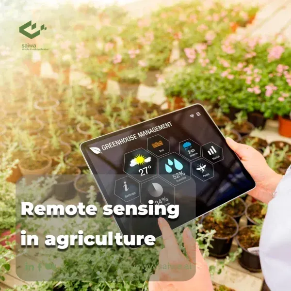
What is Remote Sensing in Agriculture?
Remote sensing refers to the gathering of information through aerial or satellite-based sensors that can detect reflected and emitted energy from agricultural lands. This data is processed into imagery and other formats that provide farmers, researchers, and agricultural agencies with a valuable wide-lens overview of cropland attributes like plant health, moisture levels, or soil composition at decisive points in the crop growth cycle. Unlike ground-based spot-checking methods, remote sensing allows consistent data gathering across thousands of agricultural acres instantaneously using specialized cameras and sensors.
The unique bird's eye insight this creates has made remote sensing in agriculture an indispensable platform globally on which to base time-sensitive decisions that can make or break crop productivity in any growing season. Experts consider remote sensing the original precision agriculture technology upon which many current digitization efforts in industrial farming continue to build. Agricultural remote sensing came of age in the 1970s and has expanded exponentially since that era with increasingly sophisticated data capture and analytics capabilities.
Key Application of Remote Sensing in Agriculture
Many pivotal agricultural applications depend on remote sensing platforms and image analytics today:
Land Use and Crop Mapping
Maps of dominant crop types, rotated planting areas and land utilization rates created through satellites form baseline data for agencies planning agricultural strategy from district to national levels. Automated analysis can classify crop types and pinpoint Shift changes like new orchards or grain plots in near real-time today.
Soil Composition and Moisture Sensing
Special camera filters allow soil chemistry signatures and moisture levels conducive or detrimental to crop growth to be measured remotely, creating variable rate application maps for water and soil nutrient amendments tailored to micro conditions.
Crop Growth Cycle Monitoring
Time series imagery allows remote visualization of crop germination, growth phases, flowering/fruiting, and senescence stages that serve as indicators of overall crop vigor and projections of final health or yields early in the season.
Irrigation Planning and Management
Thermal bands detect crop canopy temperature rises that telegraph shortages in evapotranspiration and trigger timely irrigation events optimized through soil moisture deficit modeling at exactly the right times preventing undue water wastage.
Pest and Disease Detection
Spectra outside human vision reveal crop stress and biochemical changes that allow remote identification of the onset of diseases like rusts or infestations for early targeted spraying well before visible symptoms manifest ground truthing. The above applications illustrate the pervasive role reliable remote sensing in agriculture adoption plays sustainably intensifying agricultural productivity and meeting global food security challenges ahead expected delivering 70% more output feeding 10 billion people 2050 scenarios project within planetary boundaries science warns crossing risks existential ecosystem threats.
Read Also: The Future of AI in Pest Control

Remote Sensing Systems Used in Agriculture
Many types of aerial and orbital remote sensing platforms provide imagery inputs usable for agricultural monitoring and insight generation:
Satellite Remote Sensing
Satellites provide consistent, wide-coverage multispectral imagery of global food-producing regions repeated regularly key phenological crop growth stages useful vegetation indices generate quantify peak greenness related final productivity by accessing different light wavelengths beyond capabilities perceiving measuring accelerating adoption rates precision agriculture tenets taking hold.
Aerial Remote Sensing
Piloted aircraft and increasingly drones outfitted cameras provide more customizable, high-resolution imagery that complements satellite data strengths covering key farmland areas more frequently or targeting plant health shifts meetings tighter turnaround times informing farming decisions maximizing potentials productivity possible season weather windows allow realized attainable each constraints bound operating farm.
Proximal Crop Sensing
Ground-based handheld or tractor-mounted sensor systems enable rapid, close-up spot analysis of in-field crop attributes like biomass and nitrogen levels delivering instantly actionable zone-specific insights at variable rates matched to requirements revealed.
Read Also: Practical Application & Future of AI in Agriculture
Unlocking the Full Value Through Processing
To generate usable agricultural insights from raw aerial/satellite image datasets requires digital image processing presenting clean, accurate information formats guiding decisions:
Image Preprocessing
Radiometric calibration standardizes raw pixel values to surface true ground condition reflectance signatures, while atmospheric correction adjusts detected energies to their true values – filtered from degrading confounding factors. Both processing steps help ensure robust analyses.
Thematic Classification and Vegetation Index Generation
Supervised classification uses reference spectral signatures of crops for algorithms to reliably categorize unseen images with up to 98% accuracy. Vegetation indexes like NDVI transform raw bands into indicators enhancing crop condition change detection sensitivity, and their deviations directing interventions.
Integration with GIS and Modeling
Combining remote sensing signals with geographic information systems and crop growth models via location-aware platforms enables tailored site-specific prescriptions maximizing limited land resources efficiently:
Time sequence imagery pinpoints crop development stage variations while simulations integrate weather, soils, and varieties to forecast biomass production trajectories and final yield potentials to inform pre-emptive precision amendments averting adversities.
Highlighted soil fertility deficiency zones, crop water shortage risks zones, and pest outbreak hotspots visualized on geo-boundary overlays focus managerial attention and input applications where most profitably needed at variable rates.
Unlocking New Insights: The Role of Thermal and Radar (SAR) Sensors
While multispectral imagery forms a cornerstone of agricultural monitoring, thermal and Synthetic Aperture Radar (SAR) sensors unlock crucial information invisible to standard cameras. These technologies significantly enhance the capabilities of remote sensing agriculture by providing data less affected by atmospheric conditions or time of day.
Thermal Sensing: Thermal sensors detect emitted heat energy. For crops, canopy temperature is directly linked to water stress. As plants become water-deficient, their transpiration rates decrease, leading to a rise in temperature. Thermal imagery allows farmers to pinpoint areas needing irrigation before visible signs of wilting occur, enabling highly efficient water management.
Synthetic Aperture Radar (SAR): As highlighted by resources like NASA Earthdata, SAR is an active sensing system, sending out microwave pulses and interpreting the reflected signals. Its key advantages in remote sensing agriculture include:
All-Weather Capability: Microwaves penetrate clouds, haze, and smoke, allowing reliable data collection regardless of atmospheric conditions.
Day and Night Operation: Being an active system, SAR doesn't rely on sunlight.
Sensitivity to Structure and Moisture: SAR signals interact strongly with the geometric structure of crops (like height and density, indicating biomass) and are highly sensitive to moisture content in both soil and vegetation.
Integrating these sensors provides a more complete picture. While optical data reveals plant health through colour, thermal data flags water stress, and SAR penetrates cover to assess soil moisture and physical structure. This multi-sensor approach strengthens remote sensing agriculture, offering resilience against weather limitations and providing deeper insights into crop conditions. Utilizing thermal and SAR is becoming increasingly vital for robust, year-round remote sensing agriculture applications, from irrigation management to biomass estimation and flood mapping.
Future Path of Remote Sensing in Agriculture
While already an immense value pillar sustaining global agricultural productivity growth, remote sensing promises to continue advancing integration with emerging technologies:
Next-Generation Satellite Sensors
Hyperspectral systems capturing narrow spectral bands reveal precise plant chemical composition signatures, unlocking opportunities for optimized crop nutrition and soil amendments that achieve higher per-acre output while reducing environmental impacts.
High-Frequency Satellite Revisits
Expanded medium-resolution constellations will increase cloud-free statistical robustness that degrades monitoring continuity plaguing persistent atmospheric obstacles and obscuring sensing opportunities otherwise.
Aerial Drones with Specialized Sensors
Multispectral or hyperspectral equipped camera drones enable enhanced characterization of transient, rapid crop growth shifts across zones within fields complementary satellite data strengths temporally constrained, demonstrated capable overcoming limitations conveniences where weather or logistics barriers limited insights cut-offs costly past.
Read More: AI-Based Drone Operation| AI in Drones use cases

Conclusion
Satellite and aerial remote sensing in agriculture delivers consistent repetitive wide-area measurement monitoring capabilities generating key insights crucially informing planning and maximizing productivity decisions unachievable through ground truthing alone. When remote sensing blends seamlessly into agricultural workflows, it becomes a solution for sustainable farming. This means validating models regularly, ensuring reliability, and addressing the realities of food security challenges. Through partnerships and public access, the optimism for sustainable agriculture overflows. Satellite-driven sensing opens endless possibilities, providing hope for the future of farming.
Note: Some visuals on this blog post were generated using AI tools.
Comments
No comments yet!
Table of Contents
No headings were found on this page.